Old Maps of Kalkaska County, Michigan for Hiking & Exploration
Hike through history with 101 historic maps of Kalkaska County. Explore old trails, ghost towns, and forgotten backroads — perfect for outdoor adventurers and local explorers.
- Rediscover forgotten places: Map out old mining camps, roads, and footpaths that no longer exist on modern maps.
- Layer with modern tools: Combine with LiDAR or satellite views to plan hikes through historical terrain.
- Made for exploration: Popular among hikers, overlanders, and local history lovers.
Use these maps to find adventure and explore the hidden past of Kalkaska County.
Kalkaska County, MI maps
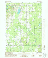
(101)- 1949 Map of Black Creek, 1953 Print
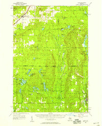
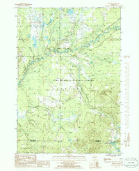
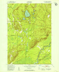 1949 Black Creek1953 Print · USGSUpper Michigan's interior is seen here just after the war, where state forest lands and military training grounds meet. Researchers can trace the path of the Manistee River and locate specific sites like Camp Grayling or the series of Upper Black Lakes.4 unique versions available
 - 1949 Map of Fletcher, 1955 Print
 1949 Fletcher1955 Print · USGSUpper Michigan's glacial interior is revealed here just after the war, showing the early infrastructure of the Camp Grayling area. Genealogists and historians can trace the New York Central tracks, the settlement of Fletcher, and local landmarks like Beaver Creek Cem.
 - 1950 Map of Cote Dame Marie, 1953 Print
 1950 Cote Dame Marie1953 Print · USGSMid-century northern Michigan comes to life in this study of the hills and forests west of Higgins Lake. Genealogists and local historians can trace family landmarks like the Beaver Creek Cem, Beaver Creek Sch, and the unique early settlement at Tent City.4 unique versions available
 - 1950 Map of Fletcher, 1953 Print
 1950 Fletcher1953 Print · USGSUpper Michigan's interior river valleys were largely dedicated to state forests and military use by the mid-twentieth century. Genealogists and researchers can trace the vicinity of the Fletcher Sch or follow the winding Manistee River and the rural route of Fletcher Road.4 unique versions available
 - 1950 Map of Lake Margrethe, 1953 Print
 1950 Lake Margrethe1953 Print · USGSCrawford County's military and natural landscapes intersect in the early fifties at Lake Margrethe. Researchers can trace the layout of Camp Grayling and its Rifle Range, or locate family-named landings like McIntyre Landing and Collens Landing.4 unique versions available
 - 1954 Map of Traverse City, 1965 Print
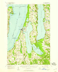
 1954 Traverse City1965 Print · USGSNorthern Michigan’s vast lakeshores and timberlands are captured here in the mid-fifties, showing the region before the modern interstate era. Genealogists and researchers can trace rail connections like the Detroit and Mackinac RR or find old communities such as Suttons Bay, Elk Rapids, and Prudenville.4 unique versions available
 - 1956 Map of Alba
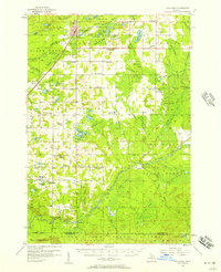
 1956 Alba1956 Print · USGSAntrim and Kalkaska counties are shown here in the mid-1950s, a period when these northern Michigan forests were heavily managed for conservation and recreation. Researchers can trace the Pennsylvania rail line into Alba or locate isolated landmarks like Barnhart Sch and Deward.3 unique versions available
 - 1956 Map of Mancelona, 1957 Print
 1956 Mancelona1957 Print · USGSAntrim and Kalkaska Counties come into focus during the mid-fifties, showing the intersection of the Pennsylvania railroad and the Pigeon River State Forest. Genealogists can trace family roots through several rural burial grounds and schools, including Maple Grove Cem and the Hardy Sch.4 unique versions available
 - 1956 Map of Kalkaska, 1957 Print
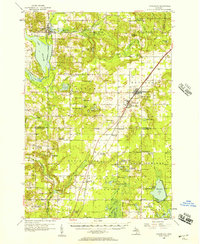
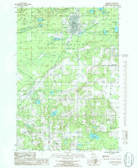
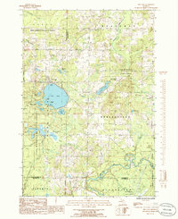
 1956 Kalkaska1957 Print · USGSNorthern Michigan’s timber and rail landscape is captured here in the mid-1950s, centered on the Kalkaska village and the Pennsylvania Railroad. Genealogists can trace rural life through sites like Taffeltown, Excelsior Ch, and the Maplegrove Sch.4 unique versions available
 - 1956 Map of Fife Lake, 1958 Print
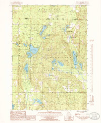
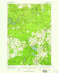 1956 Fife Lake1958 Print · USGSUpper Michigan's glacial landscape is captured in the mid-1950s, showing a region of dense state forests and fishing lakes. Researchers can locate vanished landmarks like Walton Junction, the Fife Lake Lookout Tower, and small rural centers like South Boardman.3 unique versions available
 - 1957 Map of Elk Rapids, 1958 Print
 1957 Elk Rapids1958 Print · USGSThe Grand Traverse Bay region and the Chain of Lakes are captured here during the late fifties, showing the area's intricate balance of water and rail. Researchers can trace the Chesapeake and Ohio railroad through Rapid City and locate landmarks like the Lighthouse and Clam Lake Sch (Abandoned).2 unique versions available
 - 1958 Map of Traverse City
 1958 Traverse City1958 Print · USGSNorthern Lower Michigan was a landscape of vast state forests and burgeoning lakeside retreats in the late fifties. Genealogists and historians can trace the rail corridors of the Ann Arbor RR and find established settlements from Elk Rapids to Houghton Lake.2 unique versions available
 - 1983 Map of Traverse City, 1984 Print
 1983 Traverse City1984 Print · USGSTraverse City and the surrounding bay country are captured in the early eighties as the region balanced its timber heritage with growing conservation. Genealogists and local historians can trace the rail lines of the Ann Arbor RR through settlements like Kingsley and Fife Lake.2 unique versions available
 - 1983 Map of Grayling, 1984 Print
 1983 Grayling1984 Print · USGSIn the early eighties, this Northern Michigan interior was a hub for forestry, military training, and river recreation. Researchers can trace the sprawling boundaries of Camp Grayling and locate historic markers like Hartwick Pines and Otsego Lake.2 unique versions available
 - 1983 Map of Torch River, 1984 Print
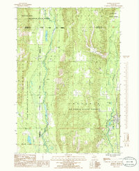
 1983 Torch River1984 Print · USGSNorthern Michigan’s inland waterways are captured in the early 1980s as they flow through Antrim and Kalkaska counties. Local researchers can trace family landmarks like St Mary Cem, Clearwater Chapel, and the riverside settlement of Rapid City.
 - 1985 Map of Starvation Lake, 1986 Print
 1985 Starvation Lake1986 Print · USGSNorthern Michigan’s lake country is captured here in the mid-1980s, showcasing a landscape of dense state forests and glacial basins. Trace recreational landmarks and local industrial sites like Camp Flying Eagle, Starvation Lake, and the Pumping Station.
 - 1985 Map of Kalkaska, 1986 Print
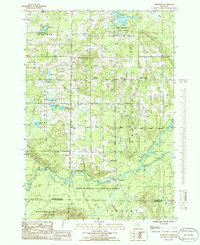
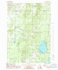
 1985 Kalkaska1986 Print · USGSMid-eighties Kalkaska is captured here as a growing hub surrounded by the sprawling woodlands of the Pere Marquette State Forest. Researchers can trace the layout of Kalkaska, find the small settlement at Crofton, and locate family-named landmarks like Vipond Creek and Butler Lake.2 unique versions available
 - 1985 Map of Frederic, 1986 Print
 1985 Frederic1986 Print · USGSNorthern Michigan’s upper Lower Peninsula is seen here in the mid-eighties as a sprawling network of state forests and river corridors. Genealogists and local historians can trace the settlement at Frederic or locate the former lumbering sites of Deward and Ishaward along the Manistee River.
 - 1985 Map of Sharon, 1986 Print
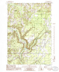
 1985 Sharon1986 Print · USGSKalkaska County's river valleys and state forest lands are captured in the mid-1980s, showcasing a landscape of timber, gas extraction, and wilderness. Researchers can trace the Old RR Grade and locate the Cannon Creek Gas Field near the settlement of Sharon.
 - 1985 Map of Leetsville, 1986 Print
 1985 Leetsville1986 Print · USGSKalkaska County at the mid-eighties peak of its resource economy shows a landscape of timber and energy. Trace local genealogies and industrial sites near Leetsville, Rugg Pond, and the scattered Oil Tanks of the Pere Marquette State Forest.
 - 1985 Map of Smithville, 1986 Print
 1985 Smithville1986 Print · USGSThe Manistee River valley in the mid-1980s reveals a quiet landscape of state forest and scattered rural settlements. Researchers can trace the Old RR Grade and locate long-standing landmarks like Smithville, Taffeltown, and the Gem Township Hall.
 - 1985 Map of South Boardman, 1986 Print
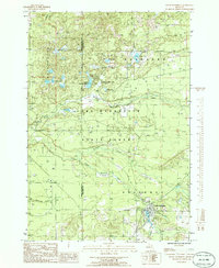 1985 South Boardman1986 Print · USGSSouth Boardman and the surrounding Pere Marquette State Forest are documented here in the mid-eighties as a region defined by its complex river systems and glacial lakes. Researchers can locate the local Cem and Boardman Park, or trace the paths of the South Branch Boardman River and Taylor Creek.2 unique versions available
 - 1985 Map of Sigma, 1986 Print
 1985 Sigma1986 Print · USGSKalkaska County's forest and river networks are captured here in the mid-1980s, showcasing a landscape of isolated settlements and winding waterways. Researchers can locate family landmarks like the cemetery near Advent Swamp or trace the early paths through Sigma and O'Neil.
 - 1985 Map of Fife Lake, 1986 Print
 1985 Fife Lake1986 Print · USGSThe Fife Lake region in the mid-1980s shows a landscape of glacial lakes and extensive timberlands managed by the Pere Marquette State Forest. Genealogists and local historians can trace the shoreline of Fife Lake, locate the community of Houseman, and follow the southern bend of the Manistee River.
 - 1985 Map of Westwood, 1986 Print
 1985 Westwood1986 Print · USGSKalkaska County in the mid-eighties shows a landscape of deep forests and glacial lakes at the intersection of major state lands. You can trace early transit routes like the Old RR Grade or locate family landmarks near Westwood, Darragh, and Manistee Lake.
Showing maps 1-25 of 101
Frequently asked questions
- What are the different types of historical maps available for Kalkaska County?
- What is the oldest map of Kalkaska County?
- Where can I purchase historical maps of Kalkaska County for my home or office?
- Where can I download high-res historical maps of Kalkaska County?
- Are there historical topographic maps available for Kalkaska County?
- Is there historical aerial imagery available for Kalkaska County?
- Where are historical maps of Kalkaska County sourced from?