Old Maps of Walker, Michigan for Metal Detecting
Plan your next treasure hunt with 41 historic maps of Walker. Find old homesites, ghost towns, trails, and gathering spots that may be lost to time — perfect for identifying promising metal detecting locations.
- Locate forgotten sites: Uncover places like long-lost settlements, abandoned rail lines, or gathering spots.
- Plan better hunts: Use map overlays combined with LiDAR or satellite views to narrow in on historically rich areas.
- Made for detectorists: Thousands of hobbyists use these maps to discover relics, coins, and hidden history.
Use these historic maps to boost your research and find new opportunities beneath the surface of Walker.
Walker, MI maps
(41)- 1914 Map of Grand Rapids
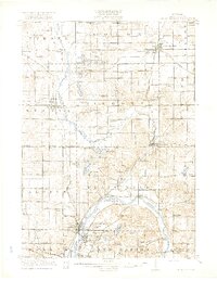
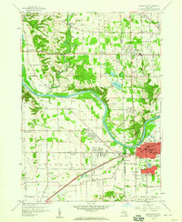
 1914 Grand Rapids1914 Print · USGSGrand Rapids and its southern townships are captured in detail just before the Great War, showing a landscape defined by river industry and rail lines. Local historians can trace early settlements and schools such as Kelloggsville and Red School, or locate family landmarks near Reeds Lake.5 unique versions available
 - 1918 Map of Cedar Springs
 1918 Cedar Springs1918 Print · USGSKent County north of Grand Rapids is shown here during the First World War, when railroads and small-town commerce linked the rural townships. Genealogists can trace family landmarks and schools like Block Tavern School, Soldiers Home, and the milling sites at Raines Mill.3 unique versions available
 - 1943 Map of Cedar Springs
 1943 Cedar Springs1943 Print · USGSKent County during the early 1940s reveals a thriving network of rail-side towns and rural school districts before postwar expansion changed the landscape. Genealogists and historians can trace family locations near Christian Hill Sch, Childsdale, and the numerous family-named landmarks like Johnston Corners.
 - 1943 Map of Grand Rapids
 1943 Grand Rapids1943 Print · USGSGrand Rapids and its surrounding Kent County townships are captured here in the early 1940s, showing a landscape defined by river industry and rail expansion. Genealogists can trace family roots through dozens of named rural schools like Sodom Sch, the County Farm, and early settlements like Byron Center.
 - 1945 Map of Ravenna, 1947 Print
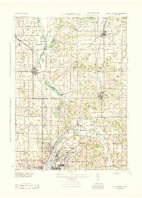
 1945 Ravenna1947 Print · USGSNear the close of the war years, this area north of the Grand River was a bustling network of small farming towns and rural school districts. Genealogists and local historians can trace the foundations of Coopersville, Ravenna, and Conklin, or locate family sites near McNitt Cem and Hoogstraat Sch.3 unique versions available
 - 1954 Map of Midland, 1967 Print
 1954 Midland1967 Print · USGSMid-Michigan at the peak of the post-war era shows a landscape balancing industrial growth in Midland with the deep timberlands of the Manistee National Forest. Researchers can trace the legacy of the timber and rail era along the Pennsylvania RR or find family roots in river towns like Chesaning and Big Rapids.4 unique versions available
 - 1958 Map of Midland
 1958 Midland1958 Print · USGSCentral Michigan in the late fifties is captured here during a period of transition for its university towns and industrial hubs. Genealogists and researchers can trace family lines through old rail-stop towns like Breckenridge and Chesaning or locate property near the Muskegon River and Prairie Farm.
 - 1958 Map of Grandville, 1959 Print
 1958 Grandville1959 Print · USGSOttawa and Allegan counties are captured here in the late fifties, showing a landscape of small towns and rural school districts connected by the Grand River. Researchers can trace family roots through the many local landmarks, including the Zutphen Cem, Hanley Sch, and South Blendon.2 unique versions available
 - 1958 Map of Grandville, 1960 Print
 1958 Grandville1960 Print · USGSMid-century Kent and Ottawa Counties come alive in this survey of the Grand River valley at a time of suburban expansion. Researchers can locate vanished landmarks like the Drive-in Theater or trace family roots through the Jenison Cem and numerous local schools like Bursley Sch.3 unique versions available
 - 1958 Map of Grand Rapids, 1973 Print
 1958 Grand Rapids1973 Print · USGSSouthern Michigan at the peak of the postwar era shows a landscape of burgeoning cities and new interstate highways. Trace family roots and regional growth in Grand Rapids, Battle Creek, and the glacial lake country around Gun Lake or Gull Lake.2 unique versions available
 - 1959 Map of Midland
 1959 Midland1959 Print · USGSMid-century Michigan comes alive in this survey of the central Lower Peninsula, from the streets of Grand Rapids to the Houghton Lake timberlands. Genealogists and rail fans can trace the Ann Arbor RR and Chesapeake and Ohio RR through towns like Big Rapids and Mount Pleasant.
 - 1961 Map of Grand Rapids
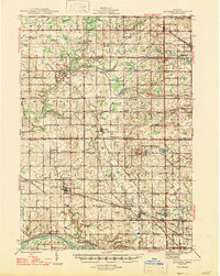
 1961 Grand Rapids1961 Print · USGSSouthern Michigan at the dawn of the 1960s reveals a region shaped by major river systems and a robust rail network. Trace mid-century industrial growth and land use from Grand Rapids to the Fort Custer Military Reservation and Gun Lake.
 - 1962 Map of Grand Rapids
 1962 Grand Rapids1962 Print · USGSMid-century Southern Michigan is mapped here at a time of massive growth, showing the expanding urban footprints of Grand Rapids and Lansing. Researchers can trace the legacy of the Grand Trunk Western RR, find historic boundaries of the Fort Custer Military Reservation, or locate sporting camps around Gun Lake.2 unique versions available
 - 1966 Map of Midland
 1966 Midland1966 Print · USGSCentral Michigan in the mid-1960s shows a landscape of growing manufacturing hubs and active resource extraction. Genealogists and historians can trace the rail corridors of the Grand Trunk Western or locate family-named landmarks near Oil wells and the Muskegon River.
 - 1967 Map of Grand Rapids West, 1969 Print
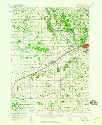
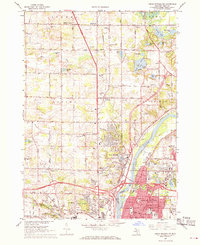
 1967 Grand Rapids West1969 Print · USGSThe Grand Rapids metropolitan area comes alive in the late sixties, showing the dense growth of Wyoming and Walker along the Grand River. Researchers can trace parish histories at St Andrews Cemetery or locate old industrial landmarks like the Kent Industrial Center.4 unique versions available
 - 1967 Map of Cedar Springs SW, 1969 Print
 1967 Cedar Springs SW1969 Print · USGSThe northern edges of Grand Rapids meet the countryside in the late sixties, showing the suburban expansion into Walker and Alpine. Genealogists and historians can trace family plots at Holy Trinity Cem or locate former schoolhouses like Koon Sch and Wheeler Sch.3 unique versions available
 - 1980 Map of Marne
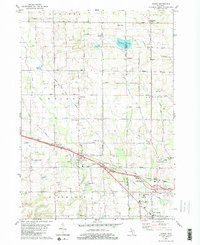 1980 Marne1980 Print · USGSThe West Michigan landscape of the late 1970s reveals a mix of growing townships and traditional farming centers near Marne. Genealogists and local historians can trace the foundations of the community at St Marys Ch, Wells Cem, and Walker Station Sch.2 unique versions available
 - 1984 Map of Grand Rapids
 1984 Grand Rapids1984 Print · USGSWest Michigan in the mid-eighties shows a thriving metropolitan core surrounded by expansive state recreation areas and river valleys. Genealogists and local historians can trace developments around Grand Rapids, institutional landmarks like Grand Rapids Bible College, and the quiet reaches of Jordan Lake.
 - 1985 Map of Cedar Springs
 1985 Cedar Springs1985 Print · USGSThe northern reaches of the Grand Rapids metro area meet the forests of the Manistee during the mid-eighties. Genealogists and historians can trace the paths of the Grand Trunk Western RR through Sparta or locate rural landmarks near Cedar Springs and Rockford.
 - 1986 Map of Cedar Springs, 1989 Print
 1986 Cedar Springs1989 Print · USGSThe northern suburbs of Grand Rapids meet the Manistee National Forest in the mid-1980s. Genealogists and historians can trace the rail-side growth of Howard City, Rockford, and Greenville along the C & O RR and Flat River.
 - 1996 Map of Grand Rapids West, 1999 Print
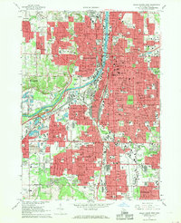
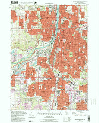 1996 Grand Rapids West1999 Print · USGSGrand Rapids and its neighboring suburbs are shown at a peak of late-twentieth-century development as the city expanded toward Wyoming and Kentwood. Genealogists and local historians can locate many historical burial sites and schools, including Greenwood Cemetery, Sacred Heart Sch, and the Fulton Street Cem.
 - 2011 Map of Grandville, 2011 Print
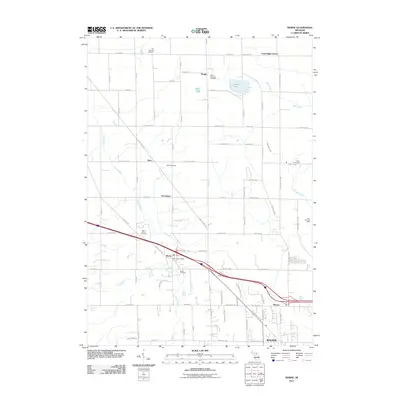
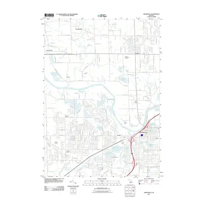 2011 Grandville2011 Print · USGSCovers Walker, including Grand Rapids, Wyoming, and other nearby areas
 - 2011 Map of Grand Rapids West, 2011 Print
 2011 Grand Rapids West2011 Print · USGSCovers Walker, including Grand Rapids, Wyoming, and other nearby areas
 - 2011 Map of Cedar Springs SW, 2011 Print
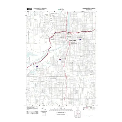
 2011 Cedar Springs SW2011 Print · USGSCovers Walker, including Grand Rapids, Plainfield Charter Township, and other nearby areas
 - 2011 Map of Marne, 2011 Print
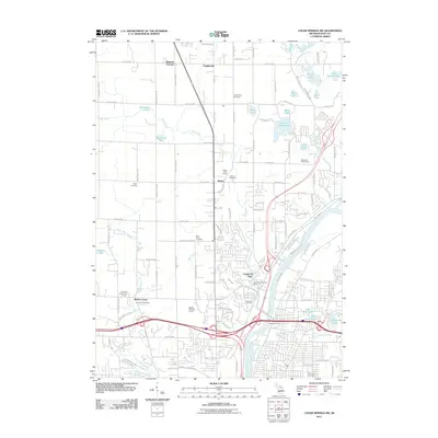
 2011 Marne2011 Print · USGSCovers Walker, including Alpine Township, Wright, and other nearby areas
Showing maps 1-25 of 41
Top cities near Walker
- Grand Rapids historical maps
- Wyoming historical maps
- Kentwood historical maps
- Plainfield Charter Township historical maps
- Gaines Charter Township historical maps
- Byron Township historical maps
See more
Top neighborhoods of Walker
Frequently asked questions
- What are the different types of historical maps available for Walker?
- What is the oldest map of Walker?
- Where can I purchase historical maps of Walker for my home or office?
- Where can I download high-res historical maps of Walker?
- Are there historical topographic maps available for Walker?
- Is there historical aerial imagery available for Walker?
- Where are historical maps of Walker sourced from?