Old Maps of Central, Houghton Township for Hiking & Exploration
Hike through history with 13 historic maps of Central. Explore old trails, ghost towns, and forgotten backroads — perfect for outdoor adventurers and local explorers.
- Rediscover forgotten places: Map out old mining camps, roads, and footpaths that no longer exist on modern maps.
- Layer with modern tools: Combine with LiDAR or satellite views to plan hikes through historical terrain.
- Made for exploration: Popular among hikers, overlanders, and local history lovers.
Use these maps to find adventure and explore the hidden past of Central.
Central, Houghton Township maps
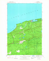
(13)- 1940 Map of Central
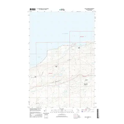
 1940 Central1940 Print · USGSKeweenaw Peninsula's rugged copper country comes into focus in this pre-war survey of the Lake Superior coastline. Genealogists and historians can trace the legacy of mining at Central and Copper Falls or locate the historic Eagle Harbor L H and the local Central Fire Tower.
 - 1946 Map of Eagle Harbor, 1968 Print
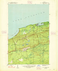
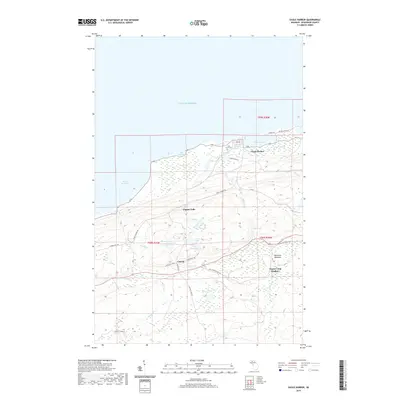
 1946 Eagle Harbor1968 Print · USGSThe Keweenaw Peninsula coastline in the mid-1940s reveals a landscape defined by maritime safety and the aging infrastructure of the copper boom. Researchers can locate the Eagle Harbor L H, trace the Old Railroad Grade, and find inland mining-era sites like Copper Falls and Central.3 unique versions available
 - 1948 Map of Eagle Harbor
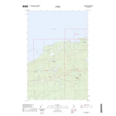
 1948 Eagle Harbor1948 Print · USGSThe Keweenaw Peninsula's rugged mining and maritime culture is on full display in the late 1940s. Genealogists and historians can trace the foundations of Central and Copper Falls, or locate family sites near Pine Grove Cem and the Coast Guard Sta.2 unique versions available
 - 1958 Map of Hancock, 1967 Print
 1958 Hancock1967 Print · USGSThe Keweenaw Peninsula and Isle Royale are seen here during the mid-twentieth century as mining and maritime hubs. Trace the dense town layouts of Hancock and Calumet, or locate remote coastal markers like the Eagle Harbor Lighthouse and Rock of Ages Light.2 unique versions available
 - 1960 Map of Hancock
 1960 Hancock1960 Print · USGSThe Keweenaw Peninsula and Isle Royale are captured in detail during the late 1950s. Researchers can trace copper-mining era settlements like Calumet and Laurium, or locate remote maritime landmarks such as the Isle Royale Lighthouse.
 - 1961 Map of Hancock
 1961 Hancock1961 Print · USGSThe Keweenaw Peninsula and Isle Royale are shown here at the start of the 1960s, featuring the region's historic copper mining and maritime infrastructure. Genealogists and researchers can trace local families through settlements like Atlantic Mine and Painesdale, or locate remote landmarks including Rock of Ages Light and Eagle Harbor.
 - 1966 Map of Hancock, 1987 Print
 1966 Hancock1987 Print · USGSThe Keweenaw Peninsula and Isle Royale are captured in the mid-1960s during a pivotal era for Michigan’s Copper Country. Trace the industrial footprint of the SOO LINE through Calumet or locate historic maritime landmarks like Fort Wilkins and Rock of Ages Light.
 - 1985 Map of Hancock
 1985 Hancock1985 Print · USGSThe Keweenaw Peninsula in the mid-1980s reveals a landscape shaped by copper and the Great Lakes. You can trace the industrial legacy of the region through the Quincy Mine, the Old RR Grade, and old cemeteries like Forest Hill Cem.3 unique versions available
 - 2011 Map of Eagle Harbor, 2011 Print
 2011 Eagle Harbor2011 Print · USGSCovers Central, including Eagle Harbor, Eagle Harbor Township, and other nearby areas
 - 2014 Map of Eagle Harbor, 2014 Print
 2014 Eagle Harbor2014 Print · USGSCovers Central, including Eagle Harbor, Eagle Harbor Township, and other nearby areas
 - 2017 Map of Eagle Harbor, 2017 Print
 2017 Eagle Harbor2017 Print · USGSCovers Central, including Eagle Harbor, Eagle Harbor Township, and other nearby areas
 - 2019 Map of Eagle Harbor, 2019 Print
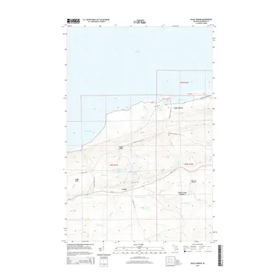
 2019 Eagle Harbor2019 Print · USGSCovers Central, including Eagle Harbor, Eagle Harbor Township, and other nearby areas
 - 2023 Map of Eagle Harbor, 2023 Print
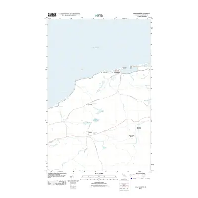
 2023 Eagle Harbor2023 Print · USGSUpper Peninsula history comes alive along the Lake Superior coast in this modern survey of Keweenaw County. Researchers can trace the legacy of copper-era settlements and shoreline landmarks, from the streets of Eagle Harbor to the inland grounds of Central and the Pine Grove Cem.
End of results
Showing maps 1-13 of 13
Top cities near Central
- Allouez historical maps
- Lake Linden historical maps
- Eagle Harbor historical maps
- Copper City historical maps
- Ahmeek historical maps
Frequently asked questions
- What are the different types of historical maps available for Central?
- What is the oldest map of Central?
- Where can I purchase historical maps of Central for my home or office?
- Where can I download high-res historical maps of Central?
- Are there historical topographic maps available for Central?
- Is there historical aerial imagery available for Central?
- Where are historical maps of Central sourced from?