Old Maps of Northport, Leelanau Township for Metal Detecting
Plan your next treasure hunt with 28 historic maps of Northport. Find old homesites, ghost towns, trails, and gathering spots that may be lost to time — perfect for identifying promising metal detecting locations.
- Locate forgotten sites: Uncover places like long-lost settlements, abandoned rail lines, or gathering spots.
- Plan better hunts: Use map overlays combined with LiDAR or satellite views to narrow in on historically rich areas.
- Made for detectorists: Thousands of hobbyists use these maps to discover relics, coins, and hidden history.
Use these historic maps to boost your research and find new opportunities beneath the surface of Northport.
Northport, Leelanau Township maps
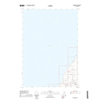
(28)- 1955 Map of Cheboygan, 1964 Print
 1955 Cheboygan1964 Print · USGSNorthern Michigan in the mid-fifties is a landscape of dense timber and deep water, showing the region just as the road network began to modernize. Trace family roots in lakeside towns like St Ignace and Petoskey, or follow the historic tracks of the Pennsylvania RR and New York Central RR.5 unique versions available
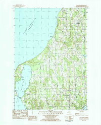
 - 1957 Map of Northport, 1958 Print
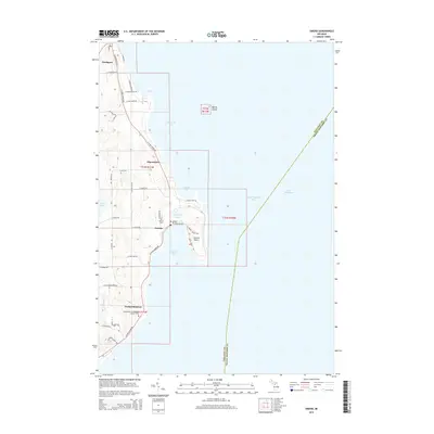
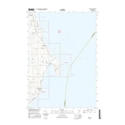
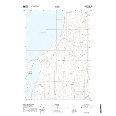
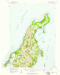 1957 Northport1958 Print · USGSThe tip of Michigan's Leelanau Peninsula is captured here in the late fifties, showcasing its unique bayside settlements and maritime history. Genealogists and local historians can locate St Wenceslaus Ch, the village of Peshawbestown, and the Grand Traverse Light.2 unique versions available
 - 1958 Map of Cheboygan
 1958 Cheboygan1958 Print · USGSThe tip of Michigan's Lower Peninsula and the surrounding Great Lakes islands are shown here in the late fifties, during the peak of the rail-and-ferry era. Trace the paths of the Pennsylvania RR and explore lakeside settlements like St James, Petoskey, and Indian River.2 unique versions available
 - 1983 Map of Northport, 1984 Print
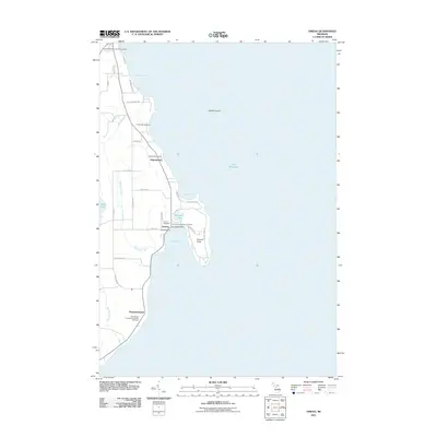
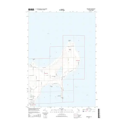
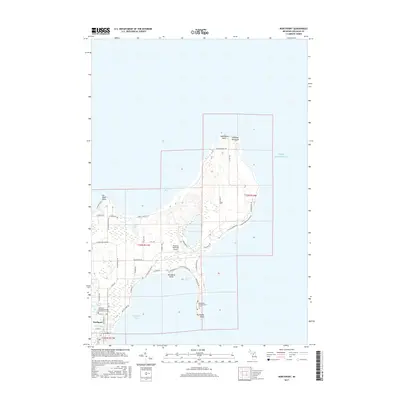
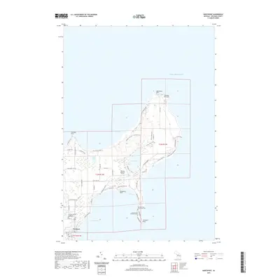
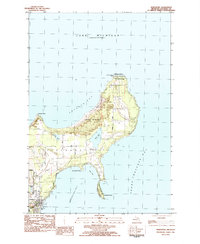 1983 Northport1984 Print · USGSThe northern tip of the Leelanau Peninsula comes into focus in the early eighties, showing a landscape where state parklands and lakeside villages meet. Trace the shoreline from Lighthouse Point to Northport, locating local landmarks like the Woolsey Memorial Airport and Grand Traverse Light.
 - 1983 Map of Omena, 1984 Print
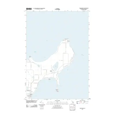
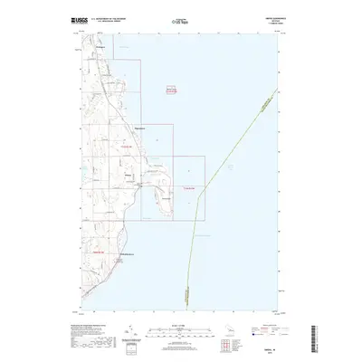
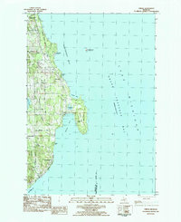 1983 Omena1984 Print · USGSLeelanau Peninsula’s eastern shore is captured here in the early eighties, showing a landscape of coastal settlements and lakeside camps. Trace family roots and local geography through Peshawbestown, the rails of the Leelanau Transit Company, and Omena Point.
 - 1983 Map of Northport NW, 1984 Print
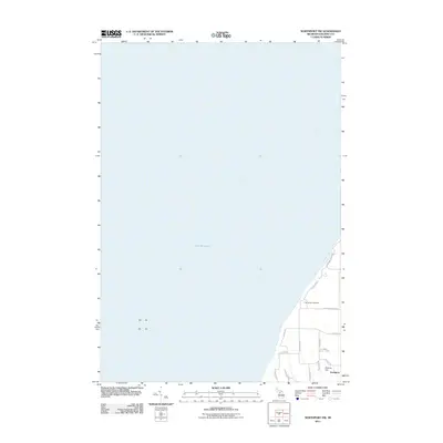
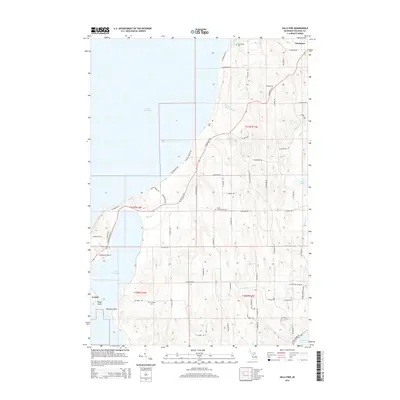
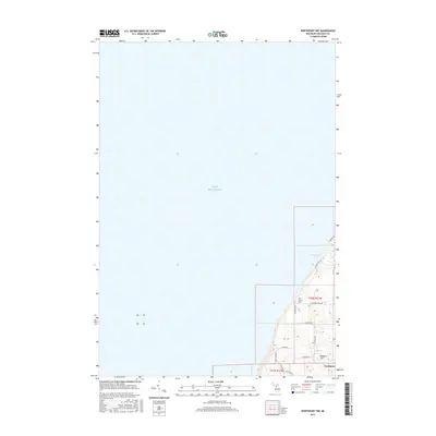
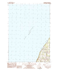 1983 Northport NW1984 Print · USGSThe Leelanau Peninsula shoreline meets the water in the early eighties, showcasing a landscape of sandy beaches and rural crossroads. Genealogists and local historians can trace family-named routes like Nelson Road and explore the area around Garthe and Peterson Park.
 - 1983 Map of Gills Pier, 1984 Print
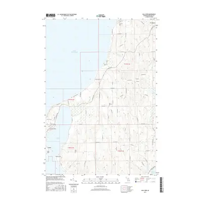
 1983 Gills Pier1984 Print · USGSThe Leelanau Peninsula shoreline in the early eighties reveals a landscape of lakeside settlements and quiet interior farm roads. Genealogists can trace family landmarks and rural institutions like the Indian Mission Ch, Solar Sch, and Beechwood Cem.
 - 1984 Map of Charlevoix, 1985 Print
 1984 Charlevoix1985 Print · USGSNorthern Michigan’s coastal peninsulas and deep inland lakes are captured here in the mid-eighties, showing the region's unique maritime and rail connectivity. Researchers can trace historic family-named landmarks and infrastructure like Woolsey Memorial Airport, Barnard Ch, and the Chesapeake and Ohio RR.2 unique versions available
 - 2011 Map of Northport, 2011 Print
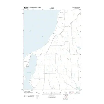
 2011 Northport2011 Print · USGSCovers Northport, including Leelanau Township, Leelanau County, and other nearby areas
 - 2011 Map of Omena, 2011 Print
 2011 Omena2011 Print · USGSCovers Northport, including Omena, Peshawbestown, and other nearby areas
 - 2011 Map of Northport NW, 2011 Print
 2011 Northport NW2011 Print · USGSCovers Northport, including Leelanau Township, Leelanau County, and other nearby areas
 - 2011 Map of Gills Pier, 2011 Print
 2011 Gills Pier2011 Print · USGSCovers Northport, including Leland Township, Leelanau Township, and other nearby areas
 - 2014 Map of Northport, 2014 Print
 2014 Northport2014 Print · USGSCovers Northport, including Leelanau Township, Leelanau County, and other nearby areas
 - 2014 Map of Northport NW, 2014 Print
 2014 Northport NW2014 Print · USGSCovers Northport, including Leelanau Township, Leelanau County, and other nearby areas
 - 2014 Map of Omena, 2014 Print
 2014 Omena2014 Print · USGSCovers Northport, including Omena, Peshawbestown, and other nearby areas
 - 2014 Map of Gills Pier, 2014 Print
 2014 Gills Pier2014 Print · USGSCovers Northport, including Leland Township, Leelanau Township, and other nearby areas
 - 2017 Map of Omena, 2017 Print
 2017 Omena2017 Print · USGSCovers Northport, including Omena, Peshawbestown, and other nearby areas
 - 2017 Map of Northport NW, 2017 Print
 2017 Northport NW2017 Print · USGSCovers Northport, including Leelanau Township, Leelanau County, and other nearby areas
 - 2017 Map of Northport, 2017 Print
 2017 Northport2017 Print · USGSCovers Northport, including Leelanau Township, Leelanau County, and other nearby areas
 - 2017 Map of Gills Pier, 2017 Print
 2017 Gills Pier2017 Print · USGSCovers Northport, including Leland Township, Leelanau Township, and other nearby areas
 - 2019 Map of Northport NW, 2019 Print
 2019 Northport NW2019 Print · USGSCovers Northport, including Leelanau Township, Leelanau County, and other nearby areas
 - 2019 Map of Gills Pier, 2019 Print
 2019 Gills Pier2019 Print · USGSCovers Northport, including Leland Township, Leelanau Township, and other nearby areas
 - 2019 Map of Northport, 2019 Print
 2019 Northport2019 Print · USGSCovers Northport, including Leelanau Township, Leelanau County, and other nearby areas
 - 2019 Map of Omena, 2019 Print
 2019 Omena2019 Print · USGSCovers Northport, including Omena, Peshawbestown, and other nearby areas
 - 2023 Map of Gills Pier, 2023 Print
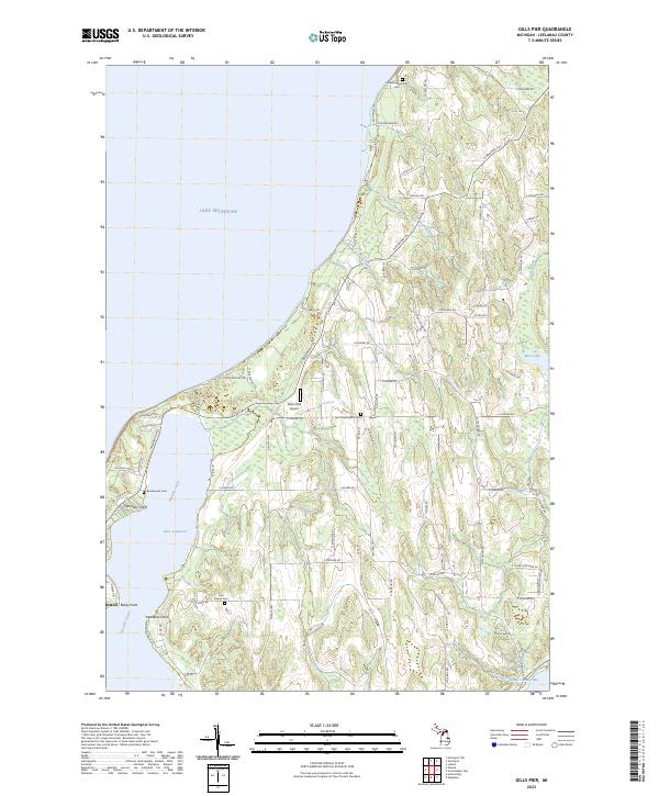 2023 Gills Pier2023 Print · USGSThe Leelanau Peninsula shoreline near Leland is documented here in the early twenty-first century, showcasing the area between Lake Leelanau and Lake Michigan. Genealogists and historians can locate several burial sites, including the Onominese Indian Cem and Saint Wenceslaus Cem.
Showing maps 1-25 of 28
Top cities near Northport
- Peninsula Township historical maps
- Elk Rapids historical maps
- Suttons Bay historical maps
- Leland historical maps
- Omena historical maps
- Lake Leelanau historical maps
Frequently asked questions
- What are the different types of historical maps available for Northport?
- What is the oldest map of Northport?
- Where can I purchase historical maps of Northport for my home or office?
- Where can I download high-res historical maps of Northport?
- Are there historical topographic maps available for Northport?
- Is there historical aerial imagery available for Northport?
- Where are historical maps of Northport sourced from?