2020s Maps of Fairfield Township, Michigan
Explore 4 historic maps of Fairfield Township from the 2020s. These maps offer a rare glimpse into what life looked like during the 2020s — showing old roads, neighborhoods, homes, and landmarks that have changed or disappeared over time.
Whether you're researching your family's past, planning a metal detecting trip, or studying how Fairfield Township's landscape evolved across the 2020s, these high-resolution maps are a powerful tool for exploring the history of this region.
- Focus on a specific era: All maps on this page are from the 2020s, giving you a focused view of this time period.
- See what’s changed: Compare century-old streets, trails, and buildings to today's modern landscape using overlays and satellite layers.
- Research with precision: Use these maps for genealogy, historical research, land use analysis, or educational projects.
- View, download, or print: Maps are fully viewable online in high resolution, and can be downloaded or printed for your own records.
Start exploring Fairfield Township's history through authentic maps from the 2020s. This is your window into the past.
Fairfield Township, MI maps
(4)- 2023 Map of Assumption, 2023 Print
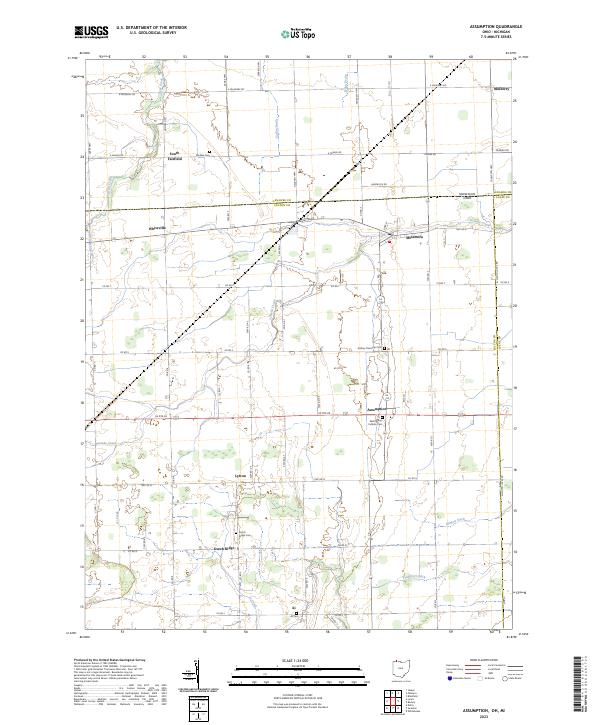 2023 Assumption2023 Print · USGSThe Michigan-Ohio border region comes alive in this contemporary survey of the rural communities near Assumption and Metamora. Genealogists can trace family heritage through local landmarks like Saint Marys Catholic Cem, Peebles Cem, and the settlement at Lytton.
 - 2023 Map of Jasper, 2023 Print
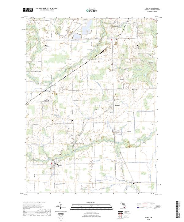 2023 Jasper2023 Print · USGSLenawee County's agricultural landscape is captured here in the early twenty-first century, showcasing a network of drainage canals and rural crossroads. Local historians can trace family plots at Old Weston Cem, Lowe Cem, and Apple Hill Cem.
 - 2023 Map of Lyons, 2023 Print
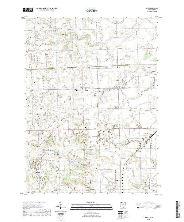 2023 Lyons2023 Print · USGSThe borderlands of Ohio and Michigan come into focus in this recent survey of the rural landscape around Lyons. Researchers can trace old family names and burial sites at Lyons Cem, Aetna Cem, and the community at Winameg.
 - 2023 Map of Palmyra, 2023 Print
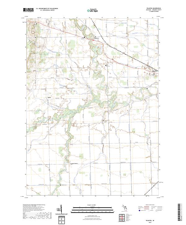 2023 Palmyra2023 Print · USGSSoutheast Michigan’s agricultural heartland is documented here, showing the intricate drainage and settlement patterns along the River Raisin. Researchers can locate numerous local burial sites including Scovell Cem and Underwood Cem near Palmyra.
End of results
Showing maps 1-4 of 4
Top cities near Fairfield Township
- Adrian historical maps
- Tecumseh historical maps
- Wauseon historical maps
- Archbold historical maps
- Swanton historical maps
- Blissfield historical maps
See more
Top neighborhoods of Fairfield Township
Frequently asked questions
- What are the different types of historical maps available for Fairfield Township?
- What is the oldest map of Fairfield Township?
- Where can I purchase historical maps of Fairfield Township for my home or office?
- Where can I download high-res historical maps of Fairfield Township?
- Are there historical topographic maps available for Fairfield Township?
- Is there historical aerial imagery available for Fairfield Township?
- Where are historical maps of Fairfield Township sourced from?