2020s Maps of Columbus Township, Michigan
Explore 9 historic maps of Columbus Township from the 2020s. These maps offer a rare glimpse into what life looked like during the 2020s — showing old roads, neighborhoods, homes, and landmarks that have changed or disappeared over time.
Whether you're researching your family's past, planning a metal detecting trip, or studying how Columbus Township's landscape evolved across the 2020s, these high-resolution maps are a powerful tool for exploring the history of this region.
- Focus on a specific era: All maps on this page are from the 2020s, giving you a focused view of this time period.
- See what’s changed: Compare century-old streets, trails, and buildings to today's modern landscape using overlays and satellite layers.
- Research with precision: Use these maps for genealogy, historical research, land use analysis, or educational projects.
- View, download, or print: Maps are fully viewable online in high resolution, and can be downloaded or printed for your own records.
Start exploring Columbus Township's history through authentic maps from the 2020s. This is your window into the past.
Columbus Township, MI maps
(9)- 2023 Map of Hardwood Island, 2023 Print
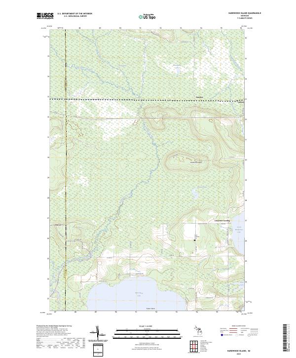 2023 Hardwood Island2023 Print · USGSModern-day Luce and Schoolcraft counties are shown here as a complex network of wetlands and rivers. Researchers can trace the rural communities of Danaher and Laketon or find family markers at the West Lakefield Cem.
 - 2023 Map of Grand Marais SE, 2023 Print
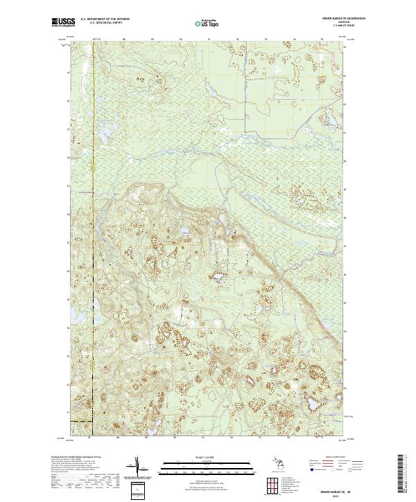 2023 Grand Marais SE2023 Print · USGSUpper Peninsula wilderness in eastern Luce County is defined here by the winding North Branch Two Hearted River and its vast wetlands. Researchers can trace historic access routes like McCloud Grade and locate remote water bodies including Potters Lake and Dairy Lake.
 - 2023 Map of Tahquamenon Lakes, 2023 Print
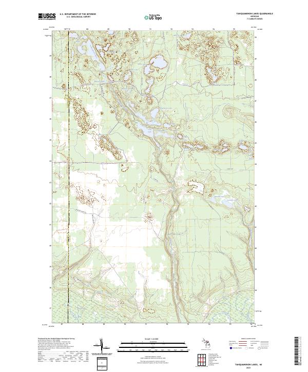 2023 Tahquamenon Lakes2023 Print · USGSThe Upper Peninsula lake country is shown here in the contemporary era, spanning the Schoolcraft and Luce county line. Trace the winding Tahquamenon River through The Spreads and locate remote landmarks like Bennet Springs and Whitney Lake.
 - 2023 Map of Muskallonge Lake SE, 2023 Print
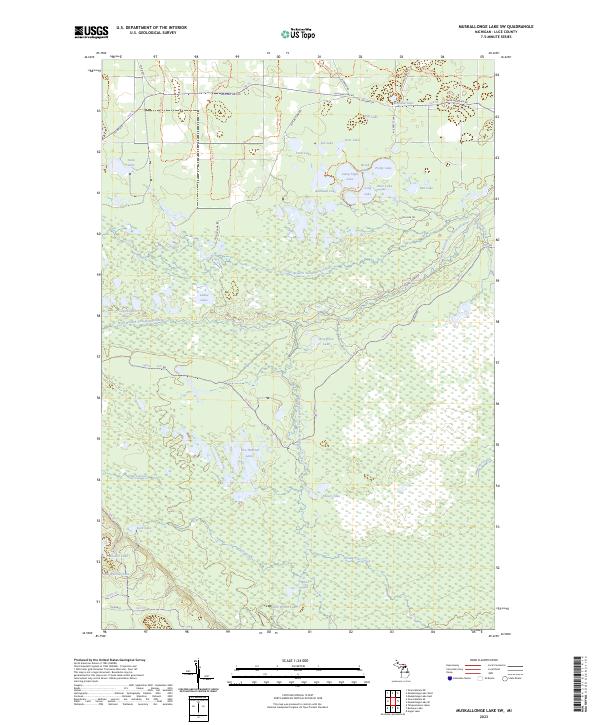
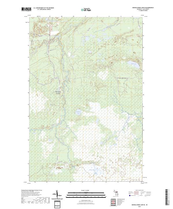 2023 Muskallonge Lake SE2023 Print · USGSUpper Peninsula wilderness in Luce County is defined by its legendary waterways and isolated junctions. Trace the paths of the Two Hearted River and Whiskey Creek, or locate interior landmarks like Pine Stump Junction and Sleeper Lake.
 - 2023 Map of Muskallonge Lake SW, 2023 Print
 2023 Muskallonge Lake SW2023 Print · USGSLuce County's forested wetlands and lake basins are captured in this recent survey of the Upper Peninsula. Researchers can trace the convergences of the North Branch Two Hearted River and explore remote sites like Two Hearted Lakes or Holland Lake.
 - 2023 Map of Auger Lake, 2023 Print
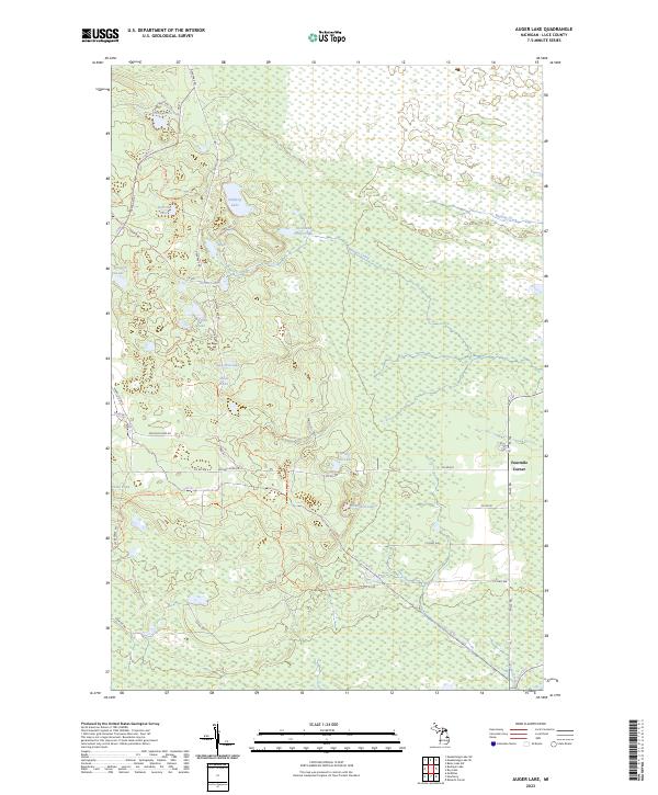 2023 Auger Lake2023 Print · USGSLuce County's forested wetlands and lake systems are captured here in the contemporary era. Trace old timber routes and local landmarks like Fourmile Corner, Auger Lake, and family-named water bodies such as Ahlman Lake and Barrett Lake.
 - 2023 Map of Buckeye Lake, 2023 Print
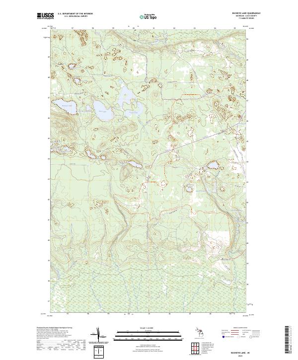 2023 Buckeye Lake2023 Print · USGSLuce County, Michigan, is shown here as a dense network of glacial lakes and northern forests during the early twenty-first century. Researchers can trace land access and water features including Buckeye Lake, Deadmans Lake, and the winding Silver Creek.
 - 2023 Map of McMillan, 2023 Print
 2023 McMillan2023 Print · USGSLuce County's lake-and-marsh country is documented here, showing the settlement patterns of the eastern Upper Peninsula. Trace local family history at Columbus Township Cem or explore the shorelines of North Manistique Lake and Manistique Lake near Helmer.
 - 2023 Map of Newberry, 2023 Print
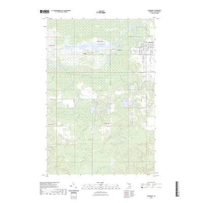 2023 Newberry2023 Print · USGSNewberry and the Tahquamenon River valley are shown in this contemporary survey of Luce County. Genealogists and local historians can locate Forest Home Cem, the Luce County Government Building, and the former sites of Dollarville and Natalie.
End of results
Showing maps 1-9 of 9
Top cities near Columbus Township
- McMillan Township historical maps
- Newberry historical maps
- Germfask historical maps
- Seney historical maps
Top neighborhoods of Columbus Township
Frequently asked questions
- What are the different types of historical maps available for Columbus Township?
- What is the oldest map of Columbus Township?
- Where can I purchase historical maps of Columbus Township for my home or office?
- Where can I download high-res historical maps of Columbus Township?
- Are there historical topographic maps available for Columbus Township?
- Is there historical aerial imagery available for Columbus Township?
- Where are historical maps of Columbus Township sourced from?