Old Maps of Luce County, Michigan
Explore 206 old maps of Luce County, spanning from 1931 to today. These high-resolution historic maps reveal how streets, neighborhoods, landmarks, and natural features evolved over time — perfect for genealogy, metal detecting, research, and local history exploration.
What you can do with these maps:
- See how Luce County changed over time: Compare historical maps to modern-day views to trace roads, homesites, rail lines & more.
- View detailed metadata: Each map includes creators, publishers, year, scale, and archive source.
- Overlay maps with satellite & LiDAR: Visualize the past alongside modern tools to explore terrain & human change.
- Trusted historical sources: Maps sourced from the USGS, Library of Congress, and other archives.
- Access maps your way: View online, download high-res files, or order prints for personal or research use.
Start exploring old maps of Luce County to uncover forgotten places, hidden landmarks, and the deep history beneath your feet.
Luce County, MI maps
(206)- 1931 Map of Gould City NE
 1931 Gould City NE1931 Print · USGSMackinac County's Upper Peninsula landscape in the early thirties shows a network of rural schoolhouses and emerging lakeside recreation. Genealogists and historians can locate family-named landmarks like Elsner Sch or the Millecoquins Lake Resort near the Greylock Spur.
 - 1931 Map of Gould City NW
 1931 Gould City NW1931 Print · USGSThe northern reaches of Mackinac County were undergoing a period of industrial and transit transition during the early thirties. Local historians can trace the paths of the Logging RR and State Highway No 135, or locate family roots at Sandtown Cem and Finley Sch.
 - 1931 Map of Epoufette NW
 1931 Epoufette NW1931 Print · USGSMackinac County's industrial and rail corridor is captured here in the early thirties as stone and timber drove the local economy. Genealogists and historians can trace the foundations of Rexton, Caffey, and the extensive works at Fiborn Quarry.
 - 1931 Map of Seney SE
 1931 Seney SE1931 Print · USGSThe Upper Peninsula lake country at the start of the 1930s reveals a wilderness defined by its massive waterways and isolated settlements. Genealogists and researchers can trace the rail-and-road corridor of State Highway No 28 and the D S S and A near the Smithers Sch.
 - 1931 Map of Blaney NE
 1931 Blaney NE1931 Print · USGSMackinac County’s interior lake country is captured in the early 1930s, showing a wild landscape of timber and wetlands across the Upper Peninsula. Researchers can trace the sprawling bounds of Cranberry Marsh and the undisturbed shorelines of Manistique Lake and Whitefish Lake.
 - 1931 Map of Gilchrist NE
 1931 Gilchrist NE1931 Print · USGSMackinac County's timber and rail landscape is frozen in time during the early 1930s, centered on the settlement of Garnet. Genealogists and local historians can trace the foundations of the community at Maplewood Cem and the industrial footprint of the Hendricks Quarry.2 unique versions available
 - 1931 Map of Gilchrist NW
 1931 Gilchrist NW1931 Print · USGSMackinac County's timber and transit corridor is captured here in the early 1930s as aerial photography began to refine the mapping of the Upper Peninsula. Trace the iron and asphalt routes of the Minneapolis St Paul and Sault Ste Marie near GILCHRIST and the winding course of North Branch Cold Creek.2 unique versions available
 - 1951 Map of Vermilion, 1955 Print
 1951 Vermilion1955 Print · USGSThe Lake Superior shoreline near the Chippewa and Luce county line is captured in the early fifties, showing the isolated coastal settlement of Vermilion. Researchers can trace the wooded boundaries of the Whitefish State Forest and locate Browns Lake or the landmark Tower near the coast.2 unique versions available
 - 1951 Map of Sheephead Lake, 1955 Print
 1951 Sheephead Lake1955 Print · USGSNorthern Michigan's forest and wetland interior are documented in the early fifties during a period of state-managed land use. Trace remote sites like the Prison Camp, the Porcupine Inn, and the waters of Sheephead Lake.2 unique versions available
 - 1951 Map of Big Beaver Creek, 1955 Print
 1951 Big Beaver Creek1955 Print · USGSUpper Peninsula timberlands and river systems are captured in the early fifties at the junction of three forests. Researchers can trace the logging history of the region via Cadillac Soo Camp 14, Buckhorn Lodge, and a Sawmill.3 unique versions available
 - 1951 Map of Hulbert, 1955 Print
 1951 Hulbert1955 Print · USGSChippewa County timberlands and river systems are shown here in the early fifties, centered on the village of Hulbert. Trace the path of the Duluth South Shore and Atlantic railroad or locate Hulbert Cem and The Antlers Cabins near the lake.3 unique versions available
 - 1951 Map of Timberlost, 1955 Print
 1951 Timberlost1955 Print · USGSThe Upper Peninsula wilderness of the early fifties is defined here by the winding river and the early boundaries of Tahquamenon Falls State Park. Genealogists and local historians can trace isolated settlements and riverside outposts like Timberlost, Whitehorse Landing, and Bowers Lodge.4 unique versions available
 - 1951 Map of Eckerman, 1958 Print
 1951 Eckerman1958 Print · USGSIn the early 1950s, this portion of Chippewa County remained a landscape of remote sporting camps and timber interests tied to the rail line. Researchers can locate family landmarks like the Hulbert Cem, Eckerman Corner, and the Cadillac Soo Camp 14.2 unique versions available
 - 1951 Map of Shelldrake, 1958 Print
 1951 Shelldrake1958 Print · USGSThe Upper Peninsula coastline is captured in the early fifties, showing the isolated hunting clubs and small fishing outposts of the Whitefish Point area. Genealogists and researchers can trace old settlements like Shelldrake, Emerson, and the Chippewa Hunt Post.
 - 1954 Map of Sault Sainte Marie, 1979 Print
 1954 Sault Sainte Marie1979 Print · USGSThe Eastern Upper Peninsula and Ontario borderlands are captured here at the height of the mid-century era. Family historians can trace settlements like Grand Marais and Stalwart, while mapping the strategic grounds of Kincheloe AFB.3 unique versions available
 - 1956 Map of Sault Sainte Marie, 1964 Print
 1956 Sault Sainte Marie1964 Print · USGSThe Eastern Upper Peninsula and the Canadian border meet in this mid-sixties survey of the bustling Soo Locks region. Genealogists and historians can trace the paths of the Soo Line and locate lakeside communities from Grand Marais to Shelldrake.2 unique versions available
 - 1957 Map of Sault Sainte Marie
 1957 Sault Sainte Marie1957 Print · USGSThe Upper Peninsula and Ontario border come alive in this mid-century portrait of the eastern Lake Superior shoreline and the vital St. Marys River corridor. Genealogists and historians can trace rail-era settlements from Newberry to Detour, while locating military landmarks like Kinross Air Force Base.
 - 1958 Map of Sault Sainte Marie
 1958 Sault Sainte Marie1958 Print · USGSThe eastern Upper Peninsula and the Canadian borderland appear here during the late fifties, a time of military growth and forest management. Researchers can locate vanished rail stops along the Soo Line, early sites like the Fiborn Quarry, and the sprawling Kinross Air Force Base.
 - 1962 Map of Auger Lake, 1974 Print
 1962 Auger Lake1974 Print · USGSLuce County’s timberlands and remote outposts are captured here in the early 1970s, showcasing a landscape of dense forests and legacy rail grades. Researchers can trace historic industrial footprints at Cleveland Cliffs Lake and old transit hubs like Eightmile Corner and Carson.
 - 1964 Map of Rexton, 1966 Print
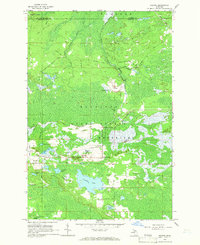 1964 Rexton1966 Print · USGSThe Upper Peninsula’s timber and mining heritage is on display in this mid-century survey of Mackinac County. Researchers can trace the legacy of the Fiborn Quarry and the Soo Line railroad near Rexton and the Caffey Cem.2 unique versions available
 - 1968 Map of Muskallonge Lake East, 1970 Print
 1968 Muskallonge Lake East1970 Print · USGSThe Luce County shoreline on Lake Superior's southern edge was a mix of logging history and emerging recreation in the late sixties. Researchers can trace the Old Railroad Grade near Deer Park or locate backcountry spots like the Reed and Green Bridge Campground.2 unique versions available
 - 1968 Map of Betsy Lake North, 1970 Print
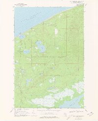 1968 Betsy Lake North1970 Print · USGSThe Lake Superior shoreline and the deep woods of the Upper Peninsula are captured here in the late sixties. Trace the isolation of Crisp Point and its lighthouse or follow the primitive jeep trails toward Culhane Lake and BETSY LAKE.2 unique versions available
 - 1968 Map of Muskallonge Lake SW, 1970 Print
 1968 Muskallonge Lake SW1970 Print · USGSThe Luce County wilderness comes into focus during the late 1960s, showing the intricate headwaters of the legendary Two Hearted River. You can trace the remote network of logging routes and trails like Ohio Camp Road and locate the West Lookout Tower among dozens of named water bodies like Beaver Lake.2 unique versions available
 - 1968 Map of Muskallonge Lake West, 1970 Print
 1968 Muskallonge Lake West1970 Print · USGSThe rugged shoreline of the Upper Peninsula is captured here in the late sixties, showing the intersection of the Great Lakes coast and the deep woods. Trace the path of the Grand Marais Truck Trail past Rainy Lake and the waters of Muskallonge Lake.2 unique versions available
 - 1968 Map of Muskallonge Lake SE, 1970 Print
 1968 Muskallonge Lake SE1970 Print · USGSUpper Peninsula wilderness in the late sixties reveals a landscape shaped by water and woods within the Lake Superior State Forest. Researchers can trace old routes near Pine Stump Junction and the winding course of the Two Hearted River.
Showing maps 1-25 of 206
Frequently asked questions
- What are the different types of historical maps available for Luce County?
- What is the oldest map of Luce County?
- Where can I purchase historical maps of Luce County for my home or office?
- Where can I download high-res historical maps of Luce County?
- Are there historical topographic maps available for Luce County?
- Is there historical aerial imagery available for Luce County?
- Where are historical maps of Luce County sourced from?