1930s Maps of Luce County, Michigan
Explore 7 historic maps of Luce County from the 1930s. These maps offer a rare glimpse into what life looked like during the 1930s — showing old roads, neighborhoods, homes, and landmarks that have changed or disappeared over time.
Whether you're researching your family's past, planning a metal detecting trip, or studying how Luce County's landscape evolved across the 1930s, these high-resolution maps are a powerful tool for exploring the history of this region.
- Focus on a specific era: All maps on this page are from the 1930s, giving you a focused view of this time period.
- See what’s changed: Compare century-old streets, trails, and buildings to today's modern landscape using overlays and satellite layers.
- Research with precision: Use these maps for genealogy, historical research, land use analysis, or educational projects.
- View, download, or print: Maps are fully viewable online in high resolution, and can be downloaded or printed for your own records.
Start exploring Luce County's history through authentic maps from the 1930s. This is your window into the past.
Luce County, MI maps
(7)- 1931 Map of Gould City NE
 1931 Gould City NE1931 Print · USGSMackinac County's Upper Peninsula landscape in the early thirties shows a network of rural schoolhouses and emerging lakeside recreation. Genealogists and historians can locate family-named landmarks like Elsner Sch or the Millecoquins Lake Resort near the Greylock Spur.
 - 1931 Map of Gould City NW
 1931 Gould City NW1931 Print · USGSThe northern reaches of Mackinac County were undergoing a period of industrial and transit transition during the early thirties. Local historians can trace the paths of the Logging RR and State Highway No 135, or locate family roots at Sandtown Cem and Finley Sch.
 - 1931 Map of Epoufette NW
 1931 Epoufette NW1931 Print · USGSMackinac County's industrial and rail corridor is captured here in the early thirties as stone and timber drove the local economy. Genealogists and historians can trace the foundations of Rexton, Caffey, and the extensive works at Fiborn Quarry.
 - 1931 Map of Seney SE
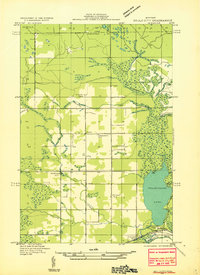
 1931 Seney SE1931 Print · USGSThe Upper Peninsula lake country at the start of the 1930s reveals a wilderness defined by its massive waterways and isolated settlements. Genealogists and researchers can trace the rail-and-road corridor of State Highway No 28 and the D S S and A near the Smithers Sch.
 - 1931 Map of Blaney NE
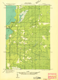
 1931 Blaney NE1931 Print · USGSMackinac County’s interior lake country is captured in the early 1930s, showing a wild landscape of timber and wetlands across the Upper Peninsula. Researchers can trace the sprawling bounds of Cranberry Marsh and the undisturbed shorelines of Manistique Lake and Whitefish Lake.
 - 1931 Map of Gilchrist NE
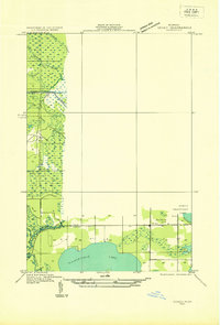
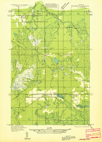 1931 Gilchrist NE1931 Print · USGSMackinac County's timber and rail landscape is frozen in time during the early 1930s, centered on the settlement of Garnet. Genealogists and local historians can trace the foundations of the community at Maplewood Cem and the industrial footprint of the Hendricks Quarry.2 unique versions available
 - 1931 Map of Gilchrist NW
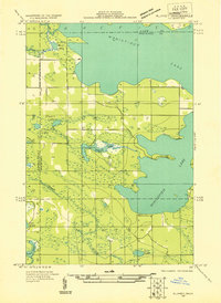
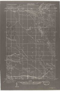 1931 Gilchrist NW1931 Print · USGSMackinac County's timber and transit corridor is captured here in the early 1930s as aerial photography began to refine the mapping of the Upper Peninsula. Trace the iron and asphalt routes of the Minneapolis St Paul and Sault Ste Marie near GILCHRIST and the winding course of North Branch Cold Creek.2 unique versions available
End of results
Showing maps 1-7 of 7
Frequently asked questions
- What are the different types of historical maps available for Luce County?
- What is the oldest map of Luce County?
- Where can I purchase historical maps of Luce County for my home or office?
- Where can I download high-res historical maps of Luce County?
- Are there historical topographic maps available for Luce County?
- Is there historical aerial imagery available for Luce County?
- Where are historical maps of Luce County sourced from?