1900s (20th Century) Maps of Brevort Township, Michigan
Explore 18 historic maps of Brevort Township from the 1900s (20th Century). These maps offer a rare glimpse into what life looked like during the 1900s — showing old roads, neighborhoods, homes, and landmarks that have changed or disappeared over time.
Whether you're researching your family's past, planning a metal detecting trip, or studying how Brevort Township's landscape evolved across the 1900s, these high-resolution maps are a powerful tool for exploring the history of this region.
- Focus on a specific era: All maps on this page are from the 1900s, giving you a focused view of this time period.
- See what’s changed: Compare century-old streets, trails, and buildings to today's modern landscape using overlays and satellite layers.
- Research with precision: Use these maps for genealogy, historical research, land use analysis, or educational projects.
- View, download, or print: Maps are fully viewable online in high resolution, and can be downloaded or printed for your own records.
Start exploring Brevort Township's history through authentic maps from the 1900s. This is your window into the past.
Brevort Township, MI maps
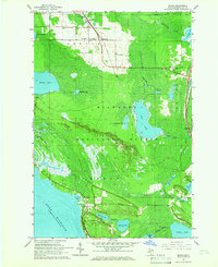
(18)- 1931 Map of Moran NE
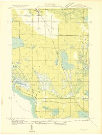 1931 Moran NE1931 Print · USGSCovers Brevort Township, including Moran, Saint Ignace Township, and other nearby areas
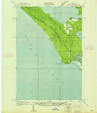
 - 1931 Map of Ozark SE
 1931 Ozark SE1931 Print · USGSCovers Brevort Township, including Saint Ignace Township, Mackinac County, and other nearby areas2 unique versions available
 - 1948 Map of Moran NE
 1948 Moran NE1948 Print · USGSCovers Brevort Township, including Moran, Saint Ignace Township, and other nearby areas
 - 1948 Map of Moran NW
 1948 Moran NW1948 Print · USGSCovers Brevort Township, including Moran Township, Mackinac County, and other nearby areas
 - 1954 Map of Sault Sainte Marie, 1979 Print
 1954 Sault Sainte Marie1979 Print · USGSCovers Brevort Township, including Sault Ste. Marie, Sault Sainte Marie, and other nearby areas3 unique versions available
 - 1955 Map of Cheboygan, 1964 Print
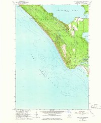
 1955 Cheboygan1964 Print · USGSCovers Brevort Township, including Petoskey, Peninsula Township, and other nearby areas5 unique versions available
 - 1956 Map of Sault Sainte Marie, 1964 Print
 1956 Sault Sainte Marie1964 Print · USGSCovers Brevort Township, including Sault Ste. Marie, Sault Sainte Marie, and other nearby areas2 unique versions available
 - 1957 Map of Sault Sainte Marie
 1957 Sault Sainte Marie1957 Print · USGSCovers Brevort Township, including Sault Ste. Marie, Sault Sainte Marie, and other nearby areas
 - 1958 Map of Cheboygan
 1958 Cheboygan1958 Print · USGSCovers Brevort Township, including Petoskey, Peninsula Township, and other nearby areas2 unique versions available
 - 1958 Map of Sault Sainte Marie
 1958 Sault Sainte Marie1958 Print · USGSCovers Brevort Township, including Sault Ste. Marie, Sault Sainte Marie, and other nearby areas
 - 1964 Map of Ozark, 1965 Print
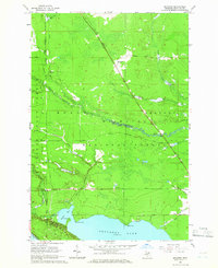
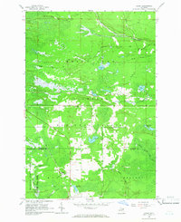 1964 Ozark1965 Print · USGSCovers Brevort Township, including Trout Lake Township, Ozark, and other nearby areas3 unique versions available
 - 1964 Map of Ozark NE, 1965 Print
 1964 Ozark NE1965 Print · USGSCovers Brevort Township, including Saint Ignace Township, Trout Lake Township, and other nearby areas2 unique versions available
 - 1964 Map of Ozark SE, 1965 Print
 1964 Ozark SE1965 Print · USGSCovers Brevort Township, including Saint Ignace Township, Mackinac County, and other nearby areas2 unique versions available
 - 1964 Map of Moran, 1966 Print
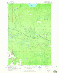
 1964 Moran1966 Print · USGSCovers Brevort Township, including Moran, Saint Ignace Township, and other nearby areas2 unique versions available
 - 1964 Map of Pointe Aux Chenes, 1966 Print
 1964 Pointe Aux Chenes1966 Print · USGSCovers Brevort Township, including Moran Township, Mackinac County, and other nearby areas2 unique versions available
 - 1964 Map of Kenneth, 1966 Print
 1964 Kenneth1966 Print · USGSCovers Brevort Township, including Moran Township, Kenneth, and other nearby areas2 unique versions available
 - 1984 Map of Cheboygan, 1985 Print
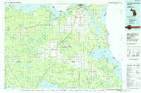
 1984 Cheboygan1985 Print · USGSCovers Brevort Township, including Cheboygan, Saint Ignace, and other nearby areas
 - 1984 Map of Sault Ste. Marie South, 1985 Print
 1984 Sault Ste. Marie South1985 Print · USGSCovers Brevort Township, including Sault Ste. Marie, Sault Sainte Marie, and other nearby areas2 unique versions available
End of results
Showing maps 1-18 of 18
Top cities near Brevort Township
- Saint Ignace historical maps
- Moran historical maps
- Brevort historical maps
- Trout Lake historical maps
- Mackinac Island historical maps
Top neighborhoods of Brevort Township
Frequently asked questions
- What are the different types of historical maps available for Brevort Township?
- What is the oldest map of Brevort Township?
- Where can I purchase historical maps of Brevort Township for my home or office?
- Where can I download high-res historical maps of Brevort Township?
- Are there historical topographic maps available for Brevort Township?
- Is there historical aerial imagery available for Brevort Township?
- Where are historical maps of Brevort Township sourced from?