2020s Maps of Moran Township, Michigan
Explore 10 historic maps of Moran Township from the 2020s. These maps offer a rare glimpse into what life looked like during the 2020s — showing old roads, neighborhoods, homes, and landmarks that have changed or disappeared over time.
Whether you're researching your family's past, planning a metal detecting trip, or studying how Moran Township's landscape evolved across the 2020s, these high-resolution maps are a powerful tool for exploring the history of this region.
- Focus on a specific era: All maps on this page are from the 2020s, giving you a focused view of this time period.
- See what’s changed: Compare century-old streets, trails, and buildings to today's modern landscape using overlays and satellite layers.
- Research with precision: Use these maps for genealogy, historical research, land use analysis, or educational projects.
- View, download, or print: Maps are fully viewable online in high resolution, and can be downloaded or printed for your own records.
Start exploring Moran Township's history through authentic maps from the 2020s. This is your window into the past.
Moran Township, MI maps
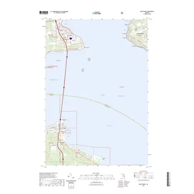
(10)- 2023 Map of Big Stone Bay, 2023 Print
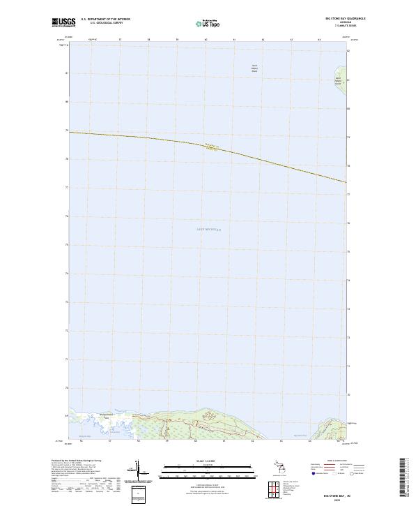 2023 Big Stone Bay2023 Print · USGSThe Straits of Mackinac shoreline comes into sharp focus in this recent survey of the Emmet County coast. Researchers can trace the protected reaches of Wilderness State Park, from Waugoshance Point to the remote Saint Helena Island.
 - 2023 Map of Brevort, 2023 Print
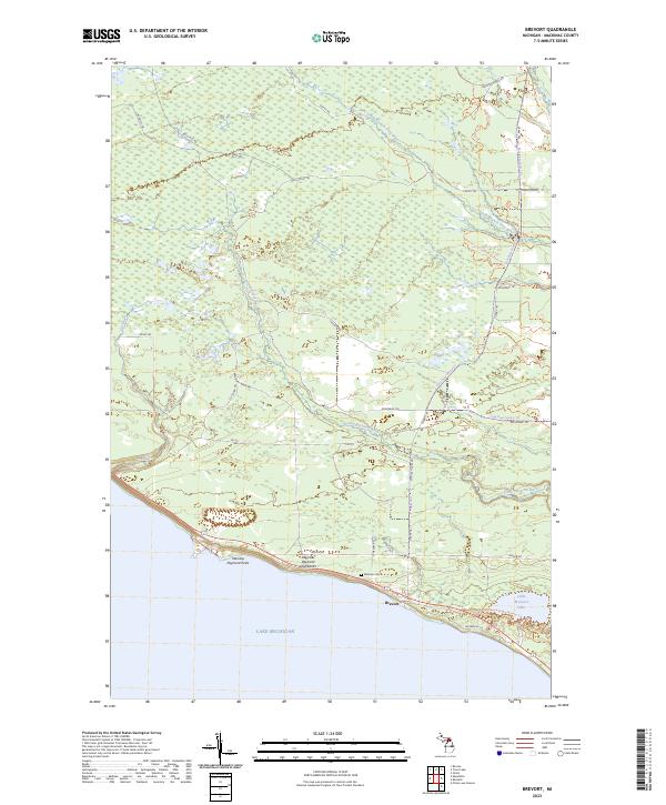 2023 Brevort2023 Print · USGSMackinac County's shoreline and wilderness are detailed in this recent survey of the Brevort area. Genealogists and hikers can trace the coastal Manitou Payment Highbanks, find the Western Cem, and follow the Little Brevoort River into the interior.
 - 2023 Map of Ozark, 2023 Print
 2023 Ozark2023 Print · USGSThe Upper Peninsula’s wooded interior comes into focus in this contemporary survey of the Hiawatha National Forest. Researchers can locate the Brethren Cem and trace recreational routes like the North Country National Scenic Trl near the settlement of Ozark.
 - 2023 Map of Evergreen Shores, 2023 Print
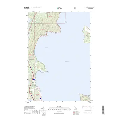 2023 Evergreen Shores2023 Print · USGSCoastal Mackinac County is mapped here in the early 2020s, showing the intersection of the Upper Peninsula mainland and the surrounding islands. Genealogists and local historians can locate Saint Ignace Township Cem or trace landmarks like Castle Rock and the Saint Martin Islands.
 - 2023 Map of Pointe aux Chenes, 2023 Print
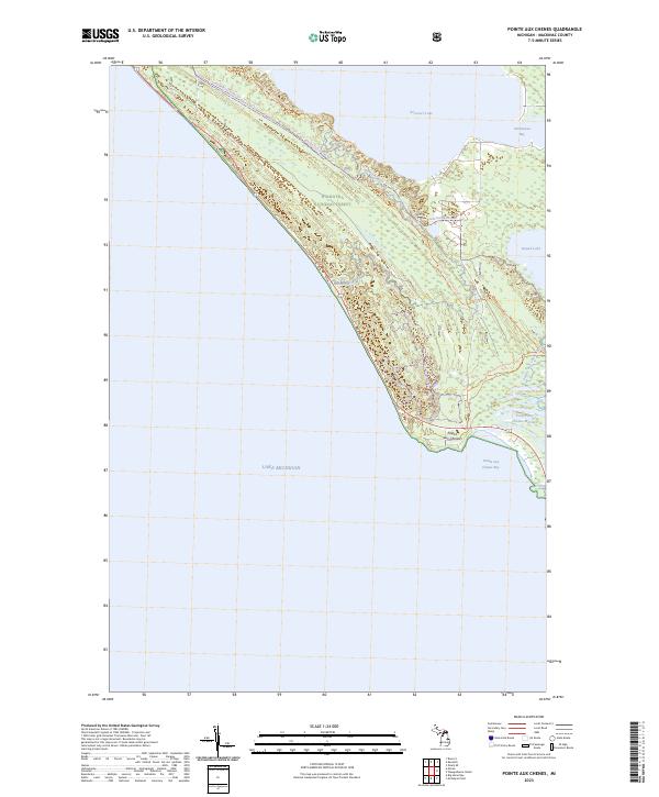 2023 Pointe aux Chenes2023 Print · USGSCoastal Mackinac County is mapped here in the early 2020s, showing a landscape where the Hiawatha National Forest meets the Great Lakes. You can trace modern recreational paths like the North Country National Scenic Trl through the Pointe aux Chenes Marshes.
 - 2023 Map of Trout Lake, 2023 Print
 2023 Trout Lake2023 Print · USGSTrout Lake sits at the junction of Mackinac and Chippewa counties in the Upper Peninsula during the early 2020s. Researchers can locate local landmarks like Lakeview Cem and trace the paths of the South Branch Carp River and Frenchman Lake.
 - 2023 Map of McGulpin Point, 2023 Print
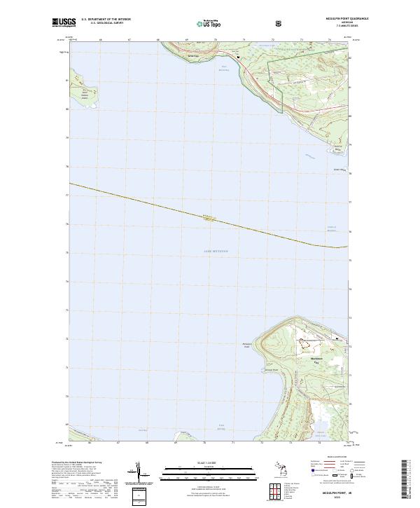 2023 McGulpin Point2023 Print · USGSThe Straits of Mackinac in the early 2020s are captured here, showing the coastal transition between Lake Michigan and Lake Huron. Trace the paths of the North Country National Scenic Trail or locate family sites at Gros Cap Cem and Lakeview Cem.
 - 2023 Map of Moran, 2023 Print
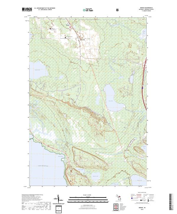 2023 Moran2023 Print · USGSMackinac County’s interior wetlands and Lake Michigan shoreline are captured here in the early twenty-first century. Researchers can locate the Immaculate Conception Cem, trace the Pointe aux Chenes River, and explore the rural settlements of Moran and Allenville.
 - 2023 Map of Kenneth, 2023 Print
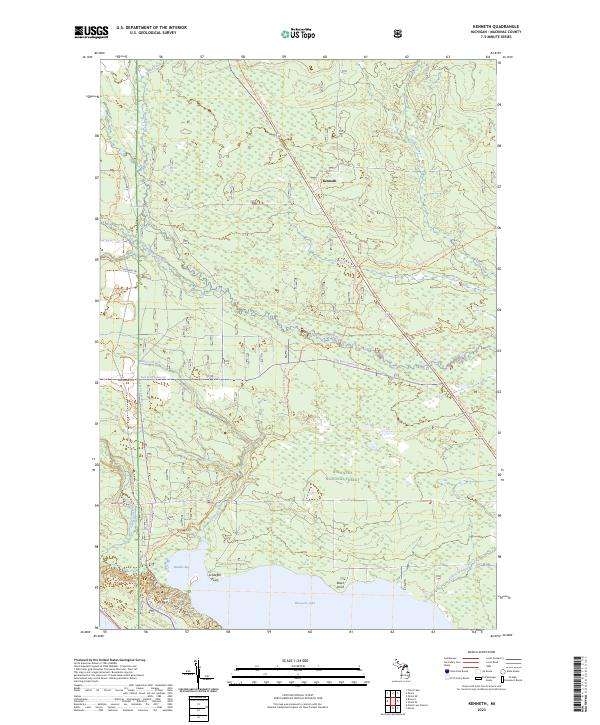 2023 Kenneth2023 Print · USGSMackinac County’s interior forests are documented here in the modern era, showing the settlement of Kenneth surrounded by federal lands. Outdoor historians can trace the North Country National Scenic Trail and the protected Mackinac Wilderness near Brevoort Lake.
 - 2023 Map of Saint Ignace, 2023 Print
 2023 Saint Ignace2023 Print · USGSThe Straits of Mackinac are captured in detail here, showing the vital connection between the Upper and Lower Peninsulas. Researchers can trace land tracts near St. Ignace and Mackinaw City, or locate historic sites like Saint Ignatius Loyola Cem and the Mackinac County Courthouse.
End of results
Showing maps 1-10 of 10
Top cities near Moran Township
- Saint Ignace historical maps
- Moran historical maps
- Mackinaw City historical maps
- Brevort historical maps
- Trout Lake historical maps
Top neighborhoods of Moran Township
Frequently asked questions
- What are the different types of historical maps available for Moran Township?
- What is the oldest map of Moran Township?
- Where can I purchase historical maps of Moran Township for my home or office?
- Where can I download high-res historical maps of Moran Township?
- Are there historical topographic maps available for Moran Township?
- Is there historical aerial imagery available for Moran Township?
- Where are historical maps of Moran Township sourced from?