Old Maps of Moran Township, Michigan for Academic Research
Study the evolution of Moran Township with 75 high-resolution historic maps. Whether you're teaching, researching, or modeling changes in land use, these maps provide essential visual documentation of urban, environmental, and geographic change.
- Analyze long-term change: Track patterns in development, transportation, and natural features.
- Ideal for environmental or urban studies: Support academic projects with primary historical map data.
- Use in the classroom or lab: Educators and researchers rely on these maps to bring historical context to life.
These maps are a powerful tool for teaching, research, and visualizing how Moran Township has changed over the decades.
Moran Township, MI maps
(75)- 1931 Map of St Ignace NW
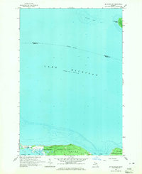
 1931 St Ignace NW1931 Print · USGSMackinac County's shoreline and offshore islands are captured here in the early 1930s, showing the region's rural character before modern expansion. Genealogists and local historians can locate early landmarks like Fort Algonquin, Rabbits Back Sch, and the docks at British Landing.
 - 1931 Map of Epoufette SE
 1931 Epoufette SE1931 Print · USGSThe Mackinac County shoreline appears in the early 1930s as a quiet stretch of coastal wetlands and new highway development. Researchers can trace early settlements like Manitou Payment and Brevoort along the banks of Little Brevoort Lake and the Brevoort River.
 - 1931 Map of Epoufette NE
 1931 Epoufette NE1931 Print · USGSUpper Peninsula timber and rail corridors come alive in this early 1930s survey of the Chippewa and Mackinac county line. Genealogy and transit researchers can trace the tracks of the Duluth South Shore and Atlantic near Wilwin and the waters of Trout Lake.
 - 1931 Map of Moran NE
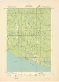
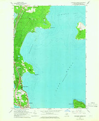
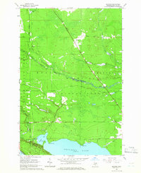
 1931 Moran NE1931 Print · USGSUpper Peninsula life in the 1930s centered on the rail-and-road corridor between the Lake Michigan shore and the inland forests. Researchers can trace family history through St Marys Cem or locate the Christensen Resort and the tracks of the Duluth South Shore and Atlantic.
 - 1948 Map of Moran NE
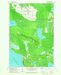
 1948 Moran NE1948 Print · USGSMackinac County's forested interior meets the Lake Michigan shoreline in the 1930s, as the timber and rail era began to embrace tourism. Genealogists and historians can trace old homesteads near Moran, St Marys Cem, and the tracks of the Duluth South Shore and Atlantic railroad.
 - 1948 Map of Moran NW
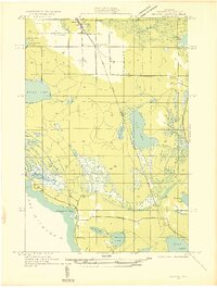
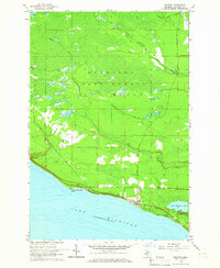
 1948 Moran NW1948 Print · USGSMackinac County's shoreline near the mid-century remains a landscape of prominent points and inland waters. Researchers can trace the path of Old Peter Road and White Trail as they lead toward Brevoort Lake and the coastal Pte Aux Chenes.
 - 1954 Map of Sault Sainte Marie, 1979 Print
 1954 Sault Sainte Marie1979 Print · USGSThe Eastern Upper Peninsula and Ontario borderlands are captured here at the height of the mid-century era. Family historians can trace settlements like Grand Marais and Stalwart, while mapping the strategic grounds of Kincheloe AFB.3 unique versions available
 - 1955 Map of Cheboygan, 1964 Print
 1955 Cheboygan1964 Print · USGSNorthern Michigan in the mid-fifties is a landscape of dense timber and deep water, showing the region just as the road network began to modernize. Trace family roots in lakeside towns like St Ignace and Petoskey, or follow the historic tracks of the Pennsylvania RR and New York Central RR.5 unique versions available
 - 1956 Map of Sault Sainte Marie, 1964 Print
 1956 Sault Sainte Marie1964 Print · USGSThe Eastern Upper Peninsula and the Canadian border meet in this mid-sixties survey of the bustling Soo Locks region. Genealogists and historians can trace the paths of the Soo Line and locate lakeside communities from Grand Marais to Shelldrake.2 unique versions available
 - 1957 Map of Sault Sainte Marie
 1957 Sault Sainte Marie1957 Print · USGSThe Upper Peninsula and Ontario border come alive in this mid-century portrait of the eastern Lake Superior shoreline and the vital St. Marys River corridor. Genealogists and historians can trace rail-era settlements from Newberry to Detour, while locating military landmarks like Kinross Air Force Base.
 - 1958 Map of Cheboygan
 1958 Cheboygan1958 Print · USGSThe tip of Michigan's Lower Peninsula and the surrounding Great Lakes islands are shown here in the late fifties, during the peak of the rail-and-ferry era. Trace the paths of the Pennsylvania RR and explore lakeside settlements like St James, Petoskey, and Indian River.2 unique versions available
 - 1958 Map of Sault Sainte Marie
 1958 Sault Sainte Marie1958 Print · USGSThe eastern Upper Peninsula and the Canadian borderland appear here during the late fifties, a time of military growth and forest management. Researchers can locate vanished rail stops along the Soo Line, early sites like the Fiborn Quarry, and the sprawling Kinross Air Force Base.
 - 1964 Map of Ozark, 1965 Print
 1964 Ozark1965 Print · USGSThe Upper Peninsula wilderness of Chippewa and Mackinac Counties is captured here in the mid-1960s as a landscape of timber and rail. Genealogists and local historians can locate the community of Ozark, the Brethren Cem, and landmarks like the Trout Lake Lookout Tower.3 unique versions available
 - 1964 Map of Big Stone Bay, 1965 Print
 1964 Big Stone Bay1965 Print · USGSThe northern tip of Emmet County is shown in the mid-1960s, where the protected lands of Wilderness State Park meet the lake. Researchers can trace the shoreline from Waugoshance Point up to the isolated St Helena Island.2 unique versions available
 - 1964 Map of Brevort, 1965 Print
 1964 Brevort1965 Print · USGSThe Mackinac coast of the Upper Peninsula comes into focus during the mid-1960s, showing the intersection of Great Lakes shoreline and managed forest. Researchers can trace the layout of the Brevort settlement, the Brevort Cem, and recreational sites like the Little Brevoort Lake Campground.2 unique versions available
 - 1964 Map of Moran, 1966 Print
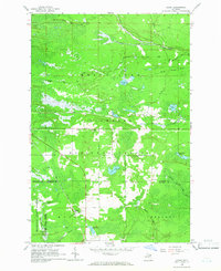
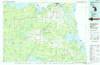
 1964 Moran1966 Print · USGSUpper Peninsula timber and rail life come into focus in the mid-1960s near the Straits. Genealogists and local historians can locate early landmarks like Zion Ch, the Brevoort Cem, and the rail stops at Moran and Allenville.2 unique versions available
 - 1964 Map of Pointe Aux Chenes, 1966 Print
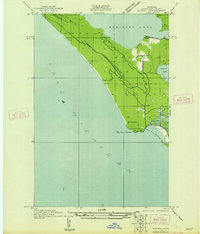
 1964 Pointe Aux Chenes1966 Print · USGSMackinac County's shoreline in the mid-sixties reveals a landscape of protected forests and complex coastal wetlands. Researchers can trace the winding Pointe Aux Chenes River through the Pointe Aux Chenes Marshes and locate the historic Lake Michigan Campground.2 unique versions available
 - 1964 Map of Evergreen Shores, 1966 Print
 1964 Evergreen Shores1966 Print · USGSThe Straits of Mackinac area in the mid-1960s shows a landscape of north-woods forests and expanding coastal settlements. Researchers can trace family sites near Evergreen Shores, locate historic British Landing on Mackinac Island, and identify landmarks like Castle Rock.2 unique versions available
 - 1964 Map of St. Ignace, 1966 Print
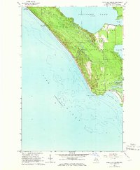
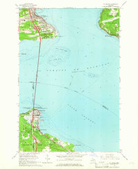 1964 St. Ignace1966 Print · USGSThe Straits of Mackinac were in a period of transition in the mid-sixties, linked by the recently completed Mackinac Bridge. Genealogists and historians can trace the rail terminals of the Pennsylvania and waterfront sites like Old Mackinac Point and Edgewater Beach.2 unique versions available
 - 1964 Map of Trout Lake, 1966 Print
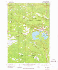 1964 Trout Lake1966 Print · USGSTrout Lake emerged as a vital Upper Peninsula rail hub in the mid-twentieth century, surrounded by the deep woods of the Hiawatha and Mackinac State Forests. Researchers can trace the original Soo Line rail corridors, the historic Lakeview Cem, and local landmarks like School No 15.2 unique versions available
 - 1964 Map of McGulpin Point, 1966 Print
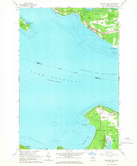 1964 McGulpin Point1966 Print · USGSThe tip of Michigan's Lower Peninsula and the Upper Peninsula shore meet at the straits in the mid-1960s. Researchers can trace the layout of Mackinaw City, locate Gros Cap Cem, or study the shoreline around Mc Gulpin Point.2 unique versions available
 - 1964 Map of Kenneth, 1966 Print
 1964 Kenneth1966 Print · USGSThe Hiawatha National Forest meets the northern shores of Brevoort Lake in the mid-1960s. Trace the Soo Line railroad through the woods past Kenneth or find local landmarks like Rock Rapids and the Boedne Bay Campground.2 unique versions available
 - 1984 Map of Cheboygan, 1985 Print
 1984 Cheboygan1985 Print · USGSThe Straits of Mackinac and the northern tip of Michigan's Lower Peninsula are shown here in the mid-1980s. Local researchers can trace family landmarks and rural crossroads from St Ignace to Cheboygan, including Riggsville and Levering.
 - 1984 Map of Sault Ste. Marie South, 1985 Print
 1984 Sault Ste. Marie South1985 Print · USGSEastern Upper Peninsula life in the 1980s is captured here, from the northern forests down to the northern shores of Lake Huron. Researchers can locate small lakeside communities like Dollar Settlement, trace the Soo Line Railroad, and find family sites near Pine Grove Cem.2 unique versions available
 - 1985 Map of Manistique Lake
 1985 Manistique Lake1985 Print · USGSThe eastern Upper Peninsula’s wilderness and rail-side villages are captured here in the mid-1980s, from the Soo Line corridor to the Lake Michigan shore. Genealogists and historians can trace the foundations of local life in Newberry, Engadine, and Seney, alongside industrial landmarks like the Calspar Quarry Pool.2 unique versions available
Showing maps 1-25 of 75
Top cities near Moran Township
- Saint Ignace historical maps
- Moran historical maps
- Mackinaw City historical maps
- Brevort historical maps
- Trout Lake historical maps
Top neighborhoods of Moran Township
Frequently asked questions
- What are the different types of historical maps available for Moran Township?
- What is the oldest map of Moran Township?
- Where can I purchase historical maps of Moran Township for my home or office?
- Where can I download high-res historical maps of Moran Township?
- Are there historical topographic maps available for Moran Township?
- Is there historical aerial imagery available for Moran Township?
- Where are historical maps of Moran Township sourced from?