Old Maps of Harrison Township, Michigan for Academic Research
Study the evolution of Harrison Township with 23 high-resolution historic maps. Whether you're teaching, researching, or modeling changes in land use, these maps provide essential visual documentation of urban, environmental, and geographic change.
- Analyze long-term change: Track patterns in development, transportation, and natural features.
- Ideal for environmental or urban studies: Support academic projects with primary historical map data.
- Use in the classroom or lab: Educators and researchers rely on these maps to bring historical context to life.
These maps are a powerful tool for teaching, research, and visualizing how Harrison Township has changed over the decades.
Harrison Township, MI maps
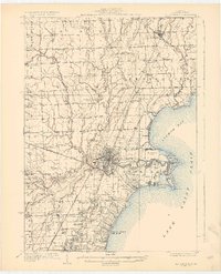
(23)- 1912 Map of Mt Clemens
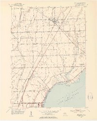
 1912 Mt Clemens1912 Print · USGSMacomb County at the dawn of the aviation age shows a landscape shaped by the winding Clinton River and the arrival of Selfridge Aviation Field. Genealogists and historians can locate legacy settlements like Waldenburg and early industrial sites like the Macomb Sugar Factory.
 - 1929 Map of Mt Clemens
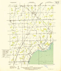
 1929 Mt Clemens1929 Print · USGSMacomb County at the end of the twenties shows a landscape of growing towns and early aviation history along the Lake Saint Clair shoreline. Genealogists and historians can trace local landmarks like Selfridge Field, the Grand Trunk Railroad, and numerous parish schools from Fraser to New Haven.4 unique versions available
 - 1936 Map of New Haven
 1936 New Haven1936 Print · USGSCoastal Macomb County and the shores of Lake St Clair are captured here during the mid-1930s, showing a landscape defined by drainage districts and rail transport. Researchers can locate vanished landmarks like Chesterfield Sta, rural schoolhouses such as Bates Sch, and the Grand Trunk railroad line.
 - 1936 Map of Selfridge Field
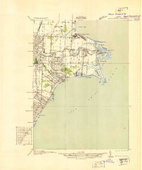 1936 Selfridge Field1936 Print · USGSThe Macomb County shoreline and the early aviation footprint of Selfridge Field are preserved here during the mid-1930s. Researchers can trace the riverfront growth of Lakeside and find local landmarks like School No 3 and Point Rosa.
 - 1952 Map of Mt Clemens East, 1954 Print
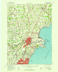
 1952 Mt Clemens East1954 Print · USGSMacomb County's shoreline was undergoing rapid suburbanization in the early fifties as the automotive and defense sectors expanded. Researchers can trace the massive footprint of Selfridge Air Force Base and locate community anchors like St Louis Sch and Lakeside.2 unique versions available
 - 1952 Map of New Haven, 1954 Print
 1952 New Haven1954 Print · USGSMacomb County's shoreline and rural interior are captured here in the early fifties, from the bustling rail corridor at New Haven to the Anchor Bay coast. Genealogists and local historians can locate several family-named landmarks and institutions, including Harris Sch, Hart Cem, and the Selfridge Air Force Base.2 unique versions available
 - 1952 Map of Mt Clemens, 1959 Print
 1952 Mt Clemens1959 Print · USGSIn the early fifties, Macomb County saw rapid suburban growth around the massive Selfridge Air Force Base and Lake St. Clair. Genealogists can trace early neighborhood roots and family landmarks like McKinley Airport, Moravian Sch, and St Paul Cem.
 - 1954 Map of Detroit
 1954 Detroit1954 Print · USGSThe Detroit metro and its Ontario neighbors are shown at the height of the mid-century industrial era, just as the suburbs were rapidly expanding. Researchers can trace the massive rail networks of the Wabash Railroad or locate landmarks like Grosse Ile and Selfridge Air Force Base.
 - 1961 Map of Detroit, 1973 Print
 1961 Detroit1973 Print · USGSThe international border between Michigan and Ontario was a bustling industrial corridor in the early sixties. Researchers can trace the transit networks and riverfront infrastructure connecting Detroit to Windsor via the Detroit-Windsor Tunnel and major air hubs like Willow Run Airport.2 unique versions available
 - 1965 Map of Detroit
 1965 Detroit1965 Print · USGSThe industrial corridor between Michigan and Ontario is captured here at mid-century, showing the dense rail and river networks of the Great Lakes. Local historians can trace the paths of the Grand Trunk Western RR and locate key landmarks like Selfridge Air Force Base and Grosse Ile.
 - 1968 Map of New Haven, 1971 Print
 1968 New Haven1971 Print · USGSNorthern Macomb County is shown in the late sixties as the shoreline of Lake St Clair fills with suburban developments. Genealogists can locate family landmarks like Hart Cem, Fairchild Chapel, and the Lenox Gas Storage Field.3 unique versions available
 - 1968 Map of Mt Clemens East, 1971 Print
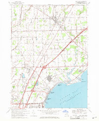
 1968 Mt Clemens East1971 Print · USGSMacomb County's Lake St. Clair shoreline comes alive in this late-sixties record of suburban growth and military activity. Researchers can trace local heritage through landmarks like Selfridge Air Force Base, St Huberts Ch, and Metropolitan Beach.4 unique versions available
 - 1981 Map of Lake St. Clair North
 1981 Lake St. Clair North1981 Print · USGSThe Michigan-Ontario borderlands come alive in the early eighties, showcasing the busy international corridor from the St Clair River down to the delta. Trace the intricate channels around Harsens Island or locate regional hubs like Selfridge Air Force Base and Sarnia.
 - 2011 Map of Mount Clemens East, 2011 Print
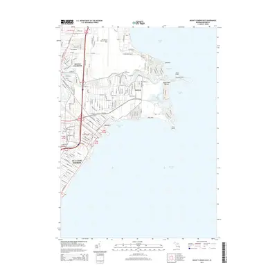
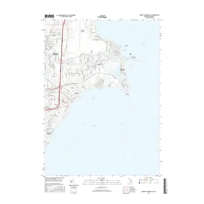
 2011 Mount Clemens East2011 Print · USGSCovers Harrison Township, including Clinton Township, Saint Clair Shores, and other nearby areas
 - 2011 Map of New Haven, 2011 Print
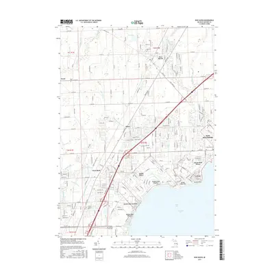
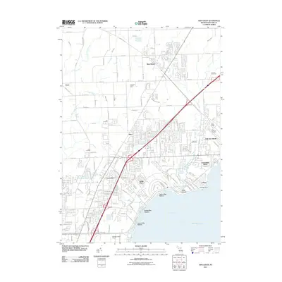 2011 New Haven2011 Print · USGSCovers Harrison Township, including Clinton Township, Macomb Township, and other nearby areas
 - 2014 Map of New Haven, 2014 Print
 2014 New Haven2014 Print · USGSCovers Harrison Township, including Clinton Township, Macomb Township, and other nearby areas
 - 2014 Map of Mount Clemens East, 2014 Print
 2014 Mount Clemens East2014 Print · USGSCovers Harrison Township, including Clinton Township, Saint Clair Shores, and other nearby areas
 - 2017 Map of New Haven, 2017 Print
 2017 New Haven2017 Print · USGSCovers Harrison Township, including Clinton Township, Macomb Township, and other nearby areas
 - 2017 Map of Mount Clemens East, 2017 Print
 2017 Mount Clemens East2017 Print · USGSCovers Harrison Township, including Clinton Township, Saint Clair Shores, and other nearby areas
 - 2019 Map of New Haven, 2019 Print
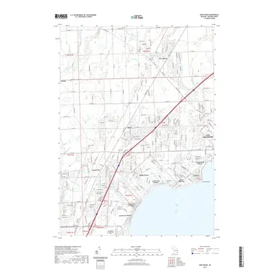 2019 New Haven2019 Print · USGSCovers Harrison Township, including Clinton Township, Macomb Township, and other nearby areas
 - 2019 Map of Mount Clemens East, 2019 Print
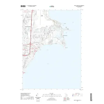 2019 Mount Clemens East2019 Print · USGSCovers Harrison Township, including Clinton Township, Saint Clair Shores, and other nearby areas
 - 2023 Map of Mount Clemens East, 2023 Print
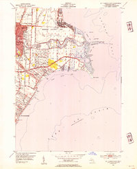
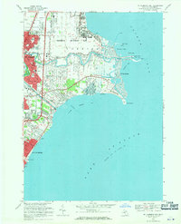
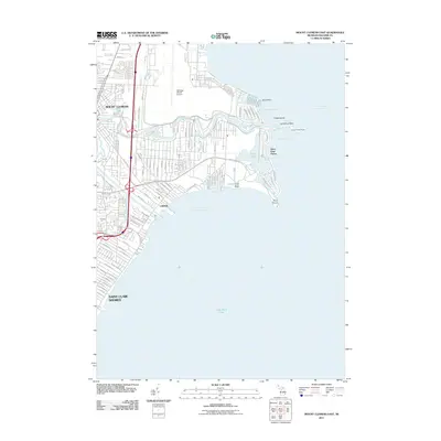
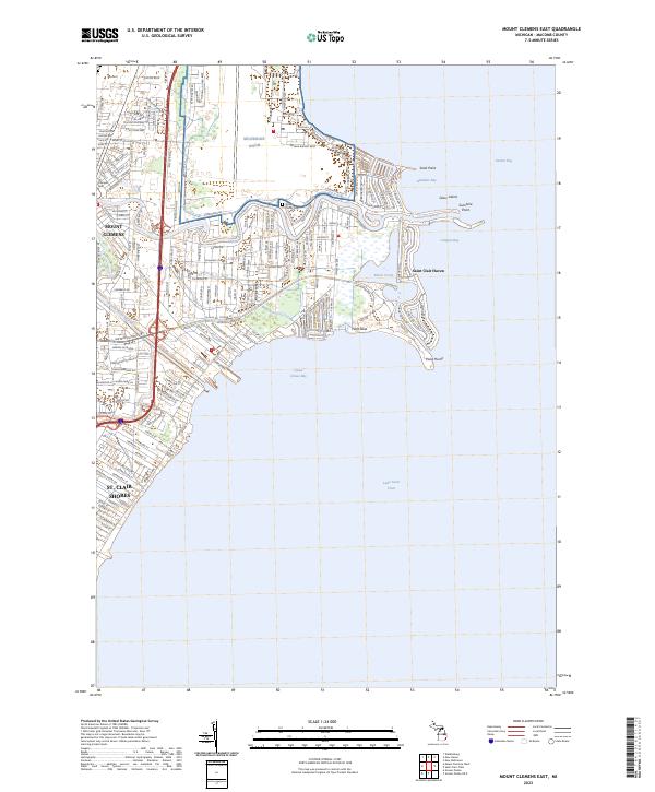 2023 Mount Clemens East2023 Print · USGSSt. Clair's western shore comes into focus in this recent survey of the Macomb County coast. Trace the development of Saint Clair Haven and Mount Clemens alongside landmarks like the Tucker Family Cem and the Clinton River Spillway.
 - 2023 Map of New Haven, 2023 Print
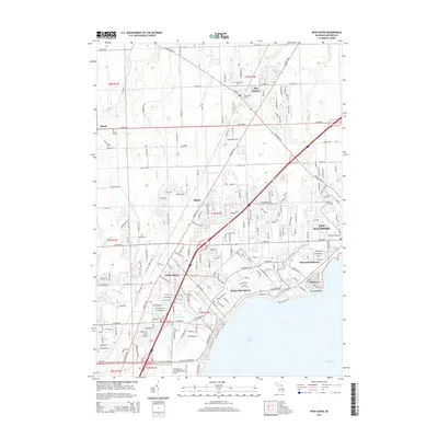
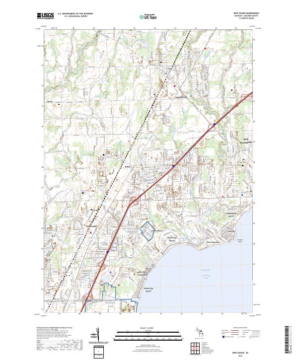 2023 New Haven2023 Print · USGSCoastal Macomb County and the inland plains come into focus in this contemporary survey of the Anchor Bay region. Researchers can trace family history through numerous burial sites like Hart Cem and Oakwood Cem or explore the rail-linked growth of New Haven.
End of results
Showing maps 1-23 of 23
Top cities near Harrison Township
- Detroit historical maps
- Sterling Heights historical maps
- Warren historical maps
- Clinton Township historical maps
- Macomb Township historical maps
- Shelby Charter Township historical maps
See more
Top neighborhoods of Harrison Township
Frequently asked questions
- What are the different types of historical maps available for Harrison Township?
- What is the oldest map of Harrison Township?
- Where can I purchase historical maps of Harrison Township for my home or office?
- Where can I download high-res historical maps of Harrison Township?
- Are there historical topographic maps available for Harrison Township?
- Is there historical aerial imagery available for Harrison Township?
- Where are historical maps of Harrison Township sourced from?