Old Maps of Ewing Township, Michigan for Hiking & Exploration
Hike through history with 75 historic maps of Ewing Township. Explore old trails, ghost towns, and forgotten backroads — perfect for outdoor adventurers and local explorers.
- Rediscover forgotten places: Map out old mining camps, roads, and footpaths that no longer exist on modern maps.
- Layer with modern tools: Combine with LiDAR or satellite views to plan hikes through historical terrain.
- Made for exploration: Popular among hikers, overlanders, and local history lovers.
Use these maps to find adventure and explore the hidden past of Ewing Township.
Ewing Township, MI maps
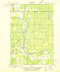
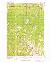
(75)- 1932 Map of Rock SW
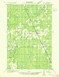 1932 Rock SW1932 Print · USGSUpper Peninsula timber and transit define this 1930s landscape near the Marquette and Delta county line. You can trace the rural school system from North Finn Sch down to St Nicholas Sch or locate family plots at ROCK CEM near the village of Rock.
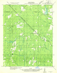
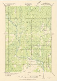
 - 1932 Map of Helena NW
 1932 Helena NW1932 Print · USGSMarquette County's timber and mining lands are shown here in the early 1930s, punctuated by remote industrial outposts and expansive wetlands. You can locate old logging sites like Victor Larson Camp and the Gardner Mine along the Escanaba River corridor.
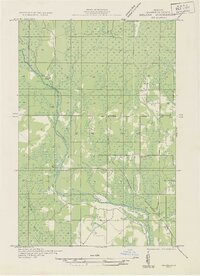
 - 1932 Map of Helena NE
 1932 Helena NE1932 Print · USGSMarquette County's logging and rail infrastructure are on full display in the early 1930s before modern development altered the Upper Peninsula. Genealogists and historians can trace numerous remote outposts like Rochenon Camp, Anderson Camp, and the settlement of Helena.
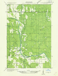
 - 1932 Map of Whitney NE
 1932 Whitney NE1932 Print · USGSThe Upper Peninsula interior during the early 1930s was a landscape of timber-hauling railroads and remote hydro projects. Researchers can locate small communities like Woodlawn and Hendricks or trace the schools and dams along the Escanaba River.
 - 1932 Map of Helena SW
 1932 Helena SW1932 Print · USGSMarquette County’s timber country comes into focus in the early 1930s, showing the railroad and logging camps that drove the regional economy. Researchers can locate vanished sites like John Bruce Camp, the Finnish Sch, and the Arnold PO along the Escanaba and Lake Superior line.
 - 1932 Map of Rock NW
 1932 Rock NW1932 Print · USGSMarquette and Delta counties are shown in the early thirties when logging camps and railroads defined life in the Upper Peninsula. Genealogists can trace family-named outposts like Selins Camp, Stenlund Camp, and the settlement of McFarland.
 - 1932 Map of Helena
 1932 Helena1932 Print · USGSMarquette County's river valleys and rail corridors are captured here in the early thirties as the region transitioned from logging camps to settled townships. Researchers can locate community anchors like the Town Hall and Lincoln Sch or trace the early industrial footprint of the Chicago and Northwestern railroad.2 unique versions available
 - 1932 Map of Gladstone NW
 1932 Gladstone NW1932 Print · USGSThe Escanaba River valley in the early 1930s shows a landscape defined by timber and transport. Genealogists and researchers can trace the rural communities of Cornell and Salva, alongside local schoolhouses like St Nicholas Sch and Chandler Sch.
 - 1950 Map of Gladstone NW
 1950 Gladstone NW1950 Print · USGSThe Upper Peninsula logging and rail landscape comes alive in this mid-century survey of the Escanaba River valley. Genealogists can locate family-named landmarks like Larsons Camp and rural sites such as St Nicholas Sch and the hamlet of Cornell.
 - 1951 Map of Helena SW
 1951 Helena SW1951 Print · USGSMarquette County's logging and rail corridor is captured here in the early 1950s, showing the intersection of timber camps and rural school life. Researchers can trace the Escanaba and Lake Superior line to Watson, the Arnold PO, and the Finnish Sch.
 - 1951 Map of Helena
 1951 Helena1951 Print · USGSMarquette County in the early thirties shows a landscape of river-driven industry and rural school districts. Genealogists and historians can trace the foundations of local education at Ewing Sch and Lincoln Sch or locate the sites of Finn Camp and Sherkeys Camp.2 unique versions available
 - 1951 Map of Helena NE
 1951 Helena NE1951 Print · USGSMarquette County's interior timberlands and marshes come into focus in the early 1950s, showing a landscape defined by seasonal outposts and rail transit. Genealogists and historians can trace old sites like Rochenon Camp, Helena, and the Parker Spur rail siding.
 - 1951 Map of Helena NW
 1951 Helena NW1951 Print · USGSMarquette County’s interior during the early 1950s was a landscape of remote camps and heavy industry centered on the Escanaba River. Genealogists and historians can trace old logging outposts like Faucett Camp and the rail operations of the Chicago and North Western.
 - 1954 Map of Escanaba, 1967 Print
 1954 Escanaba1967 Print · USGSThe Upper Peninsula and Door County shorelines meet here in the mid-fifties, showing the vital maritime and timber networks of the Great Lakes. Researchers can trace historic rail lines, old fire lookouts like the Stonington Fire Tower, and island settlements such as Washington Island.2 unique versions available
 - 1957 Map of Escanaba
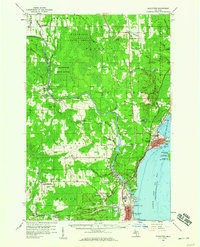
 1957 Escanaba1957 Print · USGSThe Upper Peninsula and Door County shorelines meet in the mid-fifties, capturing a landscape of timber, iron, and maritime trade. Genealogists and local historians can trace the Chicago & North Western RR through settlements like Hermansville or locate St Vitals Church and the Potawatome Indian Reservation.
 - 1958 Map of Escanaba
 1958 Escanaba1958 Print · USGSNorthern Lake Michigan maritime commerce and timberlands are captured here in the mid-fifties. Genealogists and historians can trace rail networks like the Escanaba and Lake Superior or locate island settlements such as Detroit Harbor and Fish Creek.
 - 1958 Map of Gladstone, 1959 Print
 1958 Gladstone1959 Print · USGSDelta County's industrial and forest landscapes come alive in the late fifties, from the shores of the bay to the deep timberlands. Researchers can trace family roots at Perkins Cem, locate the old Newhall Sch, or map the Ore Docks at Escanaba.
 - 1958 Map of Rock, 1959 Print
 1958 Rock1959 Print · USGSUpper Peninsula timberlands and small rail-side settlements are captured here in the late fifties, just as forest management patterns were maturing. Researchers can trace family roots through locations like Rock, McFarland, and Hillview Cem along the Chicago and Northwestern line.3 unique versions available
 - 1958 Map of Marquette, 1968 Print
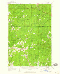
 1958 Marquette1968 Print · USGSThe Upper Peninsula’s central corridor is captured here in the mid-twentieth century as mining and timber industries thrived alongside new military installations. Genealogists and historians can trace the rail lines of the Soo Line Railroad through settlements like Gwinn, Turin, and Chatham.2 unique versions available
 - 1960 Map of Marquette
 1960 Marquette1960 Print · USGSUpper Peninsula mining and maritime commerce reach their peak in the late fifties across the Lake Superior shoreline. Genealogists and historians can locate remote settlements like Big Bay and Dukes, while tracing the Cyr Mine and the active rail lines of the Lake Superior and Ishpeming railroad.
 - 1961 Map of Marquette
 1961 Marquette1961 Print · USGSUpper Peninsula life in the early sixties centered on the iron docks and timber stands of the Lake Superior shore. Genealogists and historians can trace rail-to-port connections via the Lake Superior and Ishpeming Railroad and locate active sites like Republic Mine or the K.I. Sawyer Air Force Base.
 - 1963 Map of Watson, 1964 Print
 1963 Watson1964 Print · USGSUpper Peninsula timber and rail country come into focus during the early sixties, showing the remote settlements of Watson and Arnold. Genealogists and researchers can locate the Forest Home Cem, the Gardner Mine, and the historic Arnold Lookout Tower.
 - 1963 Map of Schaffer, 1965 Print
 1963 Schaffer1965 Print · USGSUpper Peninsula timber and rail corridors define the landscape in the early sixties, showing the vital connections between the forests and regional industry. Researchers can trace the legacy of small settlements like Perronville and Schaffer or locate the Cornell Ch and Schaffer Cem along the Ford River.2 unique versions available
 - 1968 Map of Marquette, 1977 Print
 1968 Marquette1977 Print · USGSThe Upper Peninsula iron range and Lake Superior coastline are captured here in the late sixties. Genealogists and historians can trace the rail-to-port infrastructure and the Cold War presence of K I Sawyer Air Force Base alongside towns like Ishpeming and Munising.
 - 1982 Map of Escanaba
 1982 Escanaba1982 Print · USGSUpper Peninsula timber and mining country come to life in this early 1980s survey of the lakefront and forest interior. Trace family roots and industrial history through settlements like Norway and Gladstone, or locate the Appleton Mine and Fernwood Cem near the rail lines.
Showing maps 1-25 of 75
Top cities near Ewing Township
Frequently asked questions
- What are the different types of historical maps available for Ewing Township?
- What is the oldest map of Ewing Township?
- Where can I purchase historical maps of Ewing Township for my home or office?
- Where can I download high-res historical maps of Ewing Township?
- Are there historical topographic maps available for Ewing Township?
- Is there historical aerial imagery available for Ewing Township?
- Where are historical maps of Ewing Township sourced from?