2020s Maps of Skandia Township, Michigan
Explore 6 historic maps of Skandia Township from the 2020s. These maps offer a rare glimpse into what life looked like during the 2020s — showing old roads, neighborhoods, homes, and landmarks that have changed or disappeared over time.
Whether you're researching your family's past, planning a metal detecting trip, or studying how Skandia Township's landscape evolved across the 2020s, these high-resolution maps are a powerful tool for exploring the history of this region.
- Focus on a specific era: All maps on this page are from the 2020s, giving you a focused view of this time period.
- See what’s changed: Compare century-old streets, trails, and buildings to today's modern landscape using overlays and satellite layers.
- Research with precision: Use these maps for genealogy, historical research, land use analysis, or educational projects.
- View, download, or print: Maps are fully viewable online in high resolution, and can be downloaded or printed for your own records.
Start exploring Skandia Township's history through authentic maps from the 2020s. This is your window into the past.
Skandia Township, MI maps
(6)- 2023 Map of Carlshend, 2023 Print
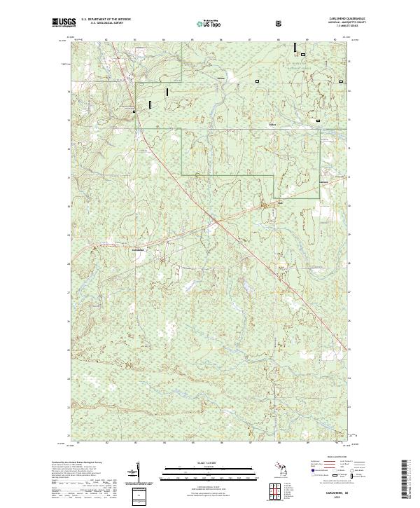 2023 Carlshend2023 Print · USGSMarquette County's rural interior comes into focus here in the early twenty-first century, showcasing a landscape of timberlands and headwaters. Researchers can locate the Emmanuel Lutheran Church Cem and trace old routes through Carlshend, Dukes, and Selma.
 - 2023 Map of Ladoga, 2023 Print
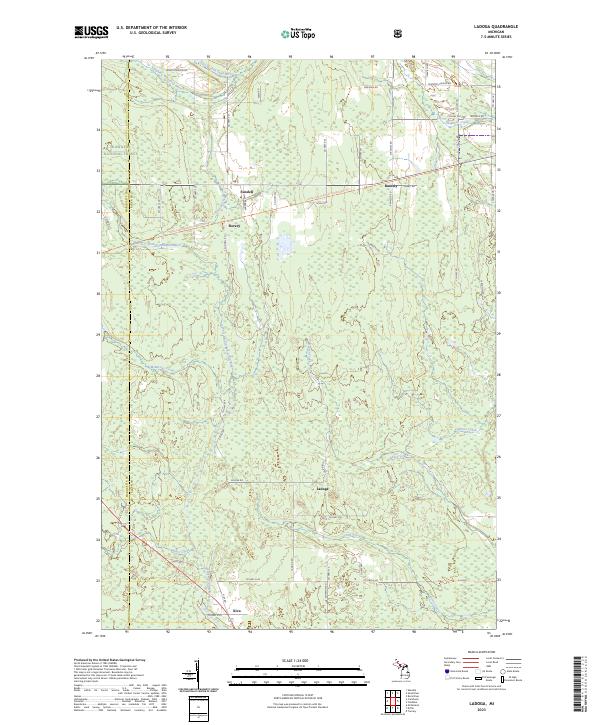 2023 Ladoga2023 Print · USGSUpper Peninsula forests and river headwaters define the landscape of Alger County in the early twenty-first century. Researchers can trace the rural communities of Sundell, Rumely, and Ladoga alongside the protected reaches of the Hiawatha National Forest.
 - 2023 Map of McFarland, 2023 Print
 2023 McFarland2023 Print · USGSThis Upper Peninsula landscape near the Marquette and Delta County line showcases the small settlements of McFarland and Lathrop in the early 2020s. Researchers can locate Hillview Cem and Lathrop Cem or trace the old Stack Grade through the wetlands.
 - 2023 Map of Diffin, 2023 Print
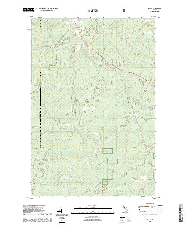 2023 Diffin2023 Print · USGSUpper Peninsula timberlands and river systems are documented here in the early twenty-first century as the borders of Alger, Marquette, and Delta Counties meet. Trace local landmarks like Whitefish Falls, the settlement at Diffin, and the winding course of Werners Creek.
 - 2023 Map of Skandia, 2023 Print
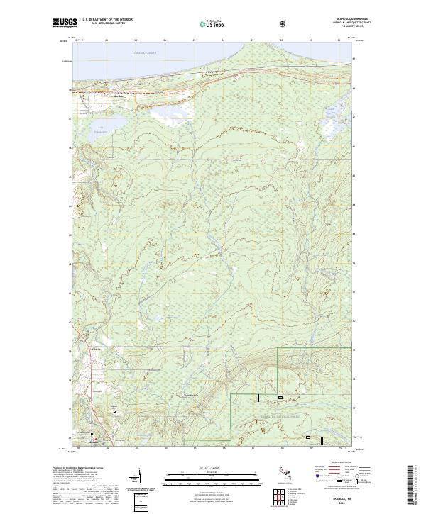 2023 Skandia2023 Print · USGSMarquette County's forested interior and Lake Superior shoreline are mapped here in the early twenty-first century. Genealogists and local historians can trace the vicinity of Skandia and Yalmar, locating landmarks like Haglund Cem and the James Jeske Flooding.
 - 2023 Map of Sand River, 2023 Print
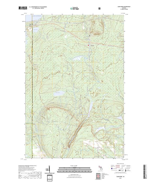 2023 Sand River2023 Print · USGSThe Lake Superior coast and Hiawatha National Forest take center stage in this 2020s study of the Upper Peninsula. Genealogists and hikers can trace connections through Deerton Cem or follow the North Country National Scenic Trl past Laughing Whitefish Falls.
End of results
Showing maps 1-6 of 6
Top cities near Skandia Township
Top neighborhoods of Skandia Township
- Carlshend historical maps
- Dukes historical maps
- Lawson historical maps
- Maple Grove historical maps
- Selma historical maps
- New Dalton historical maps
See more
Frequently asked questions
- What are the different types of historical maps available for Skandia Township?
- What is the oldest map of Skandia Township?
- Where can I purchase historical maps of Skandia Township for my home or office?
- Where can I download high-res historical maps of Skandia Township?
- Are there historical topographic maps available for Skandia Township?
- Is there historical aerial imagery available for Skandia Township?
- Where are historical maps of Skandia Township sourced from?