2020s Maps of Pierson Township, Michigan
Explore 4 historic maps of Pierson Township from the 2020s. These maps offer a rare glimpse into what life looked like during the 2020s — showing old roads, neighborhoods, homes, and landmarks that have changed or disappeared over time.
Whether you're researching your family's past, planning a metal detecting trip, or studying how Pierson Township's landscape evolved across the 2020s, these high-resolution maps are a powerful tool for exploring the history of this region.
- Focus on a specific era: All maps on this page are from the 2020s, giving you a focused view of this time period.
- See what’s changed: Compare century-old streets, trails, and buildings to today's modern landscape using overlays and satellite layers.
- Research with precision: Use these maps for genealogy, historical research, land use analysis, or educational projects.
- View, download, or print: Maps are fully viewable online in high resolution, and can be downloaded or printed for your own records.
Start exploring Pierson Township's history through authentic maps from the 2020s. This is your window into the past.
Pierson Township, MI maps
(4)- 2023 Map of Sand Lake, 2023 Print
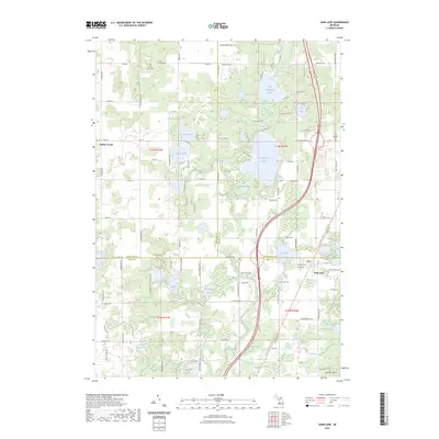 2023 Sand Lake2023 Print · USGSThe lake-dotted borderlands of Kent and Montcalm Counties appear in clear detail in this recent survey. Researchers can trace family history through several local burial grounds like Crandall Cem or locate seasonal properties near Whitefish Lake and Sand Lake.
 - 2023 Map of Tift Corner, 2023 Print
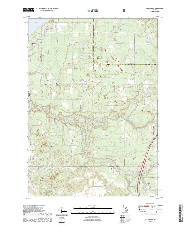 2023 Tift Corner2023 Print · USGSNewaygo and Mecosta counties meet in this recent survey of the Michigan woods and wetlands. Genealogists and local historians can trace rural property lines and find quiet burial grounds like Stearns Prairie Cem and Christian Plains Cem.
 - 2023 Map of Howard City, 2023 Print
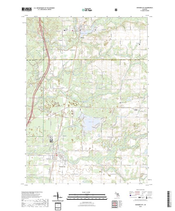 2023 Howard City2023 Print · USGSHoward City and Morley anchor this West Michigan landscape as it appeared in the 2020s, showing a region defined by river valleys and recreational trails. Genealogists can locate several local burial grounds like Saint Apollonia Cem and Reynolds Cem, while outdoor historians can trace the Fred Meijer White Pine Trail State Park.
 - 2023 Map of Coral, 2023 Print
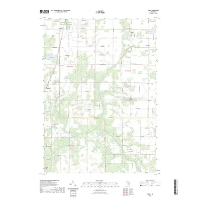 2023 Coral2023 Print · USGSMontcalm and Kent counties are shown in this 2023 survey as a landscape of rural townships and glacial lakes. Local historians can trace the footprint of Coral and Pierson, locate Saint Marys Cem, or follow the White Pine Trail.
End of results
Showing maps 1-4 of 4
Top cities near Pierson Township
- Plainfield Charter Township historical maps
- Cannon Township historical maps
- Alpine Township historical maps
- Greenville historical maps
- Rockford historical maps
- Sparta historical maps
See more
Top neighborhoods of Pierson Township
Frequently asked questions
- What are the different types of historical maps available for Pierson Township?
- What is the oldest map of Pierson Township?
- Where can I purchase historical maps of Pierson Township for my home or office?
- Where can I download high-res historical maps of Pierson Township?
- Are there historical topographic maps available for Pierson Township?
- Is there historical aerial imagery available for Pierson Township?
- Where are historical maps of Pierson Township sourced from?