Old Maps of Montmorency Township, Michigan for Metal Detecting
Plan your next treasure hunt with 59 historic maps of Montmorency Township. Find old homesites, ghost towns, trails, and gathering spots that may be lost to time — perfect for identifying promising metal detecting locations.
- Locate forgotten sites: Uncover places like long-lost settlements, abandoned rail lines, or gathering spots.
- Plan better hunts: Use map overlays combined with LiDAR or satellite views to narrow in on historically rich areas.
- Made for detectorists: Thousands of hobbyists use these maps to discover relics, coins, and hidden history.
Use these historic maps to boost your research and find new opportunities beneath the surface of Montmorency Township.
Montmorency Township, MI maps
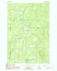
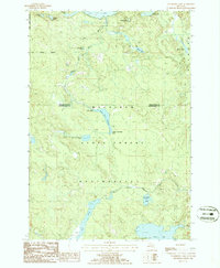
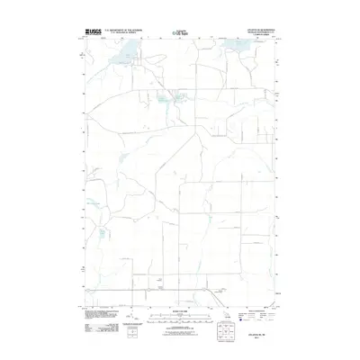
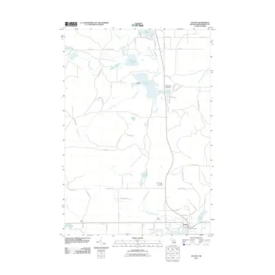
(59)- 1954 Map of Hetherton, 1956 Print
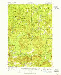 1954 Hetherton1956 Print · USGSNorthern Michigan’s sprawling timberlands are captured here in the mid-fifties, showing a landscape of state forests and quiet lakes. Researchers can trace the rural infrastructure of Hetherton, the Metzger Sch, and remote landmarks like the Pigeon River Lookout Tower.4 unique versions available
 - 1954 Map of Alpena, 1978 Print
 1954 Alpena1978 Print · USGSThe northern waters of Lake Huron meet the Ontario islands during the mid-1950s, a time of active coastal shipping and timber management. Genealogists and historians can trace the Detroit and Mackinac rail line through Alpena or locate rural landmarks like St. Catharine Ch and Forty Mile Point.2 unique versions available
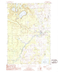
 - 1955 Map of Atlanta, 1956 Print
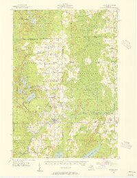
 1955 Atlanta1956 Print · USGSMontmorency County is mapped here in the mid-fifties, showing a landscape of state forests and quiet settlements before modern development. Genealogists and researchers can trace local landmarks like Pleasant Valley Ch, Avery Cem, and the Edwards Sch (Abandoned).3 unique versions available
 - 1955 Map of Hillman, 1956 Print
 1955 Hillman1956 Print · USGSThe village of Hillman and its surrounding forest lands are documented here during the mid-1950s. Local researchers can trace family roots through numerous rural sites like St Johns Ch, Babcock Sch, and the Hillman Cemetery.3 unique versions available
 - 1955 Map of Cheboygan, 1964 Print
 1955 Cheboygan1964 Print · USGSNorthern Michigan in the mid-fifties is a landscape of dense timber and deep water, showing the region just as the road network began to modernize. Trace family roots in lakeside towns like St Ignace and Petoskey, or follow the historic tracks of the Pennsylvania RR and New York Central RR.5 unique versions available
 - 1957 Map of Alpena
 1957 Alpena1957 Print · USGSNortheast Michigan and the islands of the North Channel are captured in the mid-1950s, showing the vital maritime and rail connections of the region. Researchers can trace the path of the Detroit and Mackinac RR or locate small settlements like Meldrum Bay and Lachine.
 - 1958 Map of Cheboygan
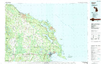
 1958 Cheboygan1958 Print · USGSThe tip of Michigan's Lower Peninsula and the surrounding Great Lakes islands are shown here in the late fifties, during the peak of the rail-and-ferry era. Trace the paths of the Pennsylvania RR and explore lakeside settlements like St James, Petoskey, and Indian River.2 unique versions available
 - 1958 Map of Alpena
 1958 Alpena1958 Print · USGSThe northern reaches of Lake Huron and the Ontario islands are mapped here in the late fifties. You can trace the Detroit and Mackinac RR through Rogers City or locate remote outposts like Meldrum Bay and St. Vital church.
 - 1969 Map of Alpena
 1969 Alpena1969 Print · USGSThe Lake Huron coastline and the Manitoulin islands come alive in this mid-century survey of the Michigan-Ontario border. Genealogists and historians can trace the Detroit and Mackinac rail line through settlements like Lachine and Cathro, or locate the numerous island reservations including Obigewong Indian Reservation No 21.
 - 1982 Map of Petoskey
 1982 Petoskey1982 Print · USGSNorthern Michigan in the early eighties shows a landscape of deep timber and vast inland lakes. Genealogists and historians can trace the rail corridors of the Michigan Central and Detroit and Mackinac between Petoskey, Gaylord, and Wolverine.
 - 1984 Map of Alpena
 1984 Alpena1984 Print · USGSThe Lake Huron shoreline in the 1980s reveals a region defined by maritime industry, timberlands, and vast inland waters. Genealogists and historians can trace the Detroit and Mackinac Railroad past old settlements like Posen, Hagensville, and the harbor at Rockport.
 - 1986 Map of Silver Lake
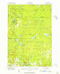
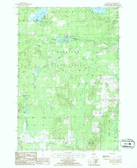
 1986 Silver Lake1986 Print · USGSThe dense forests of Northern Michigan come alive in this mid-eighties survey of the tri-county border between Cheboygan, Otsego, and Montmorency. Trace the legacy of timber and transit along the Old Railroad Grade or explore the waters of Silver Lake and the Foch Lakes Flooding.2 unique versions available
 - 1986 Map of Atlanta SE
 1986 Atlanta SE1986 Print · USGSMontmorency County’s forested interior is captured in the mid-1980s, showcasing a landscape of timber and hidden waters. Researchers can locate an Old RR Grade and a remote Landing Strip near the shores of Lake Hiawatha and Rush Lake.
 - 1986 Map of Royston
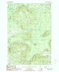
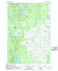 1986 Royston1986 Print · USGSMontmorency County and the Mackinaw State Forest are shown here in the mid-1980s, revealing a landscape of dense timber and glacial lakes. Genealogists and local historians can trace the early Old Railroad Grade and find family sites near Royston or the Cem in Wellington.
 - 1986 Map of Atlanta
 1986 Atlanta1986 Print · USGSMontmorency County in the mid-1980s reveals a landscape defined by state forestry and winding glacial waterways. Genealogists and historians can trace the Old RR Grade through the Green Swamp or locate family landmarks near Atlanta and Big Rock.
 - 1986 Map of Cranberry Lake
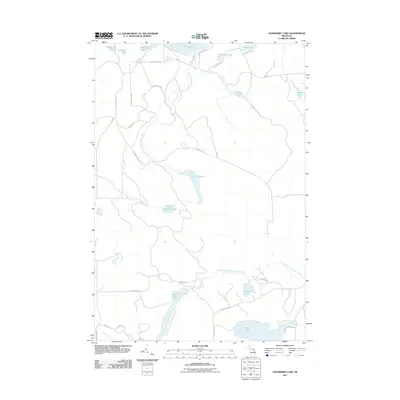
 1986 Cranberry Lake1986 Print · USGSMontmorency and Presque Isle counties are captured in the mid-1980s as a densely forested lake district within the Mackinaw State Forest. Researchers can trace the water flow from the Rainy River Dam through the Rainy River Flooding and locate remote features like the northern Landing Strip (Pvt).
 - 1986 Map of Hillman
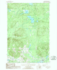
 1986 Hillman1986 Print · USGSHillman and the surrounding lake country of Montmorency County are captured here in the mid-1980s. Local researchers can trace the course of the Thunder Bay River and locate historic sites like the Cem, Gravel Pits, and Fletcher Pond.
 - 1986 Map of Lake Geneva
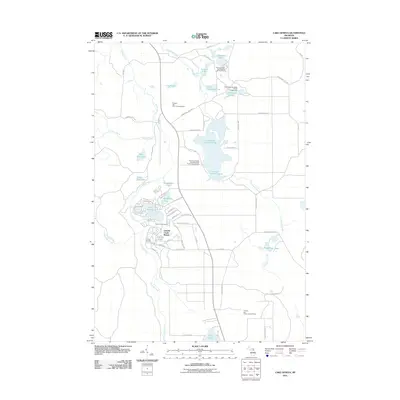
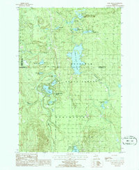 1986 Lake Geneva1986 Print · USGSMontmorency County and the surrounding state forest lands are shown here in the mid-eighties as a pristine network of glacial lakes and managed timber. You can trace the boundaries of Canada Creek Ranch or locate campsites at Clear Lake State Park and Shoepac Lake.
 - 1986 Map of Hetherton
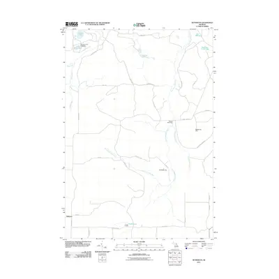
 1986 Hetherton1986 Print · USGSMontmorency County during the mid-eighties remains a landscape of deep woods and historic timber paths within the Mackinaw State Forest. Researchers can trace the heritage of the timber era via the Old Railroad Grade or locate family landmarks near Hetherton and Gingell Lake.
 - 2011 Map of Atlanta SE, 2011 Print
 2011 Atlanta SE2011 Print · USGSCovers Montmorency Township, including Avery Township, Rust Township, and other nearby areas
 - 2011 Map of Lake Geneva, 2011 Print
 2011 Lake Geneva2011 Print · USGSCovers Montmorency Township, including Canada Creek Ranch, Allis Township, and other nearby areas
 - 2011 Map of Hetherton, 2011 Print
 2011 Hetherton2011 Print · USGSCovers Montmorency Township, including Corwith Township, Hetherton, and other nearby areas
 - 2011 Map of Cranberry Lake, 2011 Print
 2011 Cranberry Lake2011 Print · USGSCovers Montmorency Township, including Case Township, Bismarck Township, and other nearby areas
 - 2011 Map of Atlanta, 2011 Print
 2011 Atlanta2011 Print · USGSCovers Montmorency Township, including Atlanta, Avery Township, and other nearby areas
 - 2011 Map of Royston, 2011 Print
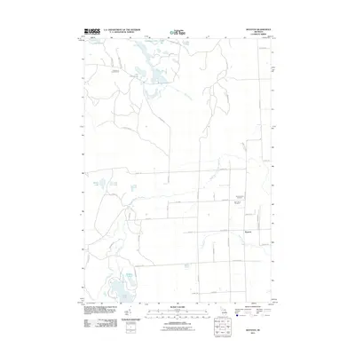 2011 Royston2011 Print · USGSCovers Montmorency Township, including Wellington Township, Bismarck Township, and other nearby areas
Showing maps 1-25 of 59
Top cities near Montmorency Township
- Hillman historical maps
- Onaway historical maps
- Atlanta historical maps
- Avery historical maps
- Rust historical maps
- Canada Creek Ranch historical maps
See more
Top neighborhoods of Montmorency Township
Frequently asked questions
- What are the different types of historical maps available for Montmorency Township?
- What is the oldest map of Montmorency Township?
- Where can I purchase historical maps of Montmorency Township for my home or office?
- Where can I download high-res historical maps of Montmorency Township?
- Are there historical topographic maps available for Montmorency Township?
- Is there historical aerial imagery available for Montmorency Township?
- Where are historical maps of Montmorency Township sourced from?