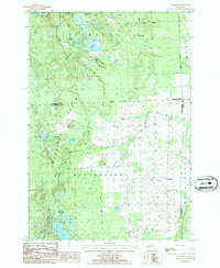
1986 Map of Royston
USGS Topo · Published 1986About this map
The northern edge of Montmorency County meets Presque Isle Co in this mid-1980s topographical study of a landscape defined by glacial lakes and timberlands. Much of the western half of the sheet is occupied by the Mackinaw State Forest, where water bodies like Lake Ferdelman and Marl Bed Lake appear among complex terrain. The drainage of the North Branch Thunder Bay River and the main Thunder Bay River cut through the central plains, leading toward the small settlements of Quinn and Royston in the east.
Find a feature on this map
28 named features on this map. Tap any name to fly to it.
Don’t see what you’re looking for? This feature index may not catch every label — zoom into the map to look around manually.
Map Details
Editions of this 1986 Royston Map
This is the sole edition of this map. No revisions or reprints were ever made.
Other maps of this area

1954 · Alpena
USGS Topo · 1:250,000

1955 · Atlanta
USGS Topo · 1:62,500

1955 · Hillman
USGS Topo · 1:62,500

1955 · Cheboygan
USGS Topo · 1:250,000

1957 · Alpena
USGS Topo · 1:250,000

1957 · Onaway
USGS Topo · 1:62,500

1958 · Cheboygan
USGS Topo · 1:250,000

1958 · Alpena
USGS Topo · 1:250,000

1969 · Alpena
USGS Topo · 1:250,000

1971 · Hawks
USGS Topo · 1:24,000