Old Maps of Roosevelt Park, Michigan for Academic Research
Study the evolution of Roosevelt Park with 11 high-resolution historic maps. Whether you're teaching, researching, or modeling changes in land use, these maps provide essential visual documentation of urban, environmental, and geographic change.
- Analyze long-term change: Track patterns in development, transportation, and natural features.
- Ideal for environmental or urban studies: Support academic projects with primary historical map data.
- Use in the classroom or lab: Educators and researchers rely on these maps to bring historical context to life.
These maps are a powerful tool for teaching, research, and visualizing how Roosevelt Park has changed over the decades.
Roosevelt Park, MI maps
(11)- 1930 Map of Lake Harbor
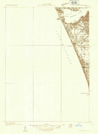 1930 Lake Harbor1930 Print · USGSThe industrial and recreational shoreline of Lake Michigan comes alive in this pre-war survey of the Muskegon region. Genealogists can trace family roots through specific locations like Indian Village, Port Sherman, and the Maple Grove Sch.
 - 1936 Map of Lake Harbor
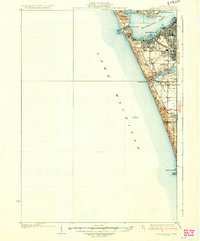 1936 Lake Harbor1936 Print · USGSCoastal Muskegon and its industrial neighbors are captured in the mid-1930s as the region transitioned into a major Lake Michigan port. Genealogists and historians can trace neighborhood growth through landmarks like Indian Village, Maple Grove Sch, and the rail lines of the P M RY.3 unique versions available
 - 1954 Map of Milwaukee, 1967 Print
 1954 Milwaukee1967 Print · USGSCoastal life and maritime commerce across Lake Michigan are seen here during the mid-fifties, bridging Wisconsin's industrial hubs and Michigan's timberlands. Genealogists and historians can trace the rail lines of the Grand Trunk Western and find long-established ports like Ludington, Port Washington, and Muskegon.3 unique versions available
 - 1958 Map of Milwaukee
 1958 Milwaukee1958 Print · USGSThe shorelines of Lake Michigan in the late fifties reveal a landscape of bustling ferry ports and growing industrial suburbs. Genealogists and historians can trace rail networks like the Chesapeake & Ohio and locate landmarks such as Little Sable Point and Holy Cross Church.
 - 1972 Map of Muskegon West, 1975 Print
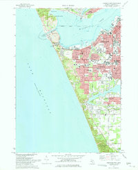 1972 Muskegon West1975 Print · USGSCoastal Michigan in the early seventies shows a bustling port city and growing suburbs nestled along the Lake Michigan shoreline. Researchers can trace neighborhood development through Lakeside Cemetery, Central High School, and the Muskegon County Airport.2 unique versions available
 - 1982 Map of Muskegon
 1982 Muskegon1982 Print · USGSThe West Michigan shoreline during the early eighties shows a bustling industrial and maritime landscape centered on Muskegon Lake and Grand Haven. Researchers can trace rail history along the Grand Trunk Western or locate local landmarks like Oakwood Cem and Cloverville.
 - 2011 Map of Muskegon West, 2011 Print
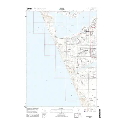
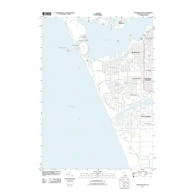 2011 Muskegon West2011 Print · USGSCovers Roosevelt Park, including Muskegon, Norton Shores, and other nearby areas
 - 2014 Map of Muskegon West, 2014 Print
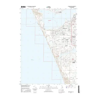
 2014 Muskegon West2014 Print · USGSCovers Roosevelt Park, including Muskegon, Norton Shores, and other nearby areas
 - 2017 Map of Muskegon West, 2017 Print
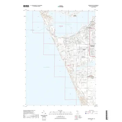
 2017 Muskegon West2017 Print · USGSCovers Roosevelt Park, including Muskegon, Norton Shores, and other nearby areas
 - 2019 Map of Muskegon West, 2019 Print
 2019 Muskegon West2019 Print · USGSCovers Roosevelt Park, including Muskegon, Norton Shores, and other nearby areas
 - 2023 Map of Muskegon West, 2023 Print
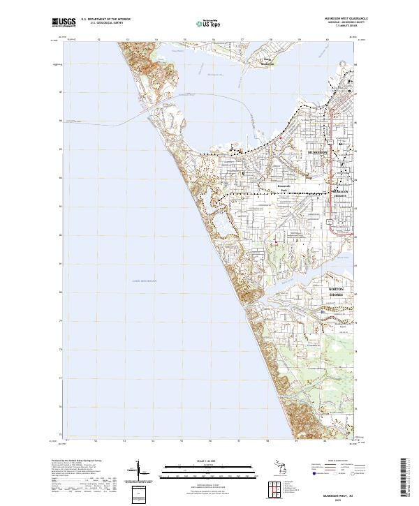 2023 Muskegon West2023 Print · USGSMuskegon’s shoreline and industrial corridor are mapped here during a period of modern expansion along the Lake Michigan coast. Genealogists and local historians can trace specific landmarks like the Old Indian Cem, Ruddiman Lagoon, and the Lake Express Ferry terminal.
End of results
Showing maps 1-11 of 11
Top cities near Roosevelt Park
- Muskegon historical maps
- Norton Shores historical maps
- Spring Lake Township historical maps
- Muskegon Heights historical maps
- Grand Haven historical maps
- Dalton historical maps
See more
Frequently asked questions
- What are the different types of historical maps available for Roosevelt Park?
- What is the oldest map of Roosevelt Park?
- Where can I purchase historical maps of Roosevelt Park for my home or office?
- Where can I download high-res historical maps of Roosevelt Park?
- Are there historical topographic maps available for Roosevelt Park?
- Is there historical aerial imagery available for Roosevelt Park?
- Where are historical maps of Roosevelt Park sourced from?