1950s Maps of Newaygo County, Michigan
Explore 14 historic maps of Newaygo County from the 1950s. These maps offer a rare glimpse into what life looked like during the 1950s — showing old roads, neighborhoods, homes, and landmarks that have changed or disappeared over time.
Whether you're researching your family's past, planning a metal detecting trip, or studying how Newaygo County's landscape evolved across the 1950s, these high-resolution maps are a powerful tool for exploring the history of this region.
- Focus on a specific era: All maps on this page are from the 1950s, giving you a focused view of this time period.
- See what’s changed: Compare century-old streets, trails, and buildings to today's modern landscape using overlays and satellite layers.
- Research with precision: Use these maps for genealogy, historical research, land use analysis, or educational projects.
- View, download, or print: Maps are fully viewable online in high resolution, and can be downloaded or printed for your own records.
Start exploring Newaygo County's history through authentic maps from the 1950s. This is your window into the past.
Newaygo County, MI maps
(14)- 1954 Map of Milwaukee, 1967 Print
 1954 Milwaukee1967 Print · USGSCoastal life and maritime commerce across Lake Michigan are seen here during the mid-fifties, bridging Wisconsin's industrial hubs and Michigan's timberlands. Genealogists and historians can trace the rail lines of the Grand Trunk Western and find long-established ports like Ludington, Port Washington, and Muskegon.3 unique versions available
 - 1954 Map of Midland, 1967 Print
 1954 Midland1967 Print · USGSMid-Michigan at the peak of the post-war era shows a landscape balancing industrial growth in Midland with the deep timberlands of the Manistee National Forest. Researchers can trace the legacy of the timber and rail era along the Pennsylvania RR or find family roots in river towns like Chesaning and Big Rapids.4 unique versions available
 - 1958 Map of Midland
 1958 Midland1958 Print · USGSCentral Michigan in the late fifties is captured here during a period of transition for its university towns and industrial hubs. Genealogists and researchers can trace family lines through old rail-stop towns like Breckenridge and Chesaning or locate property near the Muskegon River and Prairie Farm.
 - 1958 Map of Milwaukee
 1958 Milwaukee1958 Print · USGSThe shorelines of Lake Michigan in the late fifties reveal a landscape of bustling ferry ports and growing industrial suburbs. Genealogists and historians can trace rail networks like the Chesapeake & Ohio and locate landmarks such as Little Sable Point and Holy Cross Church.
 - 1958 Map of Hesperia, 1959 Print
 1958 Hesperia1959 Print · USGSThe borderlands of Oceana and Newaygo counties are captured here in the late fifties, showcasing a landscape of dense woodlots and glacial lakes. Genealogists can trace family names through rural landmarks like Indian Cem, Newman Sch, and the village of Walkerville.3 unique versions available
 - 1958 Map of Sand Lake, 1960 Print
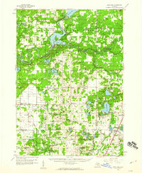 1958 Sand Lake1960 Print · USGSWest-central Michigan at the close of the fifties reveals a landscape shaped by the meeting of the Muskegon rivers and the expansive Manistee National Forest. Genealogists can locate family names and sites at Ensley Center, the Lady of Guadalupe Mission, and the Sand Lake Cem.2 unique versions available
 - 1958 Map of Twin Lake, 1960 Print
 1958 Twin Lake1960 Print · USGSMuskegon County in the late fifties shows a landscape of dense lake-country and growing crossroads. Genealogists and local historians can trace rural school districts at St Michaels Sch or find family plots at Blue Lake Cem and Horton Cem.3 unique versions available
 - 1958 Map of Fremont, 1960 Print
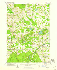
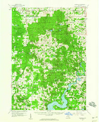
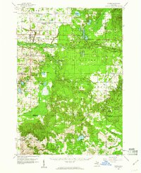
 1958 Fremont1960 Print · USGSNewaygo County's transition from forest to farmland is visible in this mid-century survey of the Muskegon River valley. Genealogists can trace family roots through numerous rural landmarks like the Danish Ch, Reeman Cem, and more than twenty localized schoolhouses.2 unique versions available
 - 1958 Map of Woodville, 1960 Print
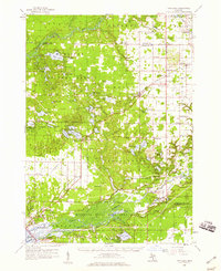
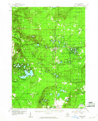
 1958 Woodville1960 Print · USGSNewaygo County and the Manistee National Forest are shown in the late fifties as a landscape of timber-town history and modern energy production. Researchers can locate family landmarks like the Old Prairie Everett Cemetery, Big Jackson School, and the remote Trumbull Corners settlement.3 unique versions available
 - 1959 Map of Midland
 1959 Midland1959 Print · USGSMid-century Michigan comes alive in this survey of the central Lower Peninsula, from the streets of Grand Rapids to the Houghton Lake timberlands. Genealogists and rail fans can trace the Ann Arbor RR and Chesapeake and Ohio RR through towns like Big Rapids and Mount Pleasant.
 - 1959 Map of Reed City, 1960 Print
 1959 Reed City1960 Print · USGSOsceola and Lake Counties are captured here in the late fifties, defined by the meeting of major rail lines and dense public forests. Researchers can locate dozens of rural landmarks, from the Fish Hatchery near Paris to schools like Rehkoff Sch and Zion Ch.2 unique versions available
 - 1959 Map of Baldwin, 1960 Print
 1959 Baldwin1960 Print · USGSLake County at the end of the fifties was a landscape of dense timber and quiet lakeside settlements. Genealogists and historians can trace old homesteads near Walkers Corners, locate Oaklawn Cem, and follow the Chesapeake and Ohio Railroad through Idlewild.4 unique versions available
 - 1959 Map of Custer, 1960 Print
 1959 Custer1960 Print · USGSIn the late fifties, the central Michigan woods around Custer were a landscape of deep national forest and active rail lines. Genealogists and local historians can trace family locations near Crystal Valley, old rural schoolhouses like Elmwood Sch, and several remote Gravel Pits.3 unique versions available
 - 1959 Map of White Cloud, 1960 Print
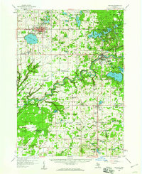
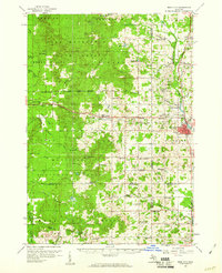
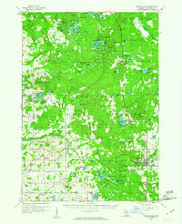 1959 White Cloud1960 Print · USGSNewaygo County in the late fifties is a landscape of glacial lakes and dense timber, anchored by the rail hub of White Cloud. Genealogists can trace rural family life through landmarks like Donahue Sch, East Denver Ch, and the isolated community of Woodland Park.3 unique versions available
End of results
Showing maps 1-14 of 14
Top cities of Newaygo County
Frequently asked questions
- What are the different types of historical maps available for Newaygo County?
- What is the oldest map of Newaygo County?
- Where can I purchase historical maps of Newaygo County for my home or office?
- Where can I download high-res historical maps of Newaygo County?
- Are there historical topographic maps available for Newaygo County?
- Is there historical aerial imagery available for Newaygo County?
- Where are historical maps of Newaygo County sourced from?