1970s Maps of Newaygo County, Michigan
Explore 11 historic maps of Newaygo County from the 1970s. These maps offer a rare glimpse into what life looked like during the 1970s — showing old roads, neighborhoods, homes, and landmarks that have changed or disappeared over time.
Whether you're researching your family's past, planning a metal detecting trip, or studying how Newaygo County's landscape evolved across the 1970s, these high-resolution maps are a powerful tool for exploring the history of this region.
- Focus on a specific era: All maps on this page are from the 1970s, giving you a focused view of this time period.
- See what’s changed: Compare century-old streets, trails, and buildings to today's modern landscape using overlays and satellite layers.
- Research with precision: Use these maps for genealogy, historical research, land use analysis, or educational projects.
- View, download, or print: Maps are fully viewable online in high resolution, and can be downloaded or printed for your own records.
Start exploring Newaygo County's history through authentic maps from the 1970s. This is your window into the past.
Newaygo County, MI maps
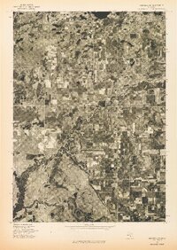
(11)- 1976 Map of Twin Lake SE
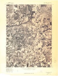
 1976 Twin Lake SE1976 Print · USGSMid-century Michigan land use and river morphology are captured in this 1976 aerial study. Researchers can trace the winding course of the Muskegon River, the development near Wolf Lake, and the distinctive circular patterns of industrial-scale irrigation.
 - 1976 Map of White Cloud SW
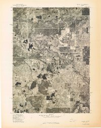
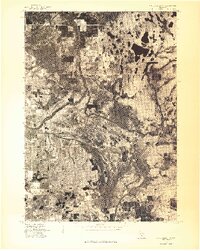
 1976 White Cloud SW1976 Print · USGSNewaygo County is captured during the mid-seventies in this detailed aerial perspective of the rural Michigan landscape. Researchers can trace the exact footprint of the settlement at Aetna and study the intricate winding path of the local river system.
 - 1976 Map of Baldwin SE
 1976 Baldwin SE1976 Print · USGSNewaygo County's woodland and water systems are seen in detail through this mid-seventies aerial survey of the Michigan landscape. Researchers can trace the path of the Pere Marquette River and the settlement patterns surrounding Marlborough.
 - 1976 Map of White Cloud SE
 1976 White Cloud SE1976 Print · USGSWhite Cloud and the surrounding Newaygo County landscape are captured in this mid-seventies aerial survey. Researchers can trace the development of White Cloud and the smaller cluster at Jugville amidst a dense network of lakes and forest.
 - 1976 Map of White Cloud NE
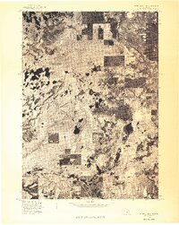 1976 White Cloud NE1976 Print · USGSNewaygo County is captured during the mid-seventies in this detailed aerial survey of the West Michigan landscape. Researchers can examine the actual ground cover and settlement patterns surrounding Brohman and Woodland Park as they appeared in 1976.
 - 1976 Map of Hersperia SE
 1976 Hersperia SE1976 Print · USGSOceana County territory is captured in high-altitude detail during the mid-seventies, showing the intersection of rural agriculture and river life. Genealogists and local historians can trace the exact 1976 footprint of Hesperia and the surrounding farmsteads.
 - 1976 Map of Hersperia NE
 1976 Hersperia NE1976 Print · USGSThe rural landscape of Oceana County is captured in the mid-1970s through this detailed aerial survey. Researchers can trace the layout of Walkerville and examine the exact boundaries of farms and woodlots across the township.
 - 1976 Map of Twin Lake NE
 1976 Twin Lake NE1976 Print · USGSMuskegon County farmland and small settlements are captured from above in the mid-1970s just as these rural communities were evolving. Genealogists and land researchers can trace the exact 1976 footprints of Holton, Brunswick, and Reeman.
 - 1976 Map of White Cloud NW
 1976 White Cloud NW1976 Print · USGSCovers Newaygo County, including Walgamor Corners, Beaver Township, and other nearby areas
 - 1976 Map of Custer SE
 1976 Custer SE1976 Print · USGSCovers Newaygo County, including Carr, Logan Township, and other nearby areas
 - 1976 Map of Baldwin SW
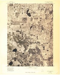
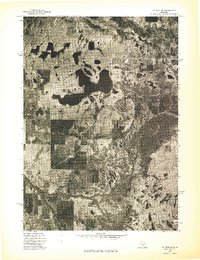 1976 Baldwin SW1976 Print · USGSMid-seventies Lake County comes into focus in this detailed orthophoto showing the transition between dense northern woodlands and developed lakefronts. Researchers can trace the complex shoreline of Big Star Lake and the winding course of the Pere Marquette River.
End of results
Showing maps 1-11 of 11
Top cities of Newaygo County
Frequently asked questions
- What are the different types of historical maps available for Newaygo County?
- What is the oldest map of Newaygo County?
- Where can I purchase historical maps of Newaygo County for my home or office?
- Where can I download high-res historical maps of Newaygo County?
- Are there historical topographic maps available for Newaygo County?
- Is there historical aerial imagery available for Newaygo County?
- Where are historical maps of Newaygo County sourced from?