2020s Maps of Oceana County, Michigan
Explore 18 historic maps of Oceana County from the 2020s. These maps offer a rare glimpse into what life looked like during the 2020s — showing old roads, neighborhoods, homes, and landmarks that have changed or disappeared over time.
Whether you're researching your family's past, planning a metal detecting trip, or studying how Oceana County's landscape evolved across the 2020s, these high-resolution maps are a powerful tool for exploring the history of this region.
- Focus on a specific era: All maps on this page are from the 2020s, giving you a focused view of this time period.
- See what’s changed: Compare century-old streets, trails, and buildings to today's modern landscape using overlays and satellite layers.
- Research with precision: Use these maps for genealogy, historical research, land use analysis, or educational projects.
- View, download, or print: Maps are fully viewable online in high resolution, and can be downloaded or printed for your own records.
Start exploring Oceana County's history through authentic maps from the 2020s. This is your window into the past.
Oceana County, MI maps
(18)- 2023 Map of Hesperia, 2023 Print
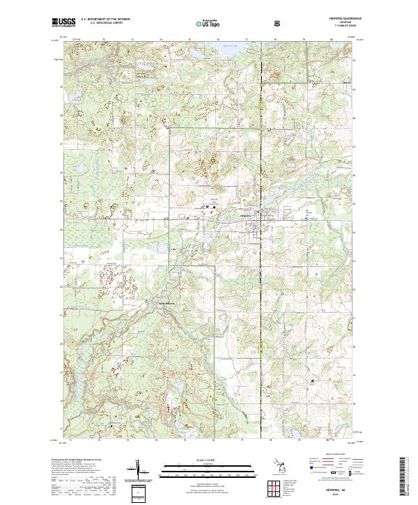 2023 Hesperia2023 Print · USGSThe village of Hesperia and the surrounding river valleys are documented here in the early 2020s. Genealogists and local researchers can pinpoint several burial grounds like Jewell Cem and Greenwood Cem, or trace the course of Knutson Creek through the Manistee National Forest.
 - 2023 Map of Shelby, 2023 Print
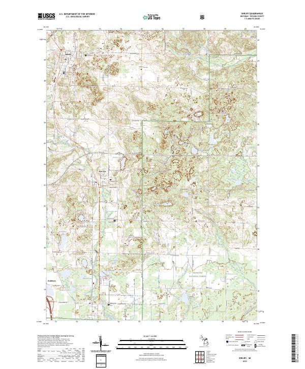 2023 Shelby2023 Print · USGSShelby and the surrounding Oceana County countryside are captured here in the early twenty-first century as part of a well-defined agricultural and forest corridor. Researchers can trace local lineage through numerous sites like New Era Cem and Eagles Cem or explore the borders of the Manistee National Forest.
 - 2023 Map of Hart, 2023 Print
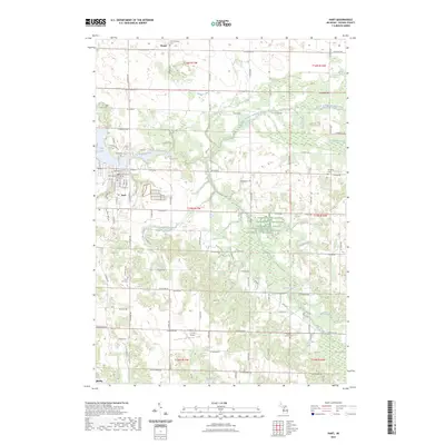 2023 Hart2023 Print · USGSThe city of Hart and its surrounding townships are shown here as they appeared in 2023, centered on the Pentwater River valley. Researchers can locate numerous family burial sites like Randall Cem or trace the rural drainage of Makins Creek and Knox Swamp.
 - 2023 Map of Crystal Valley, 2023 Print
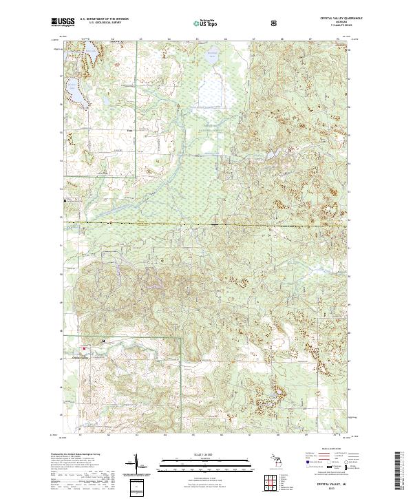 2023 Crystal Valley2023 Print · USGSThe Mason and Oceana county line comes to life in this modern record of the forested Michigan interior. Local researchers can trace family roots at the Eden Township Indian Cem or explore the creekside settlement of Crystal Valley.
 - 2023 Map of Little Point Sable, 2023 Print
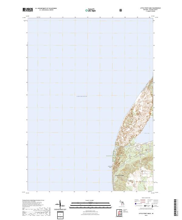 2023 Little Point Sable2023 Print · USGSThe Oceana County shoreline is captured in this recent survey, showcasing the dynamic dunes between the great lake and Silver Lake. Property researchers can trace modern boundaries near Little Point Sable or follow routes like N Lighthouse Dr and S Stone Church Rd.
 - 2023 Map of Walkerville West, 2023 Print
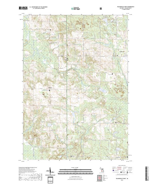 2023 Walkerville West2023 Print · USGSOceana County in the early twenty-first century remains a landscape of quiet rural settlements and glacial lakes. Researchers can trace family history through several notable sites, including the Indian Cem, Saint Joseph's Catholic Cem, and the waters of Cobmoosa Lake.
 - 2023 Map of Holton, 2023 Print
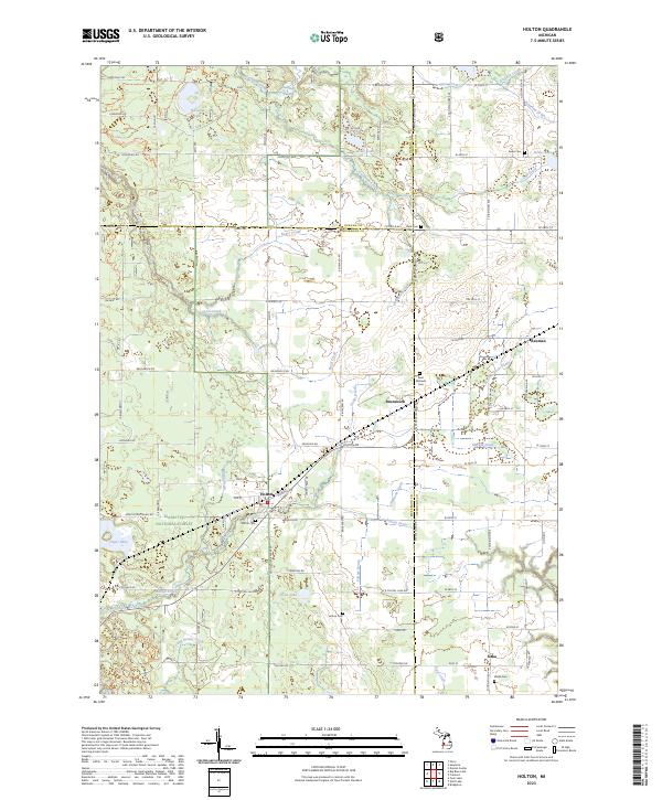 2023 Holton2023 Print · USGSThe crossroads of Muskegon, Newaygo, and Oceana counties are captured here in the early 2020s, showcasing a landscape of rural townships and managed wetlands. Family historians can locate several local burial grounds, including Saint Michaels Cem, Holton Cem, and Wilde Cem.
 - 2023 Map of Ferry, 2023 Print
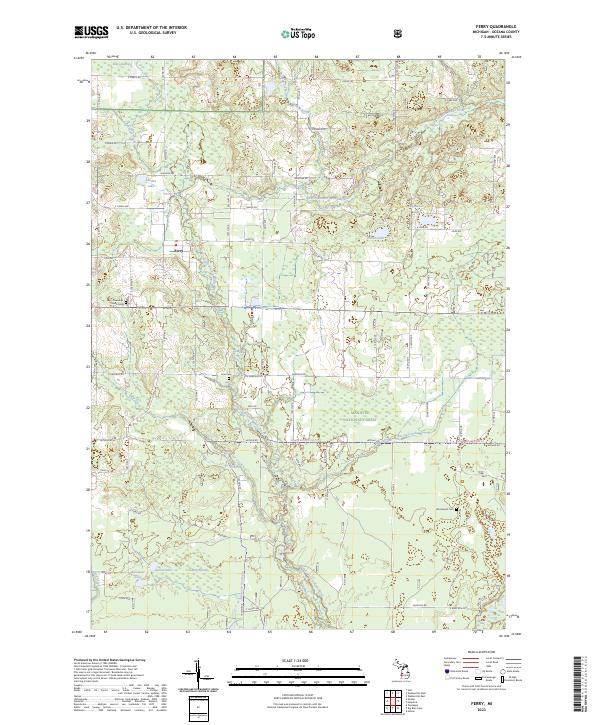 2023 Ferry2023 Print · USGSOceana County is shown in this contemporary study of its wooded river valleys and township centers. Genealogists and historians can trace the grounds of Ferry Township South Cem or explore the drainage of the North Branch White River near the settlement of Ferry.
 - 2023 Map of Montague, 2023 Print
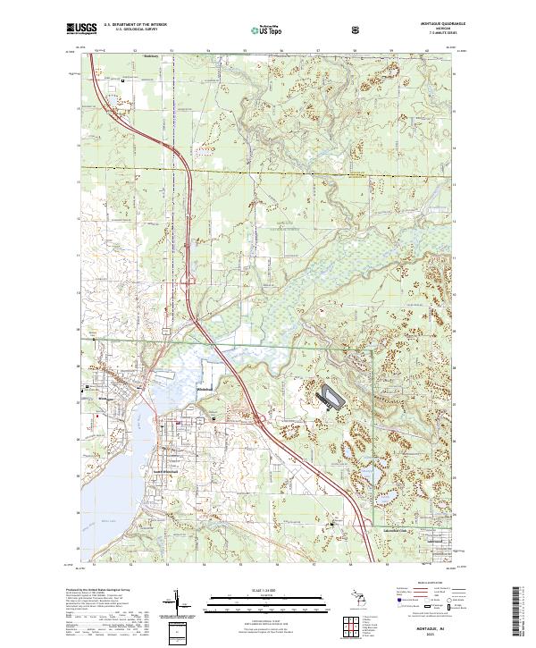 2023 Montague2023 Print · USGSWhitehall and Montague sit at the head of White Lake in the early 2020s, showing a landscape defined by the White River and its many glacial lakes. Researchers can locate several burial grounds, including Oakhurst Cem and Sammis Cem, or trace the development of Lakewood Club and South Whitehall.
 - 2023 Map of Carr, 2023 Print
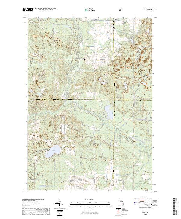 2023 Carr2023 Print · USGSThe four-county junction of Mason, Lake, Oceana, and Newaygo counties is mapped here in the modern era as part of the Manistee National Forest. Researchers can locate legacy sites like St Gregory's Catholic Cem, Colfax Cem, and the winding Big South Branch Pere Marquette River.
 - 2023 Map of Pentwater, 2023 Print
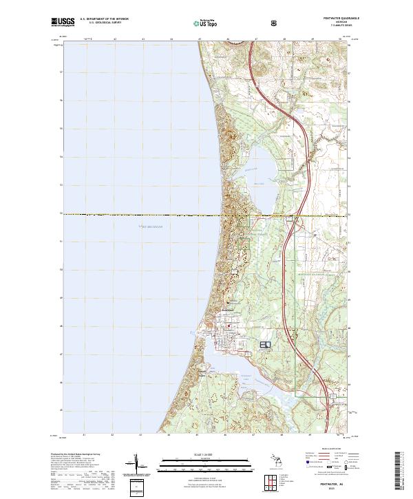 2023 Pentwater2023 Print · USGSThe Lake Michigan shoreline at Pentwater is captured here in the early 2020s, showing the town's relationship with its namesake lake and forest. Genealogists and local historians can trace the village streets and the Pentwater Township Cem, or explore coastal features like Bass Lake and French Town.
 - 2023 Map of Mears, 2023 Print
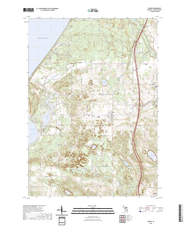 2023 Mears2023 Print · USGSThe Oceana County shoreline is captured here in its modern state, balancing lakeside recreation with deep-rooted agricultural communities. Researchers can trace family history at Mears Cem or explore the recreational landscape of the Silver Lake-Orv Area Trl and Upper Silver Lake.
 - 2023 Map of Walkerville East, 2023 Print
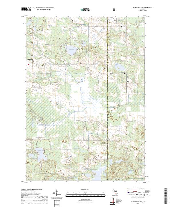 2023 Walkerville East2023 Print · USGSThe borderlands of Oceana and Newaygo counties are mapped here in the early 2020s, revealing a landscape of dense timber and quiet lakes. Family historians can locate Abson Cem, the small community of Volney, and water bodies like Gilbert Lake or Campbell Lake.
 - 2023 Map of Town Corners, 2023 Print
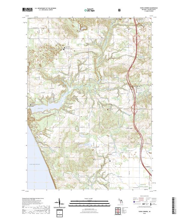 2023 Town Corners2023 Print · USGSCoastal Oceana County at the present day shows a blend of lakeside recreation and deep-rooted rural heritage along the Lake Michigan shore. Researchers can locate numerous family burial sites such as Stony Lake Cem and trace the drainage of Burke Creek into Stony Lake.
 - 2023 Map of Wiley, 2023 Print
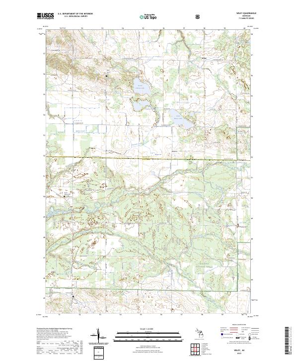 2023 Wiley2023 Print · USGSIn the quiet rural landscape of Oceana and Mason Counties, this contemporary survey captures a region defined by its timberlands and glacial lakes. Researchers can trace family history through several local burial sites, including Saint Peter's Cem, or follow the winding North Branch Pentwater River past the settlement of Wiley.
 - 2023 Map of Big Blue Lake, 2023 Print
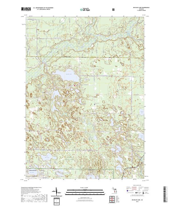 2023 Big Blue Lake2023 Print · USGSThe lake-dotted timberlands of Muskegon and Oceana counties are captured here in the twenty-first century. Genealogists and outdoor historians can trace old cemetery sites like Blue Lake Cemetery and lakefront settlements at Lakewood Club and Twin Lake.
 - 2023 Map of Bigsbie Lake, 2023 Print
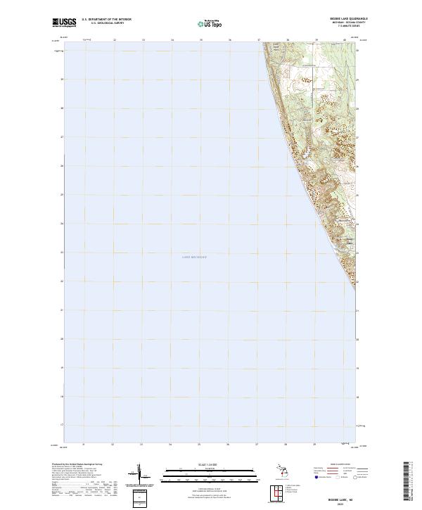 2023 Bigsbie Lake2023 Print · USGSThe Oceana County shoreline is captured here in the early 2020s, showing the intersection of lakefront development and natural dunes. Trace the residential growth around Bigsbie Lake and Stony Lake, or follow local landmarks like Little Sable Point and Stony Creek.
 - 2023 Map of Flower Creek, 2023 Print
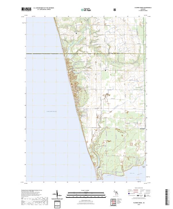 2023 Flower Creek2023 Print · USGSThe Lake Michigan coastline meets the southern reaches of the Manistee National Forest in this contemporary coastal survey. Researchers can locate early burial grounds like Flower Creek Cem and Hubbard Cem or trace the drainage of Pierson Drain into White Lake.
End of results
Showing maps 1-18 of 18
Top cities of Oceana County
Frequently asked questions
- What are the different types of historical maps available for Oceana County?
- What is the oldest map of Oceana County?
- Where can I purchase historical maps of Oceana County for my home or office?
- Where can I download high-res historical maps of Oceana County?
- Are there historical topographic maps available for Oceana County?
- Is there historical aerial imagery available for Oceana County?
- Where are historical maps of Oceana County sourced from?