2020s Maps of Claybanks Township, Michigan
Explore 2 historic maps of Claybanks Township from the 2020s. These maps offer a rare glimpse into what life looked like during the 2020s — showing old roads, neighborhoods, homes, and landmarks that have changed or disappeared over time.
Whether you're researching your family's past, planning a metal detecting trip, or studying how Claybanks Township's landscape evolved across the 2020s, these high-resolution maps are a powerful tool for exploring the history of this region.
- Focus on a specific era: All maps on this page are from the 2020s, giving you a focused view of this time period.
- See what’s changed: Compare century-old streets, trails, and buildings to today's modern landscape using overlays and satellite layers.
- Research with precision: Use these maps for genealogy, historical research, land use analysis, or educational projects.
- View, download, or print: Maps are fully viewable online in high resolution, and can be downloaded or printed for your own records.
Start exploring Claybanks Township's history through authentic maps from the 2020s. This is your window into the past.
Claybanks Township, MI maps
(2)- 2023 Map of Town Corners, 2023 Print
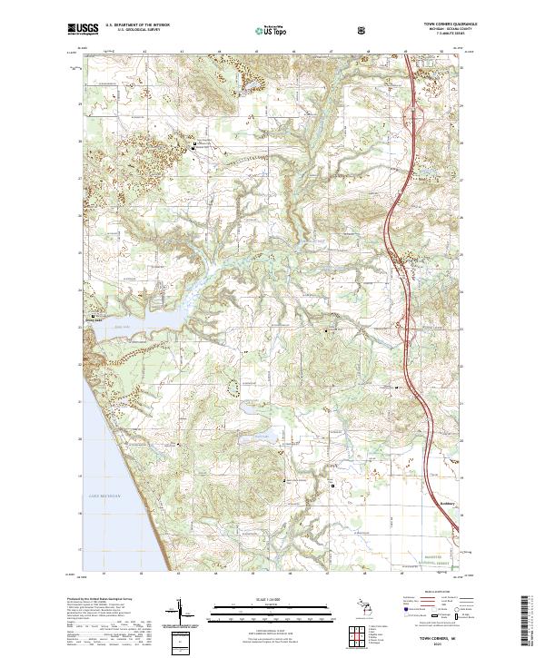 2023 Town Corners2023 Print · USGSCoastal Oceana County at the present day shows a blend of lakeside recreation and deep-rooted rural heritage along the Lake Michigan shore. Researchers can locate numerous family burial sites such as Stony Lake Cem and trace the drainage of Burke Creek into Stony Lake.
 - 2023 Map of Flower Creek, 2023 Print
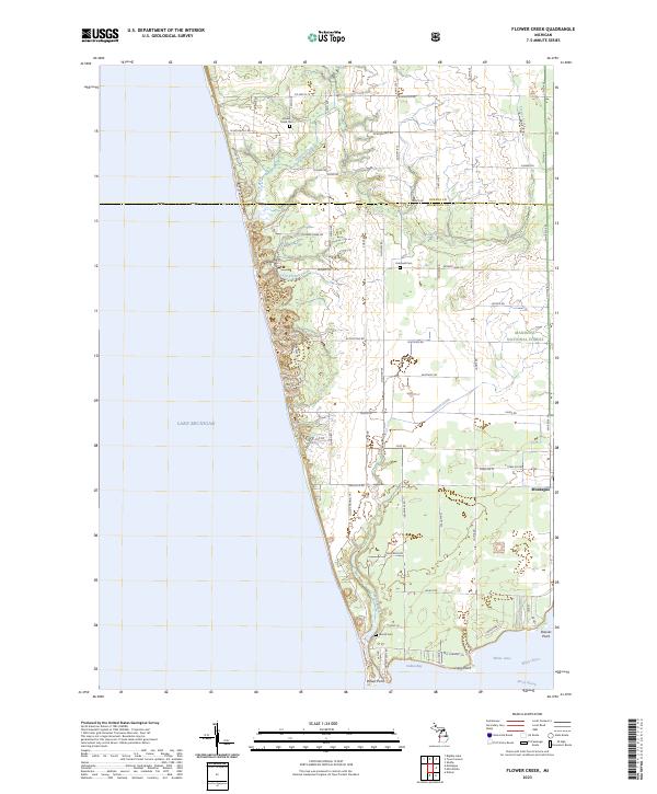 2023 Flower Creek2023 Print · USGSThe Lake Michigan coastline meets the southern reaches of the Manistee National Forest in this contemporary coastal survey. Researchers can locate early burial grounds like Flower Creek Cem and Hubbard Cem or trace the drainage of Pierson Drain into White Lake.
End of results
Showing maps 1-2 of 2
Top cities near Claybanks Township
- Dalton historical maps
- Whitehall historical maps
- Montague historical maps
- Hart historical maps
- Shelby historical maps
- Ferry historical maps
See more
Frequently asked questions
- What are the different types of historical maps available for Claybanks Township?
- What is the oldest map of Claybanks Township?
- Where can I purchase historical maps of Claybanks Township for my home or office?
- Where can I download high-res historical maps of Claybanks Township?
- Are there historical topographic maps available for Claybanks Township?
- Is there historical aerial imagery available for Claybanks Township?
- Where are historical maps of Claybanks Township sourced from?