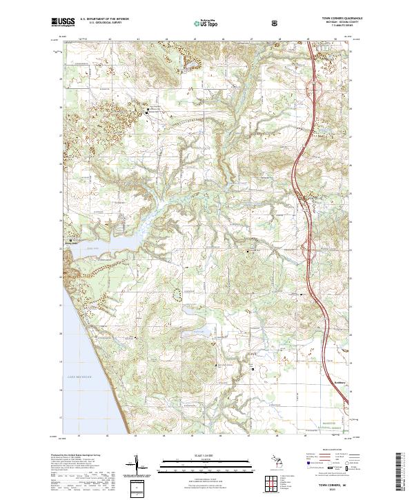
2023 Map of Town Corners
USGS Topo · Published 2023About this map
Lake Michigan forms the western boundary of this coastal landscape, where the shoreline meets a complex system of glacial lakes and creek drainages. The settlement of Stony Lake sits between its namesake water body and the big lake, serving as a focal point for a region defined by a dense network of country roads and agricultural sections. This survey provides a remarkable level of detail for genealogists, documenting numerous local burial grounds including Gardner Cem, Cranston Cem, and Saint John's Catholic Cem.
Find a feature on this map
60 named features on this map. Tap any name to fly to it.
Don’t see what you’re looking for? This feature index may not catch every label — zoom into the map to look around manually.
Map Details
Editions of this 2023 Town Corners Map
This is the sole edition of this map. No revisions or reprints were ever made.
Other maps of this area

1929 · Montague
USGS Topo · 1:48,000

1931 · Hart NW
USGS Topo · 1:31,680

1931 · Hart SE
USGS Topo · 1:31,680

1931 · Hart NE
USGS Topo · 1:31,680

1954 · Milwaukee
USGS Topo · 1:250,000

1958 · Milwaukee
USGS Topo · 1:250,000

1959 · Montague
USGS Topo · 1:62,500

1959 · Hart
USGS Topo · 1:62,500

1976 · Montague NW
USGS Topo · 1:24,000
1976 · Hart NW
USGS Topo · 1:24,000