2020s Maps of Haight Township, Michigan
Explore 8 historic maps of Haight Township from the 2020s. These maps offer a rare glimpse into what life looked like during the 2020s — showing old roads, neighborhoods, homes, and landmarks that have changed or disappeared over time.
Whether you're researching your family's past, planning a metal detecting trip, or studying how Haight Township's landscape evolved across the 2020s, these high-resolution maps are a powerful tool for exploring the history of this region.
- Focus on a specific era: All maps on this page are from the 2020s, giving you a focused view of this time period.
- See what’s changed: Compare century-old streets, trails, and buildings to today's modern landscape using overlays and satellite layers.
- Research with precision: Use these maps for genealogy, historical research, land use analysis, or educational projects.
- View, download, or print: Maps are fully viewable online in high resolution, and can be downloaded or printed for your own records.
Start exploring Haight Township's history through authentic maps from the 2020s. This is your window into the past.
Haight Township, MI maps
(8)- 2023 Map of Choate, 2023 Print
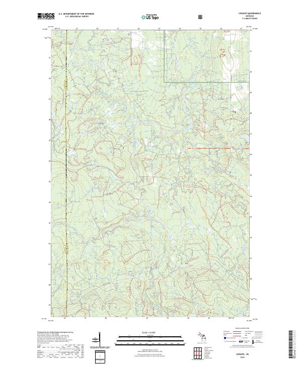 2023 Choate2023 Print · USGSThe Upper Peninsula wilderness comes alive in this contemporary survey of the Ontonagon river system. Trace the winding paths of the Cisco Branch Ontonagon River, find the secluded Wolverine Falls, and follow the network of forest trails like Nfst-6930-N Trl.
 - 2023 Map of Paynesville, 2023 Print
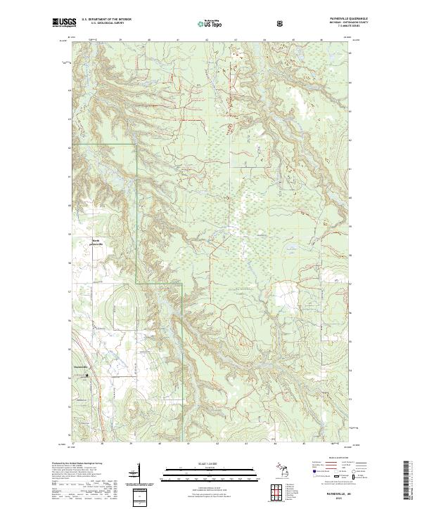 2023 Paynesville2023 Print · USGSOntonagon County's timberlands and river systems are shown in great detail here during the early 2020s. Researchers can locate family sites at the Paynesville Cem or trace the protected waters of the Ontonagon Wild and Scenic River.
 - 2023 Map of Watersmeet, 2023 Print
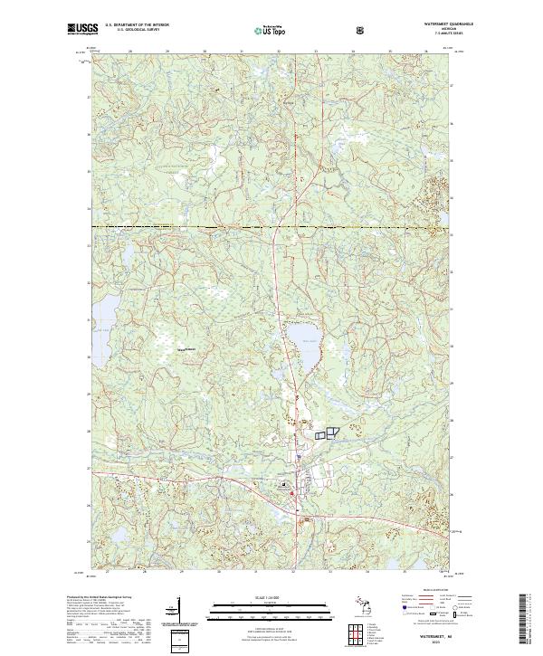 2023 Watersmeet2023 Print · USGSThe forest and river networks of the Michigan Upper Peninsula converge at Watersmeet in this modern survey. Researchers can trace local landmarks like Watersmeet Township Cemetery and the waterways of the Ontonagon Wild and Scenic River.
 - 2023 Map of Beaton, 2023 Print
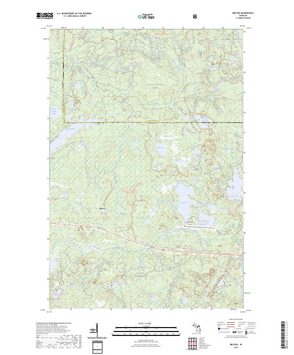 2023 Beaton2023 Print · USGSThe Northwoods of Michigan come to life in this contemporary study of the Gogebic and Ontonagon county line. Local historians and explorers can trace the remote roads leading to Beaton or navigate the shoreline details of Beatons Lake and the Sylvania Wilderness.
 - 2023 Map of Trout Creek, 2023 Print
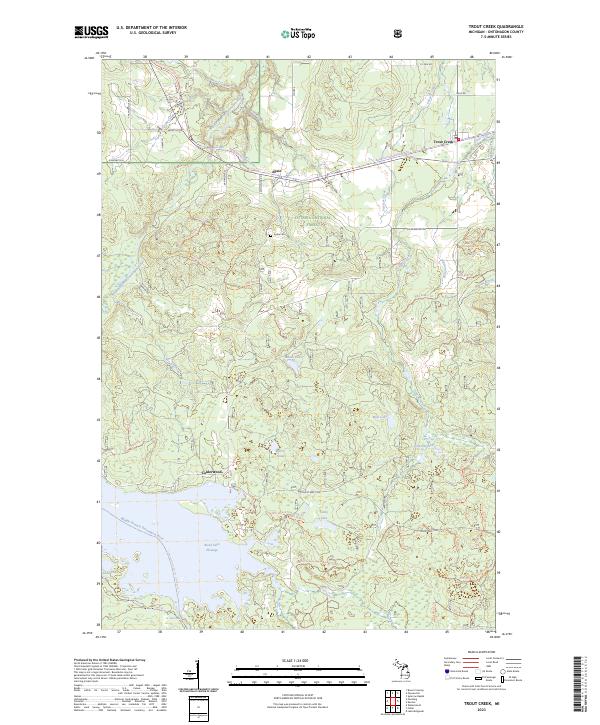 2023 Trout Creek2023 Print · USGSThe Western Upper Peninsula’s forest and river systems are shown here in the early 2020s, centered on the Middle Branch Ontonagon River. Genealogists and local historians can trace the communities of Agate and Trout Creek or locate the Agate Cem and the settlement of Calderwood.
 - 2023 Map of Bruce Crossing, 2023 Print
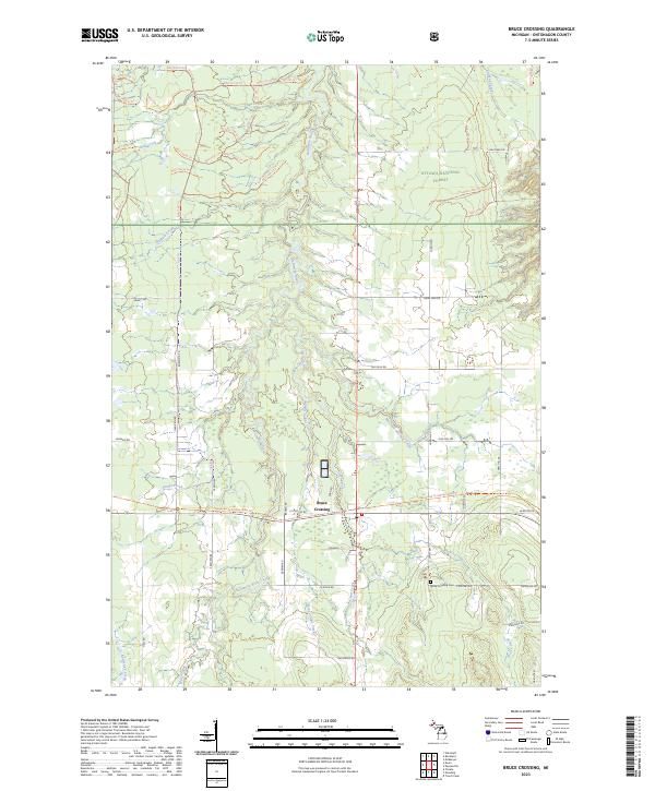 2023 Bruce Crossing2023 Print · USGSThe Western Upper Peninsula’s timber and trail networks are on full display in this recent look at Bruce Crossing. Genealogists and historians can trace family roots along Nurkkala Rd or visit the Bruce Crossing Cem near the Baltimore River.
 - 2023 Map of Paulding, 2023 Print
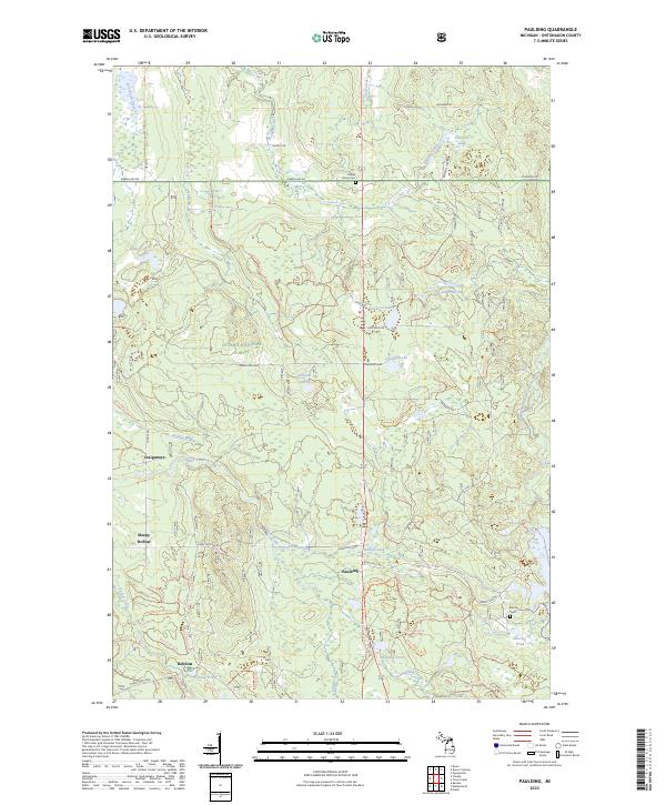 2023 Paulding2023 Print · USGSUpper Peninsula timberlands and small riverside settlements like Paulding characterize this Ontonagon County landscape in the early 2020s. Researchers can locate remote burial sites at Maple Grove Cem and trace water routes along the Ontonagon Wild and Scenic River.
 - 2023 Map of Fuller, 2023 Print
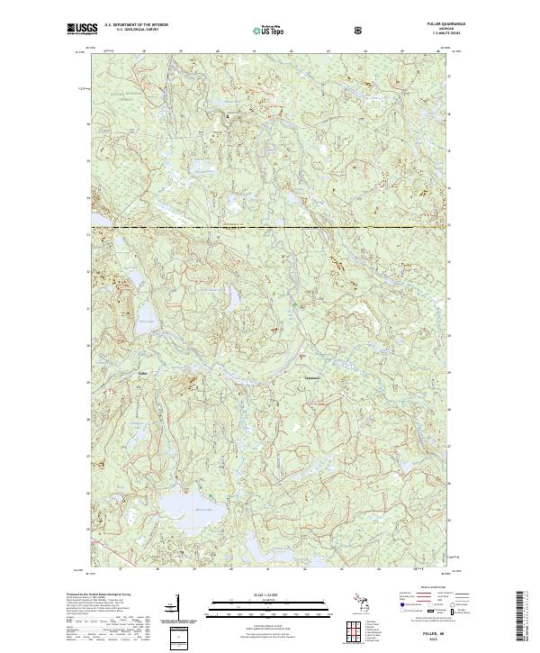 2023 Fuller2023 Print · USGSWithin the Ottawa National Forest during the 2020s, this area shows a landscape defined by the winding Ontonagon and Tamarack rivers. Researchers can locate the Interior Cem and old settlements like Fuller while tracing family ties to Marion Lake or Perch Lake.
End of results
Showing maps 1-8 of 8
Top cities near Haight Township
Top neighborhoods of Haight Township
Frequently asked questions
- What are the different types of historical maps available for Haight Township?
- What is the oldest map of Haight Township?
- Where can I purchase historical maps of Haight Township for my home or office?
- Where can I download high-res historical maps of Haight Township?
- Are there historical topographic maps available for Haight Township?
- Is there historical aerial imagery available for Haight Township?
- Where are historical maps of Haight Township sourced from?