1970s Maps of Oscoda County, Michigan
Explore 7 historic maps of Oscoda County from the 1970s. These maps offer a rare glimpse into what life looked like during the 1970s — showing old roads, neighborhoods, homes, and landmarks that have changed or disappeared over time.
Whether you're researching your family's past, planning a metal detecting trip, or studying how Oscoda County's landscape evolved across the 1970s, these high-resolution maps are a powerful tool for exploring the history of this region.
- Focus on a specific era: All maps on this page are from the 1970s, giving you a focused view of this time period.
- See what’s changed: Compare century-old streets, trails, and buildings to today's modern landscape using overlays and satellite layers.
- Research with precision: Use these maps for genealogy, historical research, land use analysis, or educational projects.
- View, download, or print: Maps are fully viewable online in high resolution, and can be downloaded or printed for your own records.
Start exploring Oscoda County's history through authentic maps from the 1970s. This is your window into the past.
Oscoda County, MI maps
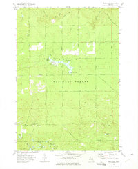
(7)- 1972 Map of McKinley, 1975 Print
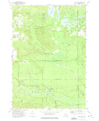 1972 McKinley1975 Print · USGSOscoda County in the early seventies preserves the landscape of the Huron National Forest and the winding Au Sable River. Researchers can trace the legacy of Michigan logging via the Old Railroad Grade and locate family landmarks at Mc Kinley and Camp Barakel.
 - 1972 Map of McCollum Lake, 1975 Print
 1972 McCollum Lake1975 Print · USGSNorthern Michigan forest lands are shown in the early seventies at the junction of four counties. Researchers can trace old logging routes along the Old Railroad Grade and locate features like McCollum Lake and the Fonro Lodge Landing Strip.
 - 1972 Map of Goodar, 1975 Print
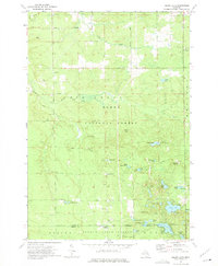
 1972 Goodar1975 Print · USGSThe northern Michigan woods of the early seventies are captured here during a period of steady forestry and recreation. Researchers can trace legacy timber routes like the Old RR Grade and locate features such as Goodar, Hughes Lake, and a Flowing Well.3 unique versions available
 - 1972 Map of Mio, 1975 Print
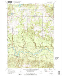
 1972 Mio1975 Print · USGSThe Au Sable River and the Huron National Forest define this corner of Oscoda County during the early 1970s. Researchers can trace the Old Railroad Grade, locate the Township No 1 Cem, and find vanished landmarks like the local Drive-in Theater.2 unique versions available
 - 1972 Map of Mack Lake, 1975 Print
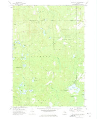
 1972 Mack Lake1975 Print · USGSThe Oscoda County woods in the early seventies reveal a landscape of forest management and scattered glacial lakes. Researchers can trace the Old RR Grade, find the Hughes Lake Lookout Tower, or locate Brainard Springs.3 unique versions available
 - 1972 Map of Island Lake, 1975 Print
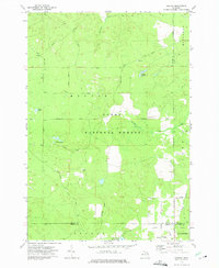
 1972 Island Lake1975 Print · USGSOscoda and Ogemaw counties are shown here in the early 1970s, a landscape defined by state and federal forest lands. Researchers can trace historic intersections like Union Corners, find the Paul Bunyan Camp, and locate the Old Railroad Grade.2 unique versions available
 - 1972 Map of Fairview, 1975 Print
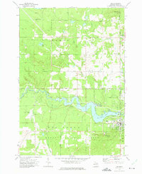
 1972 Fairview1975 Print · USGSOscoda County was a landscape of deep forests and winding river valleys in the early 1970s. Local researchers can trace the old timber corridors along the Private Railroad and Old RR Grade, or locate family sites near Fairview and Kneeland.2 unique versions available
End of results
Showing maps 1-7 of 7
Frequently asked questions
- What are the different types of historical maps available for Oscoda County?
- What is the oldest map of Oscoda County?
- Where can I purchase historical maps of Oscoda County for my home or office?
- Where can I download high-res historical maps of Oscoda County?
- Are there historical topographic maps available for Oscoda County?
- Is there historical aerial imagery available for Oscoda County?
- Where are historical maps of Oscoda County sourced from?