Old Maps of Johannesburg, Charlton Township for Hiking & Exploration
Hike through history with 12 historic maps of Johannesburg. Explore old trails, ghost towns, and forgotten backroads — perfect for outdoor adventurers and local explorers.
- Rediscover forgotten places: Map out old mining camps, roads, and footpaths that no longer exist on modern maps.
- Layer with modern tools: Combine with LiDAR or satellite views to plan hikes through historical terrain.
- Made for exploration: Popular among hikers, overlanders, and local history lovers.
Use these maps to find adventure and explore the hidden past of Johannesburg.
Johannesburg, Charlton Township maps
(12)- 1949 Map of Lewiston, 1954 Print
 1949 Lewiston1954 Print · USGSNorthern Michigan’s timber and sporting heritage is on full display here during the late nineteen-forties. Researchers can trace the Michigan Meridian, locate family sites at the Lovells Cemetery, or find old camps like the Au Sable Trout & Gun Club.2 unique versions available
 - 1950 Map of Johannesburg, 1977 Print
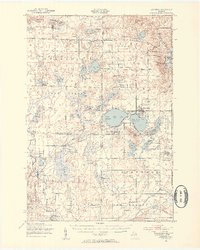
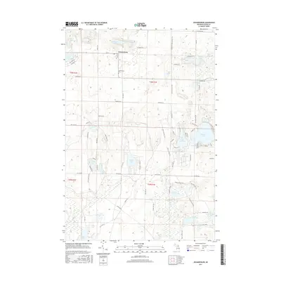
 1950 Johannesburg1977 Print · USGSOtsego County's lake-rich landscape is captured here in the mid-century, centered on the community of Johannesburg and the deep woods of the Pigeon River State Forest. Genealogists and local historians can locate the Johannesburg Cemetery, the Full Gospel Church, and family landmarks like Hill Side Farm.
 - 1951 Map of Johannesburg
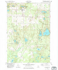
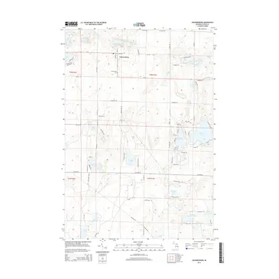
 1951 Johannesburg1951 Print · USGSThe Otsego County lake country of the early fifties is captured here at a moment of transition toward seasonal recreation. Researchers can locate family landmarks like the Johannesburg Cemetery, Echo Valley Resort, and the community gathering point at the Charlton Town Hall and Church.2 unique versions available
 - 1954 Map of Traverse City, 1965 Print
 1954 Traverse City1965 Print · USGSNorthern Michigan’s vast lakeshores and timberlands are captured here in the mid-fifties, showing the region before the modern interstate era. Genealogists and researchers can trace rail connections like the Detroit and Mackinac RR or find old communities such as Suttons Bay, Elk Rapids, and Prudenville.4 unique versions available
 - 1958 Map of Traverse City
 1958 Traverse City1958 Print · USGSNorthern Lower Michigan was a landscape of vast state forests and burgeoning lakeside retreats in the late fifties. Genealogists and historians can trace the rail corridors of the Ann Arbor RR and find established settlements from Elk Rapids to Houghton Lake.2 unique versions available
 - 1983 Map of Grayling, 1984 Print
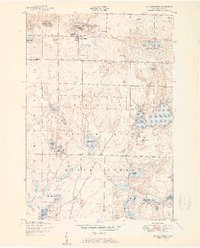
 1983 Grayling1984 Print · USGSIn the early eighties, this Northern Michigan interior was a hub for forestry, military training, and river recreation. Researchers can trace the sprawling boundaries of Camp Grayling and locate historic markers like Hartwick Pines and Otsego Lake.2 unique versions available
 - 1989 Map of Traverse City, 1990 Print
 1989 Traverse City1990 Print · USGSNorthern Michigan’s lake-country and forest lands are captured in the late eighties as seasonal tourism and timber hubs expanded. Genealogists and historians can trace the routes of the Ann Arbor RR, the boundaries of Camp Grayling, and settlements like Elk Rapids and Manton.
 - 2011 Map of Johannesburg, 2011 Print
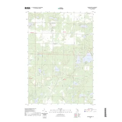
 2011 Johannesburg2011 Print · USGSCovers Johannesburg, including Chester Township, Charlton Township, and other nearby areas
 - 2014 Map of Johannesburg, 2014 Print
 2014 Johannesburg2014 Print · USGSCovers Johannesburg, including Chester Township, Charlton Township, and other nearby areas
 - 2017 Map of Johannesburg, 2017 Print
 2017 Johannesburg2017 Print · USGSCovers Johannesburg, including Chester Township, Charlton Township, and other nearby areas
 - 2019 Map of Johannesburg, 2019 Print
 2019 Johannesburg2019 Print · USGSCovers Johannesburg, including Chester Township, Charlton Township, and other nearby areas
 - 2023 Map of Johannesburg, 2023 Print
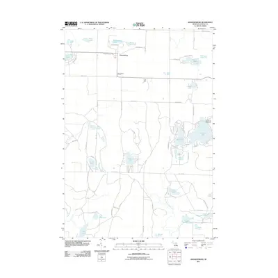
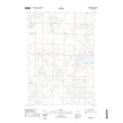
 2023 Johannesburg2023 Print · USGSThe settlement of Johannesburg and its surrounding lake country are captured in this modern survey of Otsego County. Researchers can trace local landmarks like the Johannesburg Cem and explore the network of paths including the Shore To Shore Trl and Crapo Creek Trl.
End of results
Showing maps 1-12 of 12
Top cities near Johannesburg
Frequently asked questions
- What are the different types of historical maps available for Johannesburg?
- What is the oldest map of Johannesburg?
- Where can I purchase historical maps of Johannesburg for my home or office?
- Where can I download high-res historical maps of Johannesburg?
- Are there historical topographic maps available for Johannesburg?
- Is there historical aerial imagery available for Johannesburg?
- Where are historical maps of Johannesburg sourced from?