
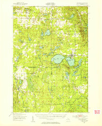
1949 Map of Lewiston
USGS Topo · Published 1954About this map
The Michigan Meridian bisects this landscape of the Northern Lower Peninsula, marking a point where heavy forest conservation efforts began to shape the land. The region is defined by three distinct state forests—Pigeon River State Forest, Presque Isle State Forest, and Au Sable State Forest—which surround the established settlement of Lewiston. The map documents a period when logging-era railroads had largely given way to a recreation-based economy, evidenced by the numerous hunting lodges and clubs, such as the Au Sable Trout & Gun Club and High Bank Lodge.
Find a feature on this map
84 named features on this map. Tap any name to fly to it.
Don’t see what you’re looking for? This feature index may not catch every label — zoom into the map to look around manually.
Map Details
Editions of this 1949 Lewiston Map
2 editions found
Other maps of this area

1949 · Otsego Lake
USGS Topo · 1:62,500

1949 · Grayling
USGS Topo · 1:62,500

1950 · Lewiston
USGS Topo · 1:24,000

1950 · Comstock Hills
USGS Topo · 1:24,000

1950 · Johannesburg
USGS Topo · 1:24,000

1950 · Lovells
USGS Topo · 1:24,000

1950 · Turtle Lake
USGS Topo · 1:24,000

1951 · K P Lake
USGS Topo · 1:24,000

1951 · Comstock Hills
USGS Topo · 1:24,000

1951 · Lovells
USGS Topo · 1:24,000