
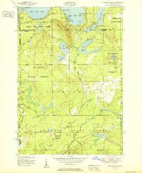
1951 Map of Comstock Hills
USGS Topo · Published 1951About this map
East Twin Lake and the Comstock Hills define this northern Michigan landscape during a mid-century era of recreational growth. The northern shoreline of the twin lakes is clustered with seasonal destinations, ranging from established sites like Trowbridges Resort and Gassel Lodge to smaller family operations such as Murrays Cabins and Organs Log Cabins. This concentration of resorts suggests the area's importance as a burgeoning vacation destination for postwar travelers.
Find a feature on this map
47 named features on this map. Tap any name to fly to it.
Don’t see what you’re looking for? This feature index may not catch every label — zoom into the map to look around manually.
Map Details
Editions of this 1951 Comstock Hills Map
2 editions found
Other maps of this area

1949 · Lewiston
USGS Topo · 1:62,500

1950 · Lewiston
USGS Topo · 1:24,000

1950 · Comstock Hills
USGS Topo · 1:24,000

1950 · Johannesburg
USGS Topo · 1:24,000

1950 · Lovells
USGS Topo · 1:24,000

1951 · Lovells
USGS Topo · 1:24,000

1951 · Johannesburg
USGS Topo · 1:24,000

1951 · Lewiston
USGS Topo · 1:24,000

1954 · Traverse City
USGS Topo · 1:250,000

1955 · Comins
USGS Topo · 1:62,500