Old Maps of Robinson Township, Michigan for Academic Research
Study the evolution of Robinson Township with 34 high-resolution historic maps. Whether you're teaching, researching, or modeling changes in land use, these maps provide essential visual documentation of urban, environmental, and geographic change.
- Analyze long-term change: Track patterns in development, transportation, and natural features.
- Ideal for environmental or urban studies: Support academic projects with primary historical map data.
- Use in the classroom or lab: Educators and researchers rely on these maps to bring historical context to life.
These maps are a powerful tool for teaching, research, and visualizing how Robinson Township has changed over the decades.
Robinson Township, MI maps
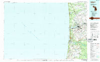
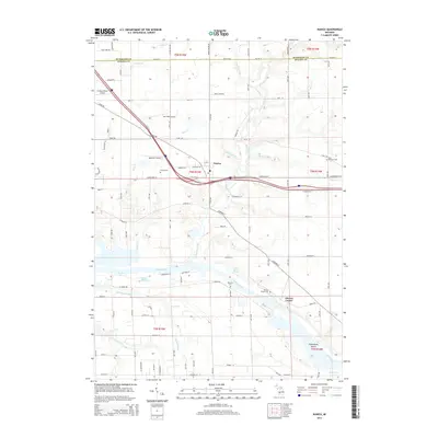
(34)- 1929 Map of Holland, 1959 Print
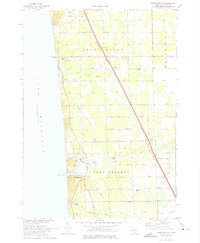
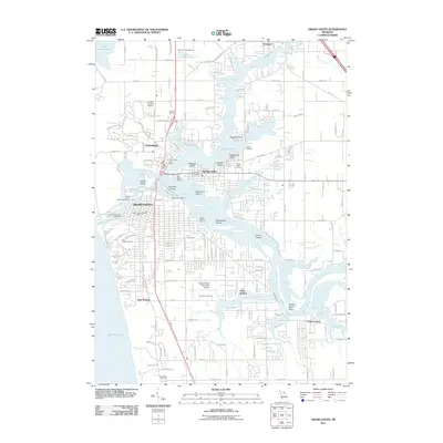
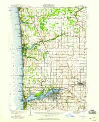 1929 Holland1959 Print · USGSThe Lake Michigan shoreline and the city of Holland appear here as they were in the late 1920s. Local researchers can trace the historic lakefront developments and rural landmarks including Getz Lakewood Farm, the Waukantanka Lodge, and the Pere Marquette rail lines.2 unique versions available
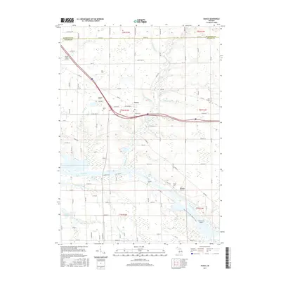
 - 1930 Map of Muskegon, 1960 Print
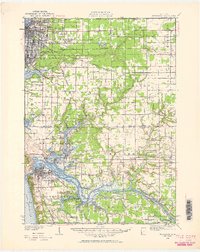 1930 Muskegon1960 Print · USGSThe Lake Michigan shoreline and the winding Grand River valley appear here as they were in the late 1920s. Researchers can locate dozens of country schools like Carr Sch and Jones Sch, or trace the tracks of the Pere Marquette railroad.2 unique versions available
 - 1932 Map of Holland
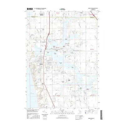
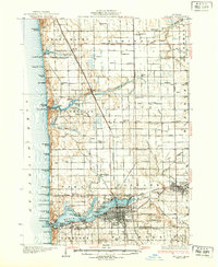 1932 Holland1932 Print · USGSThe Lake Michigan shoreline and the growing city of Holland are captured here in the early 1930s. Trace the lakefront resorts and rural schoolhouses that once dotted the landscape, from Getz Lakewood Farm to the Harderwyk Sch and Noordeloos.2 unique versions available
 - 1936 Map of Muskegon
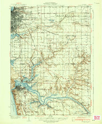 1936 Muskegon1936 Print · USGSCoastal Muskegon and Ottawa counties thrive in the mid-1930s as vital rail and shipping hubs. Genealogists and historians can trace numerous bayous along the Grand River and locate dozens of rural landmarks like Spoonville Chapel and Bates Sch.2 unique versions available
 - 1954 Map of Milwaukee, 1967 Print
 1954 Milwaukee1967 Print · USGSCoastal life and maritime commerce across Lake Michigan are seen here during the mid-fifties, bridging Wisconsin's industrial hubs and Michigan's timberlands. Genealogists and historians can trace the rail lines of the Grand Trunk Western and find long-established ports like Ludington, Port Washington, and Muskegon.3 unique versions available
 - 1958 Map of Milwaukee
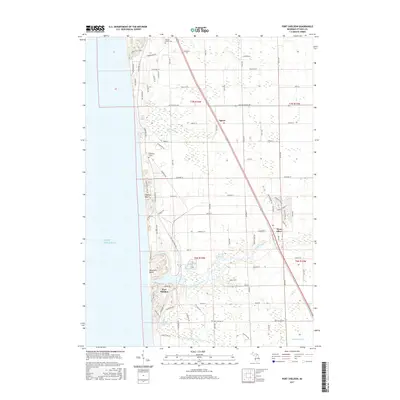
 1958 Milwaukee1958 Print · USGSThe shorelines of Lake Michigan in the late fifties reveal a landscape of bustling ferry ports and growing industrial suburbs. Genealogists and historians can trace rail networks like the Chesapeake & Ohio and locate landmarks such as Little Sable Point and Holy Cross Church.
 - 1958 Map of Racine, 1971 Print
 1958 Racine1971 Print · USGSThe Lake Michigan shoreline in the late fifties was a study in contrasts between the industrial bustle of Kenosha and the quiet woods of the Allegan State Forest. Genealogists and historians can trace the urban footprint of Evanston or locate strategic sites like Fort Sheridan and the Wind Point Light.3 unique versions available
 - 1962 Map of Racine
 1962 Racine1962 Print · USGSThe Lake Michigan shoreline in the early sixties reveals a fascinating contrast between the dense industrial rail hubs of RACINE and CHICAGO and the forested dunes of Michigan. Local historians can trace military installations like Fort Sheridan or explore the numerous inland retreats around Paw Paw Lake and Sister Lakes.
 - 1972 Map of Port Sheldon, 1975 Print
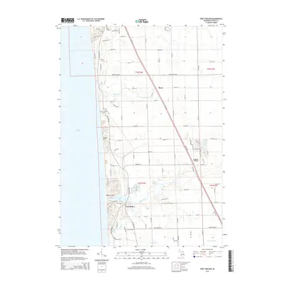
 1972 Port Sheldon1975 Print · USGSOttawa County's Lake Michigan shoreline appears here in the early seventies, showing a landscape defined by the Pigeon River and diagonal rail lines. Genealogists can trace families near West Olive, Harlem, and Immanuel Ch.2 unique versions available
 - 1972 Map of Borculo, 1975 Print
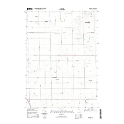
 1972 Borculo1975 Print · USGSOttawa County's rural townships are shown here in the early 1970s, as long-standing farming communities like Borculo and Olive Center continued to thrive. Genealogists can trace family locations near the West Olive Cem, the Christian Sch, and the Chesapeake and Ohio rail line.2 unique versions available
 - 1972 Map of Grand Haven, 1975 Print
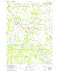
 1972 Grand Haven1975 Print · USGSGrand Haven and the lower Grand River are shown in the early seventies during a period of established lakeside industry and recreation. Researchers can trace local genealogy and land use through features like Lake Forest Cemetery, Nortonville Chapel, and the Grand Haven Memorial Airpark.3 unique versions available
 - 1972 Map of Nunica, 1975 Print
 1972 Nunica1975 Print · USGSThe Grand River valley in the early seventies shows a landscape of bayous and transit routes just inland from the lake. Researchers can find many rural landmarks, from Nunica Cem and Grace Ch to the Jablonski Landing Field and the Grand Trunk Western rail line.
 - 1982 Map of Muskegon
 1982 Muskegon1982 Print · USGSThe West Michigan shoreline during the early eighties shows a bustling industrial and maritime landscape centered on Muskegon Lake and Grand Haven. Researchers can trace rail history along the Grand Trunk Western or locate local landmarks like Oakwood Cem and Cloverville.
 - 1982 Map of Holland
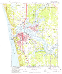
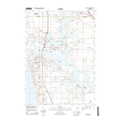
 1982 Holland1982 Print · USGSThe Lake Michigan coast in the early eighties shows a refined network of Dutch-influenced settlements and lakeside retreats. Trace the rail lines of the Chesapeake and Ohio or find family landmarks near Noordeloos and New Richmond.
 - 2011 Map of Port Sheldon, 2011 Print
 2011 Port Sheldon2011 Print · USGSCovers Robinson Township, including Port Sheldon, Grand Haven Charter Township, and other nearby areas
 - 2011 Map of Borculo, 2011 Print
 2011 Borculo2011 Print · USGSCovers Robinson Township, including Blendon Township, Ottawa Station, and other nearby areas
 - 2011 Map of Nunica, 2011 Print
 2011 Nunica2011 Print · USGSCovers Robinson Township, including Fruitport Charter Township, Ravenna Township, and other nearby areas
 - 2011 Map of Grand Haven, 2011 Print
 2011 Grand Haven2011 Print · USGSCovers Robinson Township, including Norton Shores, Spring Lake Township, and other nearby areas
 - 2014 Map of Borculo, 2014 Print
 2014 Borculo2014 Print · USGSCovers Robinson Township, including Blendon Township, Ottawa Station, and other nearby areas
 - 2014 Map of Port Sheldon, 2014 Print
 2014 Port Sheldon2014 Print · USGSCovers Robinson Township, including Port Sheldon, Grand Haven Charter Township, and other nearby areas
 - 2014 Map of Grand Haven, 2014 Print
 2014 Grand Haven2014 Print · USGSCovers Robinson Township, including Norton Shores, Spring Lake Township, and other nearby areas
 - 2014 Map of Nunica, 2014 Print
 2014 Nunica2014 Print · USGSCovers Robinson Township, including Fruitport Charter Township, Ravenna Township, and other nearby areas
 - 2017 Map of Nunica, 2017 Print
 2017 Nunica2017 Print · USGSCovers Robinson Township, including Fruitport Charter Township, Ravenna Township, and other nearby areas
 - 2017 Map of Grand Haven, 2017 Print
 2017 Grand Haven2017 Print · USGSCovers Robinson Township, including Norton Shores, Spring Lake Township, and other nearby areas
 - 2017 Map of Port Sheldon, 2017 Print
 2017 Port Sheldon2017 Print · USGSCovers Robinson Township, including Port Sheldon, Grand Haven Charter Township, and other nearby areas
Showing maps 1-25 of 34
Top cities near Robinson Township
- Muskegon historical maps
- Holland historical maps
- Norton Shores historical maps
- Spring Lake Township historical maps
- Muskegon Heights historical maps
- Grand Haven historical maps
See more
Top neighborhoods of Robinson Township
Frequently asked questions
- What are the different types of historical maps available for Robinson Township?
- What is the oldest map of Robinson Township?
- Where can I purchase historical maps of Robinson Township for my home or office?
- Where can I download high-res historical maps of Robinson Township?
- Are there historical topographic maps available for Robinson Township?
- Is there historical aerial imagery available for Robinson Township?
- Where are historical maps of Robinson Township sourced from?