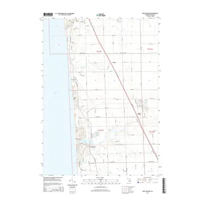
2014 Map of Port Sheldon
USGS Topo · Published 2014About this map
Lake Michigan forms the western boundary of this coastal landscape, where the shifting sands meet the mouth of the Pigeon River. The settlement at Port Sheldon is positioned near the shores of Pigeon Lake, a natural harbor formed by the river's drainage. To the north, the terrain transitions into the dune-fringed communities of Mountain Beach and Zwemer Beach. Inland, the small unincorporated areas of West Olive and Agnew serve as focal points for local transport along the route of W Olive Rd.
Find a feature on this map
52 named features on this map. Tap any name to fly to it.
Don’t see what you’re looking for? This feature index may not catch every label — zoom into the map to look around manually.
Map Details
Editions of this 2014 Port Sheldon Map
This is the sole edition of this map. No revisions or reprints were ever made.
Other maps of this area

1929 · Holland
USGS Topo · 1:62,500

1930 · Lake Harbor
USGS Topo · 1:48,000

1930 · Muskegon
USGS Topo · 1:62,500

1932 · Holland
USGS Topo · 1:62,500

1936 · Muskegon
USGS Topo · 1:62,500

1936 · Lake Harbor
USGS Topo · 1:62,500

1954 · Milwaukee
USGS Topo · 1:250,000

1958 · Milwaukee
USGS Topo · 1:250,000

1958 · Racine
USGS Topo · 1:250,000

1962 · Racine
USGS Topo · 1:250,000
Featured Places
- Port Sheldon, MI
- Robinson Township, MI
- Grand Haven Charter Township, MI
- Olive Township, MI
- Port Sheldon Township, MI