Old Maps of Bedore, Clay Township for Hiking & Exploration
Hike through history with 14 historic maps of Bedore. Explore old trails, ghost towns, and forgotten backroads — perfect for outdoor adventurers and local explorers.
- Rediscover forgotten places: Map out old mining camps, roads, and footpaths that no longer exist on modern maps.
- Layer with modern tools: Combine with LiDAR or satellite views to plan hikes through historical terrain.
- Made for exploration: Popular among hikers, overlanders, and local history lovers.
Use these maps to find adventure and explore the hidden past of Bedore.
Bedore, Clay Township maps
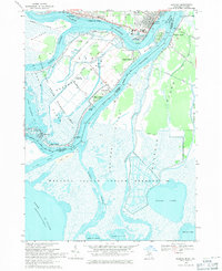
(14)- 1914 Map of Algonac
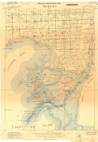 1914 Algonac1914 Print · USGSThe St. Clair River delta and Harsens Island are captured here before the mid-century shoreline changes. Genealogists can locate family holdings near Starrville or trace the early waterfront developments of Sans Souci P.O. and Tashmoo Park.
 - 1936 Map of Algonac
 1936 Algonac1936 Print · USGSThe St. Clair River delta is captured here in the mid-1930s, showing the complex boundary waters between Michigan and Ontario. Genealogists and local historians can trace family-named sites and landings from Algonac to Sans Souci, including Clays Landing and St Pauls Ch.
 - 1939 Map of Algonac
 1939 Algonac1939 Print · USGSThe St. Clair River delta is captured here in the late thirties as a thriving island community and international crossing. Genealogists and historians can trace riverside settlements like Sans Souci, Pearl Beach, and the grounds of Tashmoo Park on Harsens Island.
 - 1952 Map of Algonac, 1954 Print
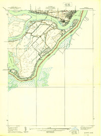
 1952 Algonac1954 Print · USGSThe river delta near Algonac and the St Clair Flats appears here in the early fifties, showing the complex web of channels and island life. Genealogists and historians can trace local landmarks like Sans Souci, Oaklawn Cem, and Tashmoo Park.2 unique versions available
 - 1954 Map of Detroit
 1954 Detroit1954 Print · USGSThe Detroit metro and its Ontario neighbors are shown at the height of the mid-century industrial era, just as the suburbs were rapidly expanding. Researchers can trace the massive rail networks of the Wabash Railroad or locate landmarks like Grosse Ile and Selfridge Air Force Base.
 - 1961 Map of Detroit, 1973 Print
 1961 Detroit1973 Print · USGSThe international border between Michigan and Ontario was a bustling industrial corridor in the early sixties. Researchers can trace the transit networks and riverfront infrastructure connecting Detroit to Windsor via the Detroit-Windsor Tunnel and major air hubs like Willow Run Airport.2 unique versions available
 - 1965 Map of Detroit
 1965 Detroit1965 Print · USGSThe industrial corridor between Michigan and Ontario is captured here at mid-century, showing the dense rail and river networks of the Great Lakes. Local historians can trace the paths of the Grand Trunk Western RR and locate key landmarks like Selfridge Air Force Base and Grosse Ile.
 - 1968 Map of Algonac, 1971 Print
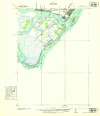
 1968 Algonac1971 Print · USGSThe St. Clair River delta is shown in detail during the late sixties, a time when island life revolved around the ferry crossings and international waterways. Researchers can trace family-owned parcels and local landmarks like Sans Souci, St Mark Ch, and the Harsens Island Sch.3 unique versions available
 - 1981 Map of Lake St. Clair North
 1981 Lake St. Clair North1981 Print · USGSThe Michigan-Ontario borderlands come alive in the early eighties, showcasing the busy international corridor from the St Clair River down to the delta. Trace the intricate channels around Harsens Island or locate regional hubs like Selfridge Air Force Base and Sarnia.
 - 2011 Map of Algonac, 2011 Print
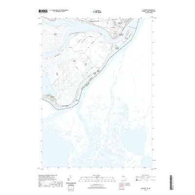
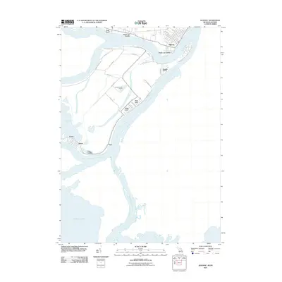 2011 Algonac2011 Print · USGSCovers Bedore, including Algonac, Grande Pointe, and other nearby areas
 - 2014 Map of Algonac, 2014 Print
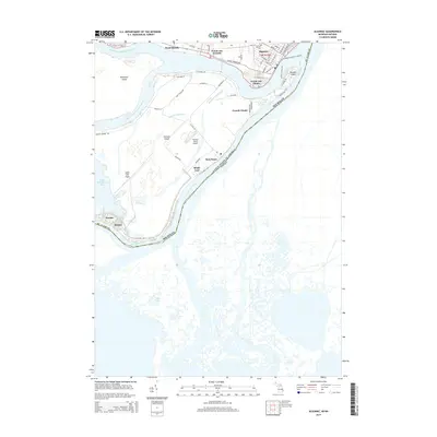 2014 Algonac2014 Print · USGSCovers Bedore, including Algonac, Grande Pointe, and other nearby areas
 - 2017 Map of Algonac, 2017 Print
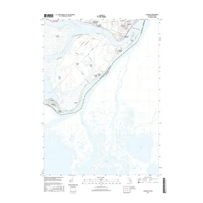 2017 Algonac2017 Print · USGSCovers Bedore, including Algonac, Grande Pointe, and other nearby areas
 - 2019 Map of Algonac, 2019 Print
 2019 Algonac2019 Print · USGSCovers Bedore, including Algonac, Grande Pointe, and other nearby areas
 - 2023 Map of Algonac, 2023 Print
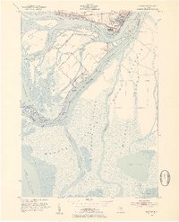
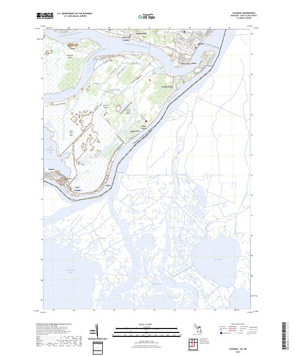 2023 Algonac2023 Print · USGSThe Saint Clair River delta comes alive in this contemporary record of Michigan's island communities and international borderlands. Trace local heritage through waterfront settlements like Sans Souci, find the Oaklawn Cem in Algonac, or follow the Walpole - Algonac Ferry.
End of results
Showing maps 1-14 of 14
Top cities near Bedore
- Chesterfield Township historical maps
- Harrison Township historical maps
- New Baltimore historical maps
- Grosse Pointe Farms historical maps
- New Haven historical maps
- Casco historical maps
See more
Frequently asked questions
- What are the different types of historical maps available for Bedore?
- What is the oldest map of Bedore?
- Where can I purchase historical maps of Bedore for my home or office?
- Where can I download high-res historical maps of Bedore?
- Are there historical topographic maps available for Bedore?
- Is there historical aerial imagery available for Bedore?
- Where are historical maps of Bedore sourced from?