1960s Maps of St. Clair Township, Michigan
Explore 6 historic maps of St. Clair Township from the 1960s. These maps offer a rare glimpse into what life looked like during the 1960s — showing old roads, neighborhoods, homes, and landmarks that have changed or disappeared over time.
Whether you're researching your family's past, planning a metal detecting trip, or studying how St. Clair Township's landscape evolved across the 1960s, these high-resolution maps are a powerful tool for exploring the history of this region.
- Focus on a specific era: All maps on this page are from the 1960s, giving you a focused view of this time period.
- See what’s changed: Compare century-old streets, trails, and buildings to today's modern landscape using overlays and satellite layers.
- Research with precision: Use these maps for genealogy, historical research, land use analysis, or educational projects.
- View, download, or print: Maps are fully viewable online in high resolution, and can be downloaded or printed for your own records.
Start exploring St. Clair Township's history through authentic maps from the 1960s. This is your window into the past.
St. Clair Township, MI maps
(6)- 1961 Map of Detroit, 1973 Print
 1961 Detroit1973 Print · USGSThe international border between Michigan and Ontario was a bustling industrial corridor in the early sixties. Researchers can trace the transit networks and riverfront infrastructure connecting Detroit to Windsor via the Detroit-Windsor Tunnel and major air hubs like Willow Run Airport.2 unique versions available
 - 1965 Map of Detroit
 1965 Detroit1965 Print · USGSThe industrial corridor between Michigan and Ontario is captured here at mid-century, showing the dense rail and river networks of the Great Lakes. Local historians can trace the paths of the Grand Trunk Western RR and locate key landmarks like Selfridge Air Force Base and Grosse Ile.
 - 1968 Map of Smiths Creek, 1970 Print
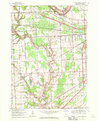 1968 Smiths Creek1970 Print · USGSSt. Clair County in the late sixties shows a landscape of growing townships and critical infrastructure along the BLACK RIVER. Researchers can trace local heritage through sites like St Marys Cem, the community at Smiths Creek, and the Sparlingville Sch grounds.2 unique versions available
 - 1968 Map of St. Clair, 1971 Print
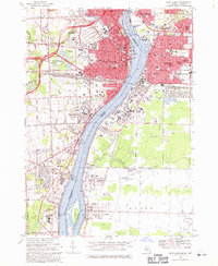
 1968 St. Clair1971 Print · USGSThe international border along the St Clair River is shown here in the late sixties, capturing the distinct industrial and residential characters of Michigan and Ontario. Genealogists can trace family landmarks like St Marys Cem, Eddy Sch, and the riverside settlement at Hawthorne.2 unique versions available
 - 1968 Map of Port Huron, 1971 Print
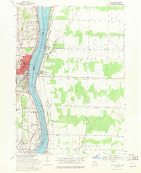
 1968 Port Huron1971 Print · USGSThe international border along the St. Clair River thrived in the late sixties as a hub of industry and transport. Genealogists and historians can trace the neighborhoods of Sarnia and Port Huron, locating family landmarks like Riverlawn Cem and St Stephen Sch.3 unique versions available
 - 1968 Map of Rattle Run, 1971 Print
 1968 Rattle Run1971 Print · USGSSt. Clair County in the late sixties shows a transition from traditional riverside milling to a complex landscape of oil fields and gas storage. Researchers can trace family roots through St Marys Cem or locate the historic Belle River Mills and Baird.
End of results
Showing maps 1-6 of 6
Top cities near St. Clair Township
- Chesterfield Township historical maps
- Port Huron historical maps
- New Baltimore historical maps
- Marysville historical maps
- Kimball historical maps
- West Tappan historical maps
See more
Top neighborhoods of St. Clair Township
Frequently asked questions
- What are the different types of historical maps available for St. Clair Township?
- What is the oldest map of St. Clair Township?
- Where can I purchase historical maps of St. Clair Township for my home or office?
- Where can I download high-res historical maps of St. Clair Township?
- Are there historical topographic maps available for St. Clair Township?
- Is there historical aerial imagery available for St. Clair Township?
- Where are historical maps of St. Clair Township sourced from?