Old Maps of Flowerfield Township, Michigan for Academic Research
Study the evolution of Flowerfield Township with 40 high-resolution historic maps. Whether you're teaching, researching, or modeling changes in land use, these maps provide essential visual documentation of urban, environmental, and geographic change.
- Analyze long-term change: Track patterns in development, transportation, and natural features.
- Ideal for environmental or urban studies: Support academic projects with primary historical map data.
- Use in the classroom or lab: Educators and researchers rely on these maps to bring historical context to life.
These maps are a powerful tool for teaching, research, and visualizing how Flowerfield Township has changed over the decades.
Flowerfield Township, MI maps
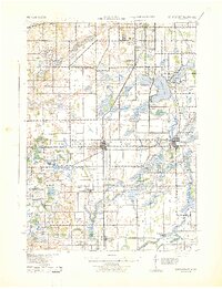
(40)- 1914 Map of Three Rivers, 1966 Print
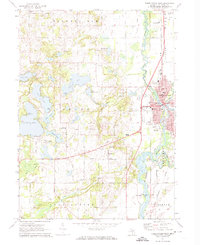
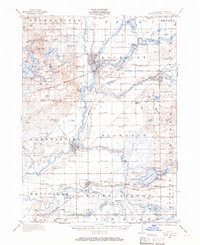 1914 Three Rivers1966 Print · USGSSt. Joseph County's river-driven economy is on full display in the early 1900s, centered on the busy rail junction at Three Rivers. Genealogists can locate dozens of country schools and churches, from Peck Academy to the remote Quail Trap School.
 - 1916 Map of Three Rivers
 1916 Three Rivers1916 Print · USGSThe river-driven industry and rural school networks of St. Joseph County are in full view during the mid-nineteen-teens. Genealogists and historians can locate old homesteads near Johnnycake School, trace the Chicago Road, or find the early power structures at Sturgis Power Dam.3 unique versions available
 - 1922 Map of Schoolcraft
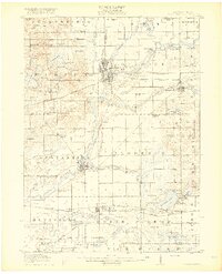
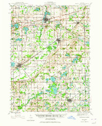
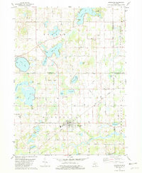
 1922 Schoolcraft1922 Print · USGSSouthern Kalamazoo and northern St. Joseph counties are captured here in the early 1920s as a thriving hub of rail transport and rural education. Genealogists can trace family footprints through dozens of local sites, from the rail junction at Schoolcraft to the lakeside Ramona Park and the Flowerfield Sta.5 unique versions available
 - 1943 Map of Three Rivers
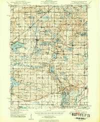
 1943 Three Rivers1943 Print · USGSSt. Joseph County and the northern Indiana borderlands appear here in the 1940s at the height of the steam-rail era. Genealogists can trace dozens of rural school sites like Johnnycake Sch and family landmarks near White Pigeon, Constantine, and Klinger Lake.
 - 1943 Map of Schoolcraft
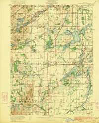
 1943 Schoolcraft1943 Print · USGSKalamazoo and St. Joseph counties are shown here during the early 1940s, a landscape defined by glacial lakes and the expansive Schoolcraft Prairie. Trace family roots at Vicksburg or locate historic rural schools like Lost Island Sch and Brick Sch.
 - 1944 Map of Marcellus, 1965 Print
 1944 Marcellus1965 Print · USGSSouthwest Michigan townships in Van Buren and Cass counties are documented here during the mid-1940s as a landscape of interconnected glacial lakes and rail lines. Researchers can trace old rural schools like Durkee Sch, the Pere Marquette rail corridor, and family burial grounds such as Wildey Cem.3 unique versions available
 - 1946 Map of Marcellus
 1946 Marcellus1946 Print · USGSThe rural landscape of Cass and Van Buren counties comes alive in the mid-1940s, showing a transition between railroad hubs and quiet farming hamlets. Genealogists can locate family-named landmarks such as Chamberlain Cem and historic schools like Porter Center Sch or Shannon Sch.2 unique versions available
 - 1948 Map of Vandalia
 1948 Vandalia1948 Print · USGSCass County's lake-studded landscape is captured here in the mid-1940s, showing a vibrant network of rural schoolhouses and lakeside retreats. Genealogists and local historians can trace early school districts like Allegheny Sch, locate the Moon Cem, and see the rail economy of Vandalia along the Grand Trunk.5 unique versions available
 - 1949 Map of Vandalia
 1949 Vandalia1949 Print · USGSIn the late 1940s, this pocket of Cass County was a hub of rural life and summer lakeside recreation. Genealogists can locate family landmarks like the Shavehead Cem or Chain Lake Ch, and trace old rail stops along the Grand Trunk.2 unique versions available
 - 1953 Map of Fort Wayne, 1963 Print
 1953 Fort Wayne1963 Print · USGSNortheast Indiana and its neighboring borderlands in Michigan and Ohio appear here during a peak era of rail and road expansion. Researchers can trace the massive rail networks of the Nickel Plate Road and Wabash or locate lakeside landmarks like Lake Wawasee and Clear Lake.4 unique versions available
 - 1956 Map of Fort Wayne
 1956 Fort Wayne1956 Print · USGSThe tri-state borderlands of Indiana, Michigan, and Ohio are captured here in the mid-fifties, centered on the growing industrial hub of Fort Wayne. Researchers can trace the heavy rail lines of the New York Central and Pennsylvania alongside prominent water features like Lake Wawasee and the Maumee River.2 unique versions available
 - 1958 Map of Grand Rapids, 1973 Print
 1958 Grand Rapids1973 Print · USGSSouthern Michigan at the peak of the postwar era shows a landscape of burgeoning cities and new interstate highways. Trace family roots and regional growth in Grand Rapids, Battle Creek, and the glacial lake country around Gun Lake or Gull Lake.2 unique versions available
 - 1961 Map of Grand Rapids
 1961 Grand Rapids1961 Print · USGSSouthern Michigan at the dawn of the 1960s reveals a region shaped by major river systems and a robust rail network. Trace mid-century industrial growth and land use from Grand Rapids to the Fort Custer Military Reservation and Gun Lake.
 - 1962 Map of Grand Rapids
 1962 Grand Rapids1962 Print · USGSMid-century Southern Michigan is mapped here at a time of massive growth, showing the expanding urban footprints of Grand Rapids and Lansing. Researchers can trace the legacy of the Grand Trunk Western RR, find historic boundaries of the Fort Custer Military Reservation, or locate sporting camps around Gun Lake.2 unique versions available
 - 1967 Map of Schoolcraft, 1969 Print
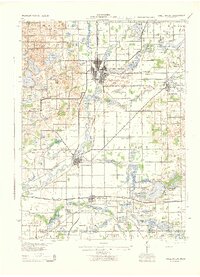
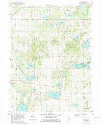
 1967 Schoolcraft1969 Print · USGSSouthwest Michigan's agricultural heartland is documented here in the late 1960s, showing the intersection of rail and rural life. Genealogists can locate family-named routes and community landmarks like Upper Flatbush Cem, Edwards Corners, and the Grange Hall.3 unique versions available
 - 1972 Map of Three Rivers West, 1974 Print
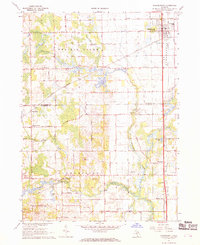
 1972 Three Rivers West1974 Print · USGSThe confluence of three major rivers and a dense network of glacial lakes define this St. Joseph County landscape in the early seventies. Genealogists and local researchers can trace family landmarks like Flatbush Cem, Dutch Settlement, and the Lake Section Community School.2 unique versions available
 - 1981 Map of Marcellus, 1982 Print
 1981 Marcellus1982 Print · USGSMarcellus and the surrounding lake country of Cass County are captured here in the early eighties as the rail-and-road network remained central to rural life. Researchers can trace the Grand Trunk Western line, locate family plots at Bly Cem, or find old gathering spots like Harmony Chapel.
 - 1981 Map of Jones, 1982 Print
 1981 Jones1982 Print · USGSCass County's glacial landscape is captured here in the early eighties, showing the rural communities of Jones and Wakelee. Genealogists and historians can trace family-named sites like Poe Cem, Driskels Lake, and the Grand Trunk Western rail line.
 - 1982 Map of Kalamazoo, 1983 Print
 1982 Kalamazoo1983 Print · USGSThe Kalamazoo River valley in the early eighties shows a landscape of growing suburban centers and heavy rail infrastructure. Genealogists and researchers can trace the limits of Kalamazoo and Battle Creek or locate landmarks like Fort Custer National Cemetery and Gull Lake.
 - 1985 Map of Elkhart
 1985 Elkhart1985 Print · USGSThe Indiana-Michigan borderlands come into focus in the mid-1980s, showcasing the industrial rail hubs and rural agricultural townships of the St. Joseph valley. Genealogists and historians can trace the growth of Elkhart, Goshen, and Three Rivers, or locate smaller communities like Middlebury and White Pigeon.2 unique versions available
 - 2011 Map of Schoolcraft, 2011 Print
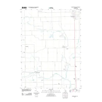 2011 Schoolcraft2011 Print · USGSCovers Flowerfield Township, including Flowerfield, Schoolcraft, and other nearby areas
 - 2011 Map of Marcellus, 2011 Print
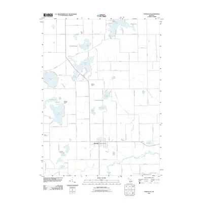 2011 Marcellus2011 Print · USGSCovers Flowerfield Township, including Marcellus, Marcellus Township, and other nearby areas
 - 2011 Map of Three Rivers West, 2011 Print
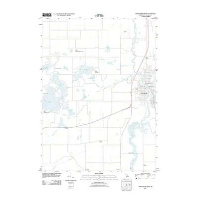 2011 Three Rivers West2011 Print · USGSCovers Flowerfield Township, including Three Rivers, Fabius, and other nearby areas
 - 2011 Map of Jones, 2011 Print
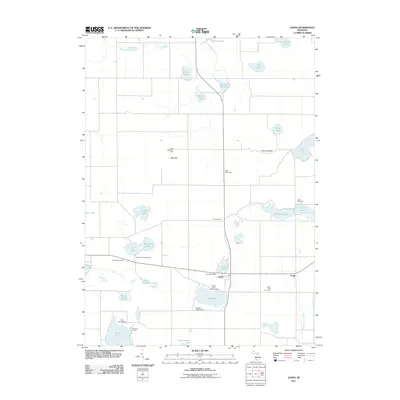 2011 Jones2011 Print · USGSCovers Flowerfield Township, including Marcellus Township, Constantine Township, and other nearby areas
 - 2014 Map of Marcellus, 2014 Print
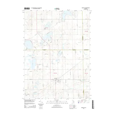 2014 Marcellus2014 Print · USGSCovers Flowerfield Township, including Marcellus, Marcellus Township, and other nearby areas
Showing maps 1-25 of 40
Top cities near Flowerfield Township
- Kalamazoo historical maps
- Portage historical maps
- Three Rivers historical maps
- Fabius historical maps
- Paw Paw historical maps
- Mattawan historical maps
See more
Top neighborhoods of Flowerfield Township
Frequently asked questions
- What are the different types of historical maps available for Flowerfield Township?
- What is the oldest map of Flowerfield Township?
- Where can I purchase historical maps of Flowerfield Township for my home or office?
- Where can I download high-res historical maps of Flowerfield Township?
- Are there historical topographic maps available for Flowerfield Township?
- Is there historical aerial imagery available for Flowerfield Township?
- Where are historical maps of Flowerfield Township sourced from?