2020s Maps of Wheatland Township, Michigan
Explore 2 historic maps of Wheatland Township from the 2020s. These maps offer a rare glimpse into what life looked like during the 2020s — showing old roads, neighborhoods, homes, and landmarks that have changed or disappeared over time.
Whether you're researching your family's past, planning a metal detecting trip, or studying how Wheatland Township's landscape evolved across the 2020s, these high-resolution maps are a powerful tool for exploring the history of this region.
- Focus on a specific era: All maps on this page are from the 2020s, giving you a focused view of this time period.
- See what’s changed: Compare century-old streets, trails, and buildings to today's modern landscape using overlays and satellite layers.
- Research with precision: Use these maps for genealogy, historical research, land use analysis, or educational projects.
- View, download, or print: Maps are fully viewable online in high resolution, and can be downloaded or printed for your own records.
Start exploring Wheatland Township's history through authentic maps from the 2020s. This is your window into the past.
Wheatland Township, MI maps
(2)- 2023 Map of Argyle, 2023 Print
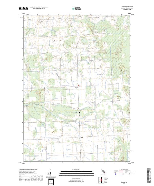 2023 Argyle2023 Print · USGSSanilac County's agricultural heartland appears here in the early twenty-first century, structured by section roads and an extensive drainage network. Genealogists can locate several key burial sites, including Saint Joseph and Saint Ignatius Cem, Argyle Cem, and Wheatland Cem.
 - 2023 Map of Palms, 2023 Print
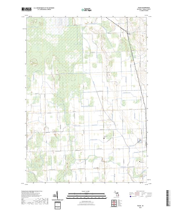 2023 Palms2023 Print · USGSThe community of Palms and its surrounding agricultural lands are documented in this recent survey. Genealogists and local historians can locate the Farnsworth Grave, Downing Cem, and the winding course of the Black River.
End of results
Showing maps 1-2 of 2
Top cities near Wheatland Township
- Sandusky historical maps
- Watertown historical maps
- Deckerville historical maps
- Elmer historical maps
- Ubly historical maps
- Argyle historical maps
See more
Top neighborhoods of Wheatland Township
Frequently asked questions
- What are the different types of historical maps available for Wheatland Township?
- What is the oldest map of Wheatland Township?
- Where can I purchase historical maps of Wheatland Township for my home or office?
- Where can I download high-res historical maps of Wheatland Township?
- Are there historical topographic maps available for Wheatland Township?
- Is there historical aerial imagery available for Wheatland Township?
- Where are historical maps of Wheatland Township sourced from?