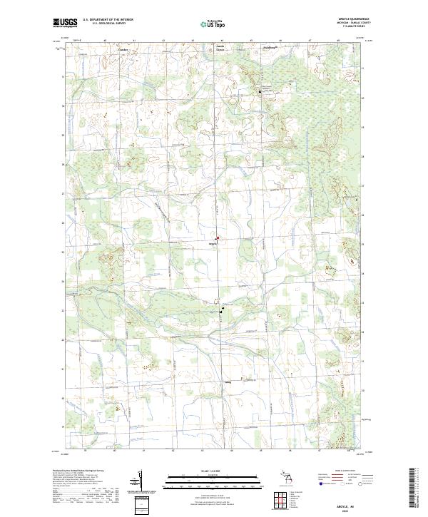
2023 Map of Argyle
USGS Topo · Published 2023About this map
Argyle sits at the center of this rural Sanilac County landscape, defined by an intricate network of agricultural waterways and the meandering path of the Middle Branch Cass River. The region’s development is clearly etched in its drainage system, including the South Branch Ingles Drain, Evergreen and Austin Drain, and Franzel Drain, which supported the conversion of the Thumb's interior into productive farmland. Several distinct community hubs like Cumber, Austin Center, and Laing anchor the surrounding townships, while local genealogy is well-preserved through numerous burial grounds such as Saint Joseph and Saint Ignatius Cem, Wheatland Cem, and the Lutheran Cem. The road network, including arterial routes like Ubly Rd and Deckerville Rd, follows the traditional section lines typical of Michigan's farming heartland, connecting these small settlements to the broader county landscape.
Find a feature on this map
62 named features on this map. Tap any name to fly to it.
Don’t see what you’re looking for? This feature index may not catch every label — zoom into the map to look around manually.
Map Details
Editions of this 2023 Argyle Map
This is the sole edition of this map. No revisions or reprints were ever made.
Other maps of this area

1954 · Flint
USGS Topo · 1:250,000

1958 · Flint
USGS Topo · 1:250,000

1963 · Snover
USGS Topo · 1:24,000

1963 · New Greenleaf
USGS Topo · 1:24,000

1963 · Sandusky
USGS Topo · 1:24,000

1963 · Ubly
USGS Topo · 1:24,000

1963 · Minden City
USGS Topo · 1:24,000

1963 · Palms
USGS Topo · 1:24,000

1963 · Shabbona
USGS Topo · 1:24,000
1963 · Decker
USGS Topo · 1:24,000