
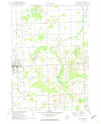
1963 Map of Ubly
USGS Topo · Published 1964About this map
Agricultural lands and a complex network of man-made irrigation define this portion of the Thumb region as it appeared in the early 1960s. The village of Ubly serves as the primary hub, situated along the Chesapeake and Ohio railroad line which cuts diagonally across the northern landscape. Local life is anchored by rural institutions such as the Bingham Sch and several small burial grounds including Valley Cem and Mt Pleasant Cem.
Find a feature on this map
61 named features on this map. Tap any name to fly to it.
Don’t see what you’re looking for? This feature index may not catch every label — zoom into the map to look around manually.
Map Details
Editions of this 1963 Ubly Map
This is the sole edition of this map. No revisions or reprints were ever made.
Other maps of this area

1954 · Flint
USGS Topo · 1:250,000

1958 · Flint
USGS Topo · 1:250,000

1963 · New Greenleaf
USGS Topo · 1:24,000

1963 · Minden City
USGS Topo · 1:24,000

1963 · Palms
USGS Topo · 1:24,000

1963 · Shabbona
USGS Topo · 1:24,000

1963 · Argyle
USGS Topo · 1:24,000

1970 · Bad Axe West
USGS Topo · 1:24,000

1970 · Bad Axe SE
USGS Topo · 1:24,000
1970 · Bad Axe East
USGS Topo · 1:24,000