
Loading...
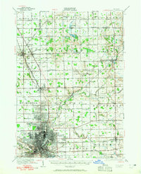
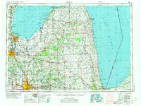
Loading map...1958 Map of Flint
USGS Topo · Published 1958About this map
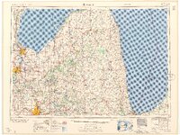
Saginaw Bay and the vast expanse of Lake Huron anchor this 1950s regional overview of the Michigan Thumb, illustrating the industrial and agricultural heartland of the era. The industrial centers of Flint, Saginaw, and Bay City are shown at a peak of mid-century connectivity, linked by a dense network of major railroads including the New York Central, Chesapeake and Ohio, and Grand Trunk Western.
Find a feature on this map
249 named features on this map. Tap any name to fly to it.
Don’t see what you’re looking for? This feature index may not catch every label — zoom into the map to look around manually.
Map Details
Date Portrayed1958
Date Published1958
PublisherU.S. Geological Survey
Map TypeTopographic
Scale1:250,000
Physical Dimensions30 x 22 inches
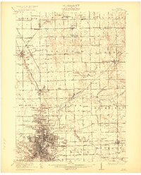
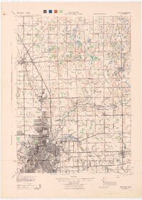
Editions of this 1958 Flint Map
2 editions found
Historical Maps of Flint Through Time
7 maps found


Featured Locations
Source Details
SourceU.S. Geological Survey
CopyrightPublic Domain