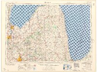
1958 Map of Flint
USGS Topo · Published 1958About this map
Industrial centers and coastal agricultural landscapes define this mid-century survey of the Thumb region. The expanding footprints of Flint, Bay City, and Port Huron anchor the map, showing the post-war development of Michigan's manufacturing heartland. Along the shoreline of Saginaw Bay and Lake Huron, the map details a network of coastal towns such as Sebewaing and Harbor Beach, alongside recreational areas like Albert E Sleeper State Park and Lakeport State Park.
Find a feature on this map
111 named features on this map. Tap any name to fly to it.
Don’t see what you’re looking for? This feature index may not catch every label — zoom into the map to look around manually.
Map Details
Editions of this 1958 Flint Map
2 editions found

Other maps of this area

1912 · Port Huron
USGS Topo · 1:62,500

1914 · Armada
USGS Topo · 1:62,500

1916 · Bay City
USGS Topo · 1:62,500

1917 · Chesaning
USGS Topo · 1:62,500

1917 · St. Charles
USGS Topo · 1:62,500

1919 · Bay City
USGS Topo · 1:62,500

1919 · Saginaw
USGS Topo · 1:62,500

1919 · Burt
USGS Topo · 1:62,500

1920 · Flint
USGS Topo · 1:62,500

1920 · Holly
USGS Topo · 1:62,500