
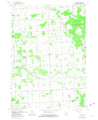
1963 Map of Argyle
USGS Topo · Published 1964About this map
The Middle Branch Cass River meanders through this portion of Sanilac County, defining a landscape shaped by rural agricultural development and a dense network of drainage systems. The survey captures the mid-century layout of small settlements like Argyle, Austin Center, and Cumber, which serve as the social hubs for the surrounding farmsteads. Local education and community life are grounded in the numerous district schools, including Argyle Sch, Starr Sch, and Wheeler Sch, while the presence of Mt Pleasant Cem and Wheatland Cem provides vital links for genealogists. To the northeast, the Minden City State Game Area stands as a significant natural reserve, contrasting with the organized grid of farm-to-market roads such as Stone Road and Deckerville Road. Numerous gravel pits scattered throughout the quadrangle hint at the local mineral extraction that supported the area's infrastructure.
Find a feature on this map
66 named features on this map. Tap any name to fly to it.
Don’t see what you’re looking for? This feature index may not catch every label — zoom into the map to look around manually.
Map Details
Editions of this 1963 Argyle Map
2 editions found
Other maps of this area

1954 · Flint
USGS Topo · 1:250,000

1958 · Flint
USGS Topo · 1:250,000

1963 · Snover
USGS Topo · 1:24,000

1963 · New Greenleaf
USGS Topo · 1:24,000

1963 · Sandusky
USGS Topo · 1:24,000

1963 · Ubly
USGS Topo · 1:24,000

1963 · Minden City
USGS Topo · 1:24,000

1963 · Palms
USGS Topo · 1:24,000

1963 · Shabbona
USGS Topo · 1:24,000
1963 · Decker
USGS Topo · 1:24,000