1900s (20th Century) Maps of Manistique, Michigan
Explore 8 historic maps of Manistique from the 1900s (20th Century). These maps offer a rare glimpse into what life looked like during the 1900s — showing old roads, neighborhoods, homes, and landmarks that have changed or disappeared over time.
Whether you're researching your family's past, planning a metal detecting trip, or studying how Manistique's landscape evolved across the 1900s, these high-resolution maps are a powerful tool for exploring the history of this region.
- Focus on a specific era: All maps on this page are from the 1900s, giving you a focused view of this time period.
- See what’s changed: Compare century-old streets, trails, and buildings to today's modern landscape using overlays and satellite layers.
- Research with precision: Use these maps for genealogy, historical research, land use analysis, or educational projects.
- View, download, or print: Maps are fully viewable online in high resolution, and can be downloaded or printed for your own records.
Start exploring Manistique's history through authentic maps from the 1900s. This is your window into the past.
Manistique, MI maps
(8)- 1931 Map of Cooks NE
 1931 Cooks NE1931 Print · USGSCoastal Schoolcraft County comes alive in this early 1930s survey of the northern Lake Michigan shoreline. Genealogists and local historians can trace the rail lines of the Manistique Ry and locate family landmarks like Heights Sch and Dufour.
 - 1954 Map of Escanaba, 1967 Print
 1954 Escanaba1967 Print · USGSThe Upper Peninsula and Door County shorelines meet here in the mid-fifties, showing the vital maritime and timber networks of the Great Lakes. Researchers can trace historic rail lines, old fire lookouts like the Stonington Fire Tower, and island settlements such as Washington Island.2 unique versions available
 - 1957 Map of Escanaba
 1957 Escanaba1957 Print · USGSThe Upper Peninsula and Door County shorelines meet in the mid-fifties, capturing a landscape of timber, iron, and maritime trade. Genealogists and local historians can trace the Chicago & North Western RR through settlements like Hermansville or locate St Vitals Church and the Potawatome Indian Reservation.
 - 1958 Map of Escanaba
 1958 Escanaba1958 Print · USGSNorthern Lake Michigan maritime commerce and timberlands are captured here in the mid-fifties. Genealogists and historians can trace rail networks like the Escanaba and Lake Superior or locate island settlements such as Detroit Harbor and Fish Creek.
 - 1958 Map of Cooks, 1959 Print
 1958 Cooks1959 Print · USGSThe Upper Peninsula shoreline south of Manistique comes alive in the late fifties, showing a mix of timber forest and new beach settlements. Trace family sites at Cooks Cem, locate the Cooks Lookout Tower, and follow the Garden Trail through the woods.
 - 1972 Map of Manistique East, 1975 Print
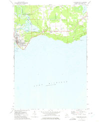 1972 Manistique East1975 Print · USGSManistique and its northern Lake Michigan harbor are captured here in the early 1970s, showcasing the intersection of the Upper Peninsula's timber and maritime industries. Genealogists and local historians can locate the Fairview Sch, trace the Soo Line tracks, and find the Fairview Cemetery near the city center.
 - 1983 Map of Manistique
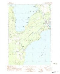
 1983 Manistique1983 Print · USGSThe northern shores of Lake Michigan and the Garden Peninsula appear here in the early eighties. Historians can trace the Soo Line rail corridor and explore coastal settlements like Nahma, Fayette, and the harbor town of Manistique.
 - 1983 Map of Manistique West, 1984 Print
 1983 Manistique West1984 Print · USGSThe Lake Michigan shoreline near Manistique and Thompson is captured here in the early eighties, where state and national forests meet the lake. Researchers can locate the Ossawinamakee Beach Historic Site, trace the Southtown Railroad Grade, and find the Fish Hatchery Thompson.
End of results
Showing maps 1-8 of 8
Top cities near Manistique
Frequently asked questions
- What are the different types of historical maps available for Manistique?
- What is the oldest map of Manistique?
- Where can I purchase historical maps of Manistique for my home or office?
- Where can I download high-res historical maps of Manistique?
- Are there historical topographic maps available for Manistique?
- Is there historical aerial imagery available for Manistique?
- Where are historical maps of Manistique sourced from?