Old Maps of Mueller Township, Michigan
Explore 50 old maps of Mueller Township, spanning from 1931 to today. These high-resolution historic maps reveal how streets, neighborhoods, landmarks, and natural features evolved over time — perfect for genealogy, metal detecting, research, and local history exploration.
What you can do with these maps:
- See how Mueller Township changed over time: Compare historical maps to modern-day views to trace roads, homesites, rail lines & more.
- View detailed metadata: Each map includes creators, publishers, year, scale, and archive source.
- Overlay maps with satellite & LiDAR: Visualize the past alongside modern tools to explore terrain & human change.
- Trusted historical sources: Maps sourced from the USGS, Library of Congress, and other archives.
- Access maps your way: View online, download high-res files, or order prints for personal or research use.
Start exploring old maps of Mueller Township to uncover forgotten places, hidden landmarks, and the deep history beneath your feet.
Mueller Township, MI maps
(50)- 1931 Map of Seul Choix Point NE
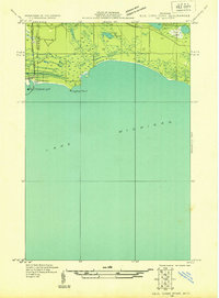 1931 Seul Choix Point NE1931 Print · USGSThe Upper Peninsula coast of Lake Michigan in the early 1930s is defined here by its maritime infrastructure and vast wetlands. Researchers can trace the industrial footprint of Inland Harbor, the navigation at Port Inland Light, and secluded water bodies like Batty Doe Lake.2 unique versions available
 - 1931 Map of Seul Choix Point NW
 1931 Seul Choix Point NW1931 Print · USGSUpper Peninsula lakefront life is documented here in the early 1930s as the shoreline meets the northern woods. Genealogy researchers can locate the isolated Seul Choix School and Seul Choix Point Light or trace the early rail path of the Minn St Paul and Sault Ste Marie.
 - 1931 Map of Blaney SW
 1931 Blaney SW1931 Print · USGSThe Upper Peninsula timber and rail landscape comes alive in this early 1930s survey of the Schoolcraft County interior. Researchers can trace the industrial footprint of the Lumber Co railroad, the Stone Quarry at Calaspar, and the New Blaney Fire Tower.
 - 1931 Map of Blaney NE
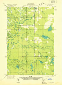
 1931 Blaney NE1931 Print · USGSMackinac County’s interior lake country is captured in the early 1930s, showing a wild landscape of timber and wetlands across the Upper Peninsula. Researchers can trace the sprawling bounds of Cranberry Marsh and the undisturbed shorelines of Manistique Lake and Whitefish Lake.
 - 1931 Map of Blaney SE
 1931 Blaney SE1931 Print · USGSMackinac County's wetlands and timberlands are captured here in the early thirties, just as aerial photography began to refine modern mapping. Genealogists and researchers can trace the settlement at Huntspur or locate industrial sites like the Stonequarry and the Minneapolis St Paul and Sault Sainte Marie railroad.
 - 1931 Map of Blaney NW
 1931 Blaney NW1931 Print · USGSThe Manistique River valley and the settlement of Germfask are captured here in the early 1930s as modern surveying first reached this watery landscape. Genealogists and local historians can trace rural landmarks like South School and named water bodies such as Mezik Lake and Chip Lake.
 - 1954 Map of Sault Sainte Marie, 1979 Print
 1954 Sault Sainte Marie1979 Print · USGSThe Eastern Upper Peninsula and Ontario borderlands are captured here at the height of the mid-century era. Family historians can trace settlements like Grand Marais and Stalwart, while mapping the strategic grounds of Kincheloe AFB.3 unique versions available
 - 1955 Map of Cheboygan, 1964 Print
 1955 Cheboygan1964 Print · USGSNorthern Michigan in the mid-fifties is a landscape of dense timber and deep water, showing the region just as the road network began to modernize. Trace family roots in lakeside towns like St Ignace and Petoskey, or follow the historic tracks of the Pennsylvania RR and New York Central RR.5 unique versions available
 - 1956 Map of Sault Sainte Marie, 1964 Print
 1956 Sault Sainte Marie1964 Print · USGSThe Eastern Upper Peninsula and the Canadian border meet in this mid-sixties survey of the bustling Soo Locks region. Genealogists and historians can trace the paths of the Soo Line and locate lakeside communities from Grand Marais to Shelldrake.2 unique versions available
 - 1957 Map of Sault Sainte Marie
 1957 Sault Sainte Marie1957 Print · USGSThe Upper Peninsula and Ontario border come alive in this mid-century portrait of the eastern Lake Superior shoreline and the vital St. Marys River corridor. Genealogists and historians can trace rail-era settlements from Newberry to Detour, while locating military landmarks like Kinross Air Force Base.
 - 1958 Map of Cheboygan
 1958 Cheboygan1958 Print · USGSThe tip of Michigan's Lower Peninsula and the surrounding Great Lakes islands are shown here in the late fifties, during the peak of the rail-and-ferry era. Trace the paths of the Pennsylvania RR and explore lakeside settlements like St James, Petoskey, and Indian River.2 unique versions available
 - 1958 Map of Sault Sainte Marie
 1958 Sault Sainte Marie1958 Print · USGSThe eastern Upper Peninsula and the Canadian borderland appear here during the late fifties, a time of military growth and forest management. Researchers can locate vanished rail stops along the Soo Line, early sites like the Fiborn Quarry, and the sprawling Kinross Air Force Base.
 - 1972 Map of Hughes Point, 1974 Print
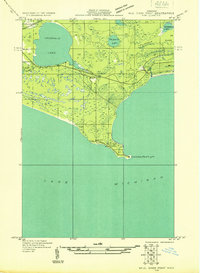
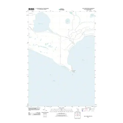
 1972 Hughes Point1974 Print · USGSUpper Peninsula shoreline and wetlands are documented here in the early seventies, just as modern hydrographic surveys were updated. Trace the rugged coastal features of Island Harbor, Port Island, and the secluded waters of Batty Doe Lake within the Mackinac State Forest.2 unique versions available
 - 1972 Map of Seul Choix Point, 1975 Print
 1972 Seul Choix Point1975 Print · USGSThe northern shores of Lake Michigan come into focus in the early 1970s, showing a rugged peninsula defined by maritime safety and heavy industry. Trace the historic Lighthouse and Coast Guard Sta at Seul Choix Point alongside the massive Quarry works near Milakokia River.
 - 1972 Map of Blaney Park, 1975 Print
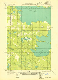
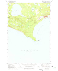
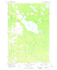
 1972 Blaney Park1975 Print · USGSSchoolcraft County’s resort and timber lands are captured here in the early 1970s, showcasing the development around Mueller Township. Genealogists and researchers can trace local family landmarks like Maple Grove Ch or follow the Soo Line rail history through Blaney Junction and Parkington.
 - 1972 Map of Germfask, 1975 Print
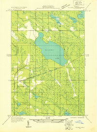
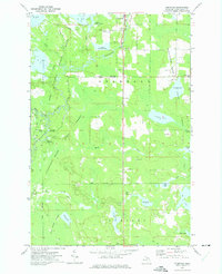 1972 Germfask1975 Print · USGSSchoolcraft County’s timber and wetlands are captured in the early seventies, where the Manistique River divides managed wildlife pools and state forests. Researchers can locate legacy burial grounds like Old Germfask Cem and Blaney Cem or the small settlement of Gagnon.
 - 1972 Map of Milakokia Lake, 1975 Print
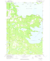
 1972 Milakokia Lake1975 Print · USGSUpper Peninsula timber and mining operations define this corner of Mackinac County in the 1970s. Researchers can trace the industrial footprint of the large Quarry, find the location of Pike Lake Station, and follow the path of the Soo Line and an Old Railroad Grade.
 - 1972 Map of Curtis West, 1975 Print
 1972 Curtis West1975 Print · USGSMackinac County's lakeland region comes into focus during the early seventies, showing the gateway between the Manistique Lakes. Genealogists and historians can trace the Old Railroad Grade, find the Sandpit Cem, and explore the settlement of Curtis.
 - 1984 Map of Beaver Island, 1985 Print
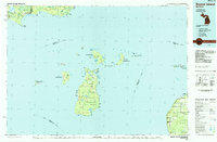 1984 Beaver Island1985 Print · USGSBeaver Island and the surrounding archipelago are shown in the mid-eighties before modern developments changed these remote coastal landscapes. Researchers can trace the layout of island settlements like St James or mainland hamlets such as Good Hart and Middle Village.2 unique versions available
 - 1985 Map of Manistique Lake
 1985 Manistique Lake1985 Print · USGSThe eastern Upper Peninsula’s wilderness and rail-side villages are captured here in the mid-1980s, from the Soo Line corridor to the Lake Michigan shore. Genealogists and historians can trace the foundations of local life in Newberry, Engadine, and Seney, alongside industrial landmarks like the Calspar Quarry Pool.2 unique versions available
 - 2011 Map of Blaney Park, 2011 Print
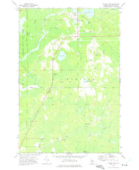
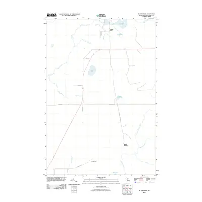 2011 Blaney Park2011 Print · USGSCovers Mueller Township, including Blaney Junction, Blaney Park, and other nearby areas
 - 2011 Map of Seul Choix Point, 2011 Print
 2011 Seul Choix Point2011 Print · USGSCovers Mueller Township, including Doyle Township, Schoolcraft County, and other nearby areas
 - 2011 Map of Hughes Point, 2011 Print
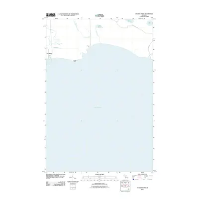 2011 Hughes Point2011 Print · USGSCovers Mueller Township, including Newton Township, Port Inland, and other nearby areas
 - 2011 Map of Milakokia Lake, 2011 Print
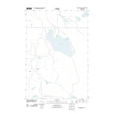 2011 Milakokia Lake2011 Print · USGSCovers Mueller Township, including Newton Township, Huntspur, and other nearby areas
 - 2011 Map of Curtis West, 2011 Print
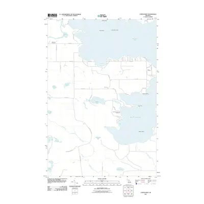 2011 Curtis West2011 Print · USGSCovers Mueller Township, including Newton Township, Germfask Township, and other nearby areas
Showing maps 1-25 of 50
Top cities near Mueller Township
Top neighborhoods of Mueller Township
- Inland historical maps
- Blaney Junction historical maps
- Blaney Park historical maps
- Parkington historical maps
- Port Inland historical maps
Frequently asked questions
- What are the different types of historical maps available for Mueller Township?
- What is the oldest map of Mueller Township?
- Where can I purchase historical maps of Mueller Township for my home or office?
- Where can I download high-res historical maps of Mueller Township?
- Are there historical topographic maps available for Mueller Township?
- Is there historical aerial imagery available for Mueller Township?
- Where are historical maps of Mueller Township sourced from?