Old Maps of Parkington, Mueller Township
Explore 12 old maps of Parkington, spanning from 1931 to today. These high-resolution historic maps reveal how streets, neighborhoods, landmarks, and natural features evolved over time — perfect for genealogy, metal detecting, research, and local history exploration.
What you can do with these maps:
- See how Parkington changed over time: Compare historical maps to modern-day views to trace roads, homesites, rail lines & more.
- View detailed metadata: Each map includes creators, publishers, year, scale, and archive source.
- Overlay maps with satellite & LiDAR: Visualize the past alongside modern tools to explore terrain & human change.
- Trusted historical sources: Maps sourced from the USGS, Library of Congress, and other archives.
- Access maps your way: View online, download high-res files, or order prints for personal or research use.
Start exploring old maps of Parkington to uncover forgotten places, hidden landmarks, and the deep history beneath your feet.
Parkington, Mueller Township maps
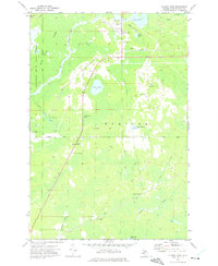
(12)- 1931 Map of Blaney SW
 1931 Blaney SW1931 Print · USGSThe Upper Peninsula timber and rail landscape comes alive in this early 1930s survey of the Schoolcraft County interior. Researchers can trace the industrial footprint of the Lumber Co railroad, the Stone Quarry at Calaspar, and the New Blaney Fire Tower.
 - 1954 Map of Sault Sainte Marie, 1979 Print
 1954 Sault Sainte Marie1979 Print · USGSThe Eastern Upper Peninsula and Ontario borderlands are captured here at the height of the mid-century era. Family historians can trace settlements like Grand Marais and Stalwart, while mapping the strategic grounds of Kincheloe AFB.3 unique versions available
 - 1956 Map of Sault Sainte Marie, 1964 Print
 1956 Sault Sainte Marie1964 Print · USGSThe Eastern Upper Peninsula and the Canadian border meet in this mid-sixties survey of the bustling Soo Locks region. Genealogists and historians can trace the paths of the Soo Line and locate lakeside communities from Grand Marais to Shelldrake.2 unique versions available
 - 1957 Map of Sault Sainte Marie
 1957 Sault Sainte Marie1957 Print · USGSThe Upper Peninsula and Ontario border come alive in this mid-century portrait of the eastern Lake Superior shoreline and the vital St. Marys River corridor. Genealogists and historians can trace rail-era settlements from Newberry to Detour, while locating military landmarks like Kinross Air Force Base.
 - 1958 Map of Sault Sainte Marie
 1958 Sault Sainte Marie1958 Print · USGSThe eastern Upper Peninsula and the Canadian borderland appear here during the late fifties, a time of military growth and forest management. Researchers can locate vanished rail stops along the Soo Line, early sites like the Fiborn Quarry, and the sprawling Kinross Air Force Base.
 - 1972 Map of Blaney Park, 1975 Print
 1972 Blaney Park1975 Print · USGSSchoolcraft County’s resort and timber lands are captured here in the early 1970s, showcasing the development around Mueller Township. Genealogists and researchers can trace local family landmarks like Maple Grove Ch or follow the Soo Line rail history through Blaney Junction and Parkington.
 - 1985 Map of Manistique Lake
 1985 Manistique Lake1985 Print · USGSThe eastern Upper Peninsula’s wilderness and rail-side villages are captured here in the mid-1980s, from the Soo Line corridor to the Lake Michigan shore. Genealogists and historians can trace the foundations of local life in Newberry, Engadine, and Seney, alongside industrial landmarks like the Calspar Quarry Pool.2 unique versions available
 - 2011 Map of Blaney Park, 2011 Print
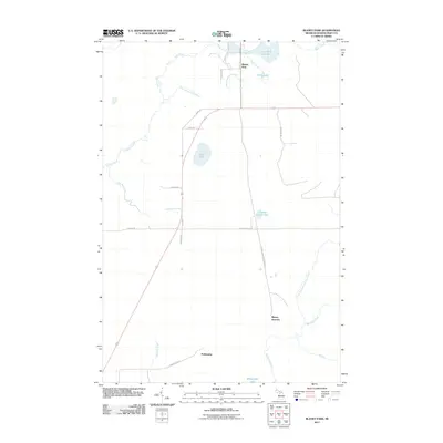 2011 Blaney Park2011 Print · USGSCovers Parkington, including Blaney Junction, Blaney Park, and other nearby areas
 - 2014 Map of Blaney Park, 2014 Print
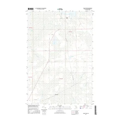
 2014 Blaney Park2014 Print · USGSCovers Parkington, including Blaney Junction, Blaney Park, and other nearby areas
 - 2017 Map of Blaney Park, 2017 Print
 2017 Blaney Park2017 Print · USGSCovers Parkington, including Blaney Junction, Blaney Park, and other nearby areas
 - 2019 Map of Blaney Park, 2019 Print
 2019 Blaney Park2019 Print · USGSCovers Parkington, including Blaney Junction, Blaney Park, and other nearby areas
 - 2023 Map of Blaney Park, 2023 Print
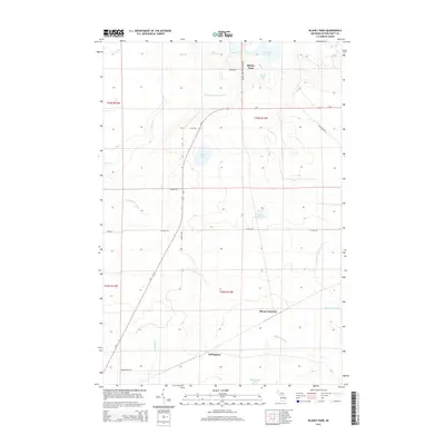
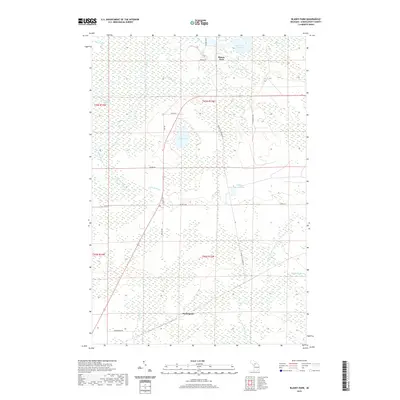
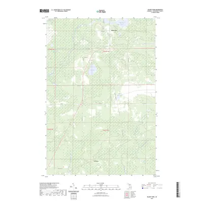 2023 Blaney Park2023 Print · USGSSchoolcraft County's timber and wetland interior is captured here in the early twenty-first century, centered on the historic resort community of Blaney Park. Local historians can trace the paths of Old US Hwy 2, find the Parkington settlement, and locate the Calspar Quarry Pool.
End of results
Showing maps 1-12 of 12
Frequently asked questions
- What are the different types of historical maps available for Parkington?
- What is the oldest map of Parkington?
- Where can I purchase historical maps of Parkington for my home or office?
- Where can I download high-res historical maps of Parkington?
- Are there historical topographic maps available for Parkington?
- Is there historical aerial imagery available for Parkington?
- Where are historical maps of Parkington sourced from?