
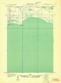
1931 Map of Seul Choix Point NE
USGS Topo · Published 1931About this map
Port Inland Light stands at the edge of Lake Michigan, marking a critical industrial and maritime gateway during the early 1930s. This survey, compiled from aerial photography by the Air Corps, reveals the infrastructure of Inland Harbor and the Inland Transmission Electric Line that powered the developing coast. The landscape is defined by the transition from open water to the interior wetlands of Newton, where the Milakokia flows through a series of coastal marshes.
Find a feature on this map
11 named features on this map. Tap any name to fly to it.
Don’t see what you’re looking for? This feature index may not catch every label — zoom into the map to look around manually.
Map Details
Editions of this 1931 Seul Choix Point NE Map
2 editions found
Other maps of this area

1931 · Seul Choix Point NW
USGS Topo · 1:31,680

1931 · Blaney SW
USGS Topo · 1:31,680

1931 · Blaney SE
USGS Topo · 1:31,680

1954 · Sault Sainte Marie
USGS Topo · 1:250,000

1955 · Cheboygan
USGS Topo · 1:250,000

1956 · Sault Sainte Marie
USGS Topo · 1:250,000

1957 · Sault Sainte Marie
USGS Topo · 1:250,000

1958 · Cheboygan
USGS Topo · 1:250,000

1958 · Sault Sainte Marie
USGS Topo · 1:250,000

1972 · Hughes Point
USGS Topo · 1:24,000