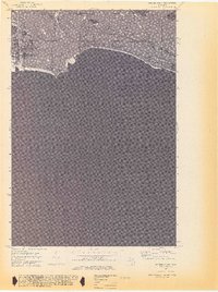
1972 Map of Hughes Point
USGS Topo · Published 1974About this map
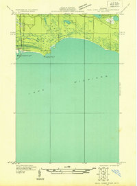
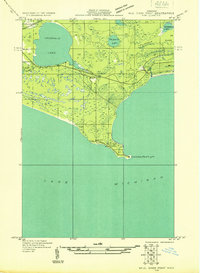
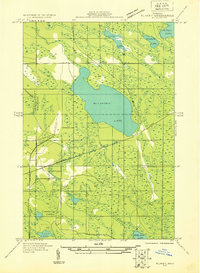
Mackinac State Forest dominates the northern shoreline of Lake Michigan in this early 1970s survey, revealing a landscape defined by intricate wetlands and coastal inlets. The interior is characterized by numerous small water bodies such as Shoepac Lake, Batty Doe Lake, and the expansive Swan Marsh, which feeds into Swan Creek. This area shows the intersection of state-managed timberlands and the fluctuating coastal environment of the Upper Peninsula. Along the coast, distinct geographical features like Hughes Point and Seiners Point frame the entrance to Island Harbor, a sheltered area protected by Port Island. The map provides a look at the hydrography of the region just before modern development, including the location of various Lights and a Gaging Sta used for monitoring the Great Lakes' water levels and navigation.
Find a feature on this map
14 named features on this map. Tap any name to fly to it.
Don’t see what you’re looking for? This feature index may not catch every label — zoom into the map to look around manually.
Map Details
Editions of this 1972 Hughes Point Map
2 editions found

Other maps of this area
1931 · Seul Choix Point NE
USGS Topo · 1:31,680
1931 · Seul Choix Point NW
USGS Topo · 1:31,680

1931 · Blaney SW
USGS Topo · 1:31,680
1931 · Blaney SE
USGS Topo · 1:31,680

1954 · Sault Sainte Marie
USGS Topo · 1:250,000

1955 · Cheboygan
USGS Topo · 1:250,000

1956 · Sault Sainte Marie
USGS Topo · 1:250,000

1957 · Sault Sainte Marie
USGS Topo · 1:250,000

1958 · Cheboygan
USGS Topo · 1:250,000

1958 · Sault Sainte Marie
USGS Topo · 1:250,000
Featured Places
- Newton Township, MI
- Mueller Township, MI
- Port Inland, Mueller Township
- Mackinac County, MI
- Schoolcraft County, MI