Old Maps of Seney, Seney Township for Genealogy
Trace your family roots with 12 historic maps of Seney. These high-res maps reveal old neighborhoods, homesites, landmarks, and streets — helping you uncover where your ancestors lived and how the area evolved over time.
- Explore historic neighborhoods: Identify where your relatives may have lived in the 1800s or 1900s.
- Compare maps over time: Trace the changes in streets, buildings, and landmarks for multi-generational research.
- Perfect for genealogy & ancestry research: Used by family historians and researchers to map out lineage and migration.
These maps are an incredible resource for exploring your personal connection to Seney's past.
Seney, Seney Township maps
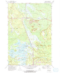
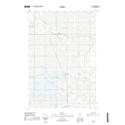
(12)- 1931 Map of Seney SW
 1931 Seney SW1931 Print · USGSUpper Peninsula wetlands and rail corridors are preserved in this early 1930s survey of Schoolcraft County. Genealogists and historians can trace the foundations of Seney and Germfask along the Manistique River and the Duluth South Shore and Atlantic railroad.
 - 1954 Map of Sault Sainte Marie, 1979 Print
 1954 Sault Sainte Marie1979 Print · USGSThe Eastern Upper Peninsula and Ontario borderlands are captured here at the height of the mid-century era. Family historians can trace settlements like Grand Marais and Stalwart, while mapping the strategic grounds of Kincheloe AFB.3 unique versions available
 - 1956 Map of Sault Sainte Marie, 1964 Print
 1956 Sault Sainte Marie1964 Print · USGSThe Eastern Upper Peninsula and the Canadian border meet in this mid-sixties survey of the bustling Soo Locks region. Genealogists and historians can trace the paths of the Soo Line and locate lakeside communities from Grand Marais to Shelldrake.2 unique versions available
 - 1957 Map of Sault Sainte Marie
 1957 Sault Sainte Marie1957 Print · USGSThe Upper Peninsula and Ontario border come alive in this mid-century portrait of the eastern Lake Superior shoreline and the vital St. Marys River corridor. Genealogists and historians can trace rail-era settlements from Newberry to Detour, while locating military landmarks like Kinross Air Force Base.
 - 1958 Map of Sault Sainte Marie
 1958 Sault Sainte Marie1958 Print · USGSThe eastern Upper Peninsula and the Canadian borderland appear here during the late fifties, a time of military growth and forest management. Researchers can locate vanished rail stops along the Soo Line, early sites like the Fiborn Quarry, and the sprawling Kinross Air Force Base.
 - 1972 Map of Seney, 1975 Print
 1972 Seney1975 Print · USGSThe Upper Peninsula marshlands are captured here in the early 1970s, showcasing the extensive water management systems of the Seney National Wildlife Refuge. Researchers can trace the legacy of regional transport through the SOO LINE railroad and the OLD RAILROAD GRADE near Seney.2 unique versions available
 - 1985 Map of Manistique Lake
 1985 Manistique Lake1985 Print · USGSThe eastern Upper Peninsula’s wilderness and rail-side villages are captured here in the mid-1980s, from the Soo Line corridor to the Lake Michigan shore. Genealogists and historians can trace the foundations of local life in Newberry, Engadine, and Seney, alongside industrial landmarks like the Calspar Quarry Pool.2 unique versions available
 - 2011 Map of Seney, 2011 Print
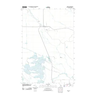 2011 Seney2011 Print · USGSCovers Seney, including Germfask Township, Doyle Township, and other nearby areas
 - 2014 Map of Seney, 2014 Print
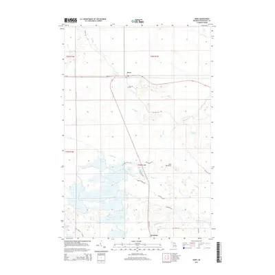 2014 Seney2014 Print · USGSCovers Seney, including Germfask Township, Doyle Township, and other nearby areas
 - 2017 Map of Seney, 2017 Print
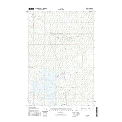 2017 Seney2017 Print · USGSCovers Seney, including Germfask Township, Doyle Township, and other nearby areas
 - 2019 Map of Seney, 2019 Print
 2019 Seney2019 Print · USGSCovers Seney, including Germfask Township, Doyle Township, and other nearby areas
 - 2023 Map of Seney, 2023 Print
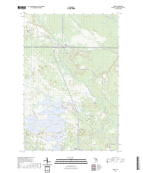 2023 Seney2023 Print · USGSIn the modern Michigan wilderness, this survey tracks the intricate water systems and conservation pools of Schoolcraft County. Researchers can locate Boot Hill Cem near Seney or trace the Fox River down toward Germfask.
End of results
Showing maps 1-12 of 12
Top cities near Seney
Frequently asked questions
- What are the different types of historical maps available for Seney?
- What is the oldest map of Seney?
- Where can I purchase historical maps of Seney for my home or office?
- Where can I download high-res historical maps of Seney?
- Are there historical topographic maps available for Seney?
- Is there historical aerial imagery available for Seney?
- Where are historical maps of Seney sourced from?