1960s Maps of Northfield Township, Michigan
Explore 6 historic maps of Northfield Township from the 1960s. These maps offer a rare glimpse into what life looked like during the 1960s — showing old roads, neighborhoods, homes, and landmarks that have changed or disappeared over time.
Whether you're researching your family's past, planning a metal detecting trip, or studying how Northfield Township's landscape evolved across the 1960s, these high-resolution maps are a powerful tool for exploring the history of this region.
- Focus on a specific era: All maps on this page are from the 1960s, giving you a focused view of this time period.
- See what’s changed: Compare century-old streets, trails, and buildings to today's modern landscape using overlays and satellite layers.
- Research with precision: Use these maps for genealogy, historical research, land use analysis, or educational projects.
- View, download, or print: Maps are fully viewable online in high resolution, and can be downloaded or printed for your own records.
Start exploring Northfield Township's history through authentic maps from the 1960s. This is your window into the past.
Northfield Township, MI maps
(6)- 1961 Map of Detroit, 1973 Print
 1961 Detroit1973 Print · USGSThe international border between Michigan and Ontario was a bustling industrial corridor in the early sixties. Researchers can trace the transit networks and riverfront infrastructure connecting Detroit to Windsor via the Detroit-Windsor Tunnel and major air hubs like Willow Run Airport.2 unique versions available
 - 1965 Map of Detroit
 1965 Detroit1965 Print · USGSThe industrial corridor between Michigan and Ontario is captured here at mid-century, showing the dense rail and river networks of the Great Lakes. Local historians can trace the paths of the Grand Trunk Western RR and locate key landmarks like Selfridge Air Force Base and Grosse Ile.
 - 1965 Map of Ann Arbor West, 1967 Print
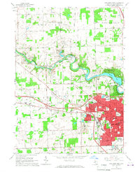 1965 Ann Arbor West1967 Print · USGSWashtenaw County during the mid-sixties shows the westward growth of the university city alongside established river towns. Genealogists and researchers can trace family names and local landmarks like Bethlehem Cemetery, Delhi Mills, and the Webster Ch parish.3 unique versions available
 - 1965 Map of South Lyon, 1967 Print
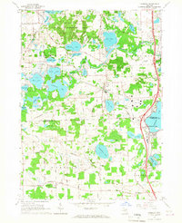
 1965 South Lyon1967 Print · USGSSoutheast Michigan in the mid-sixties reveals a countryside defined by the Chesapeake and Ohio Railroad and numerous glacial lakes. Trace early burial grounds like Old Irish Cem and Rose Cem, alongside the schoolyards of Sayre Sch.4 unique versions available
 - 1965 Map of Ann Arbor East, 1967 Print
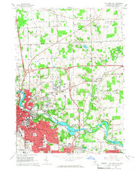 1965 Ann Arbor East1967 Print · USGSAnn Arbor and its eastern townships show a mix of university expansion and rural heritage in the mid-sixties. Researchers can trace historic sites like Dixboro, family plots at St Patricks Cem, and the growing University of Michigan.7 unique versions available
 - 1965 Map of Hamburg, 1967 Print
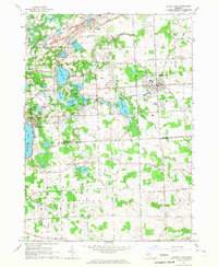
 1965 Hamburg1967 Print · USGSThe lake country of Livingston and Washtenaw Counties is captured here in the mid-1960s as residential settlements grew around the Huron River. Local historians can trace the rail paths of the Ann Arbor RR or locate landmarks like the Boys Training Camp and Pettysville.4 unique versions available
End of results
Showing maps 1-6 of 6
Top cities near Northfield Township
- Ann Arbor historical maps
- Canton Township historical maps
- Novi historical maps
- Ypsilanti Charter Township historical maps
- Commerce Charter Township historical maps
- Pittsfield Charter Township historical maps
See more
Top neighborhoods of Northfield Township
Frequently asked questions
- What are the different types of historical maps available for Northfield Township?
- What is the oldest map of Northfield Township?
- Where can I purchase historical maps of Northfield Township for my home or office?
- Where can I download high-res historical maps of Northfield Township?
- Are there historical topographic maps available for Northfield Township?
- Is there historical aerial imagery available for Northfield Township?
- Where are historical maps of Northfield Township sourced from?