Old Maps of Belleville, Michigan for Hiking & Exploration
Hike through history with 16 historic maps of Belleville. Explore old trails, ghost towns, and forgotten backroads — perfect for outdoor adventurers and local explorers.
- Rediscover forgotten places: Map out old mining camps, roads, and footpaths that no longer exist on modern maps.
- Layer with modern tools: Combine with LiDAR or satellite views to plan hikes through historical terrain.
- Made for exploration: Popular among hikers, overlanders, and local history lovers.
Use these maps to find adventure and explore the hidden past of Belleville.
Belleville, MI maps
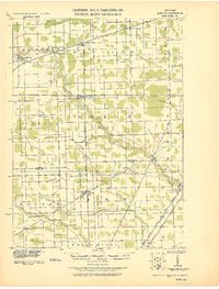
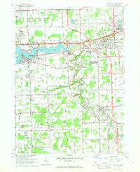
(16)- 1906 Map of Romulus
 1906 Romulus1906 Print · USGSSoutheast Michigan at the turn of the century shows a landscape defined by the winding Huron River and a dense network of competing steam and electric railways. Genealogists can trace early homesteads and rail stops in settlements like New Boston, Waltz, and the early crossroads at Carleton.2 unique versions available
 - 1928 Map of Romulus
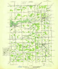
 1928 Romulus1928 Print · USGSSoutheast Michigan at the height of its rail-and-river era shows a dense network of transit lines and river towns. Genealogists can trace family roots through settlements like French Landing, Waltz, and South Rockwood or follow the path of the Pere Marquette RR.
 - 1936 Map of Belleville
 1936 Belleville1936 Print · USGSWestern Wayne County is seen here in the mid-1930s, showing a landscape defined by the Huron River and a burgeoning network of roads and rail. Researchers can locate old family plots and rural institutions like Martinsville Cem, Mt Pleasant Sch, and the Tyler Rd Community Hall.
 - 1942 Map of Belleville
 1942 Belleville1942 Print · USGSIn the early 1940s, western Wayne County remained a landscape of river-fed townships and railroad hamlets. Local historians can trace early community hubs like French Landing and Martinsville or locate family sites near St Stephens Cem.
 - 1952 Map of Belleville, 1953 Print
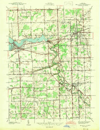
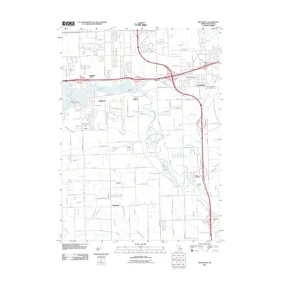
 1952 Belleville1953 Print · USGSWayne County during the early fifties shows a fascinating mix of classic rail towns and new high-speed transit. Trace the older routes of the Wabash RR or locate family history at Little Farms, French Landing, and the Martinsville Cem.3 unique versions available
 - 1954 Map of Detroit
 1954 Detroit1954 Print · USGSThe Detroit metro and its Ontario neighbors are shown at the height of the mid-century industrial era, just as the suburbs were rapidly expanding. Researchers can trace the massive rail networks of the Wabash Railroad or locate landmarks like Grosse Ile and Selfridge Air Force Base.
 - 1961 Map of Detroit, 1973 Print
 1961 Detroit1973 Print · USGSThe international border between Michigan and Ontario was a bustling industrial corridor in the early sixties. Researchers can trace the transit networks and riverfront infrastructure connecting Detroit to Windsor via the Detroit-Windsor Tunnel and major air hubs like Willow Run Airport.2 unique versions available
 - 1965 Map of Detroit
 1965 Detroit1965 Print · USGSThe industrial corridor between Michigan and Ontario is captured here at mid-century, showing the dense rail and river networks of the Great Lakes. Local historians can trace the paths of the Grand Trunk Western RR and locate key landmarks like Selfridge Air Force Base and Grosse Ile.
 - 1967 Map of Belleville, 1969 Print
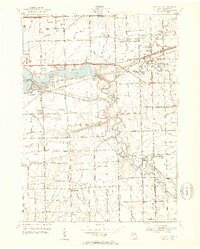
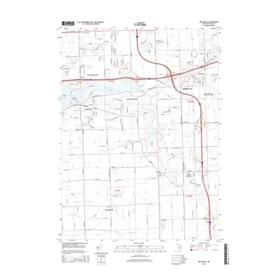
 1967 Belleville1969 Print · USGSWayne County's suburban and rural landscape comes into focus in the late sixties as the freeway system expands through the Huron River valley. Researchers can trace family sites at Martinsville Cem, find early schools like Elwell Sch, and locate industrial hubs at French Landing.5 unique versions available
 - 1985 Map of Detroit
 1985 Detroit1985 Print · USGSSoutheast Michigan in the mid-eighties shows a landscape defined by industrial power and suburban reach from the Detroit River to the Huron Valley. Researchers can trace the rail lines of the Conrail, explore the grounds of the University of Michigan, and locate numerous sites like Mt Olivet Cem.
 - 1989 Map of Detroit, 1991 Print
 1989 Detroit1991 Print · USGSSoutheast Michigan and across the river into Ontario reached a point of peak metropolitan density at the end of the 1980s. Local researchers can trace the footprint of the University of Michigan campus, the industrial waterfronts of Wyandotte, and the extensive grounds of Glen Eden Cem.
 - 2011 Map of Belleville, 2011 Print
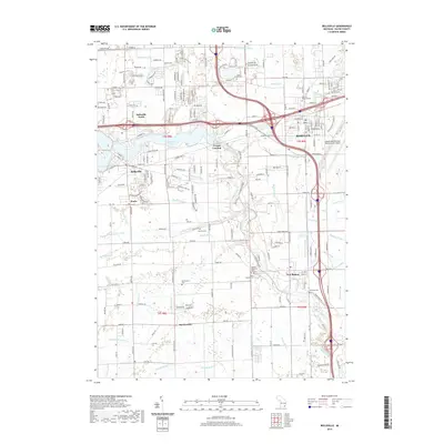
 2011 Belleville2011 Print · USGSCovers Belleville, including Van Buren Charter Township, Romulus, and other nearby areas
 - 2014 Map of Belleville, 2014 Print
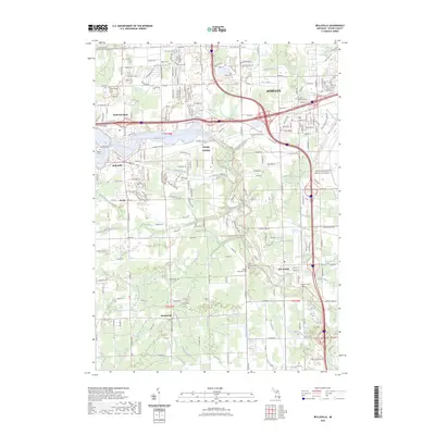
 2014 Belleville2014 Print · USGSCovers Belleville, including Van Buren Charter Township, Romulus, and other nearby areas
 - 2017 Map of Belleville, 2017 Print
 2017 Belleville2017 Print · USGSCovers Belleville, including Van Buren Charter Township, Romulus, and other nearby areas
 - 2019 Map of Belleville, 2019 Print
 2019 Belleville2019 Print · USGSCovers Belleville, including Van Buren Charter Township, Romulus, and other nearby areas
 - 2023 Map of Belleville, 2023 Print
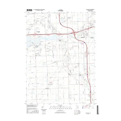
 2023 Belleville2023 Print · USGSModern Wayne County development meets historic township roots in this detailed survey of the Huron River valley. Researchers can trace the layout of Belleville and New Boston alongside notable sites like Romulus Memorial Cem and French Landing.
End of results
Showing maps 1-16 of 16
Top cities near Belleville
- Detroit historical maps
- Ann Arbor historical maps
- Canton Township historical maps
- Canton Charter Township historical maps
- Livonia historical maps
- Dearborn historical maps
See more
Frequently asked questions
- What are the different types of historical maps available for Belleville?
- What is the oldest map of Belleville?
- Where can I purchase historical maps of Belleville for my home or office?
- Where can I download high-res historical maps of Belleville?
- Are there historical topographic maps available for Belleville?
- Is there historical aerial imagery available for Belleville?
- Where are historical maps of Belleville sourced from?