2020s Maps of Huron Charter Township, Michigan
Explore 4 historic maps of Huron Charter Township from the 2020s. These maps offer a rare glimpse into what life looked like during the 2020s — showing old roads, neighborhoods, homes, and landmarks that have changed or disappeared over time.
Whether you're researching your family's past, planning a metal detecting trip, or studying how Huron Charter Township's landscape evolved across the 2020s, these high-resolution maps are a powerful tool for exploring the history of this region.
- Focus on a specific era: All maps on this page are from the 2020s, giving you a focused view of this time period.
- See what’s changed: Compare century-old streets, trails, and buildings to today's modern landscape using overlays and satellite layers.
- Research with precision: Use these maps for genealogy, historical research, land use analysis, or educational projects.
- View, download, or print: Maps are fully viewable online in high resolution, and can be downloaded or printed for your own records.
Start exploring Huron Charter Township's history through authentic maps from the 2020s. This is your window into the past.
Huron Charter Township, MI maps
(4)- 2023 Map of Belleville, 2023 Print
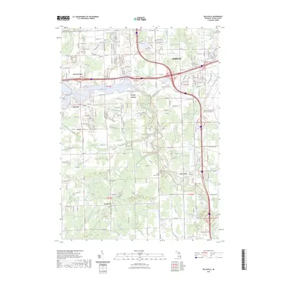 2023 Belleville2023 Print · USGSModern Wayne County development meets historic township roots in this detailed survey of the Huron River valley. Researchers can trace the layout of Belleville and New Boston alongside notable sites like Romulus Memorial Cem and French Landing.
 - 2023 Map of Flat Rock, 2023 Print
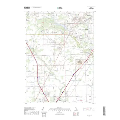 2023 Flat Rock2023 Print · USGSSoutheastern Michigan at the start of the 2020s shows a dense nexus of industry and transportation along the Huron River. Researchers can trace modern infrastructure and rail routes like the Grand Trunk Western RR alongside local centers such as Flat Rock and Woodhaven.
 - 2023 Map of Flat Rock NE, 2023 Print
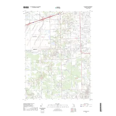 2023 Flat Rock NE2023 Print · USGSWayne County's industrial and residential corridors are shown here as they appeared in 2023, centered on the expansion of Romulus. Researchers can find several burial sites including Oak Ridge Cem and Kittle Cem alongside the Huron River and its many named drains.
 - 2023 Map of Carleton, 2023 Print
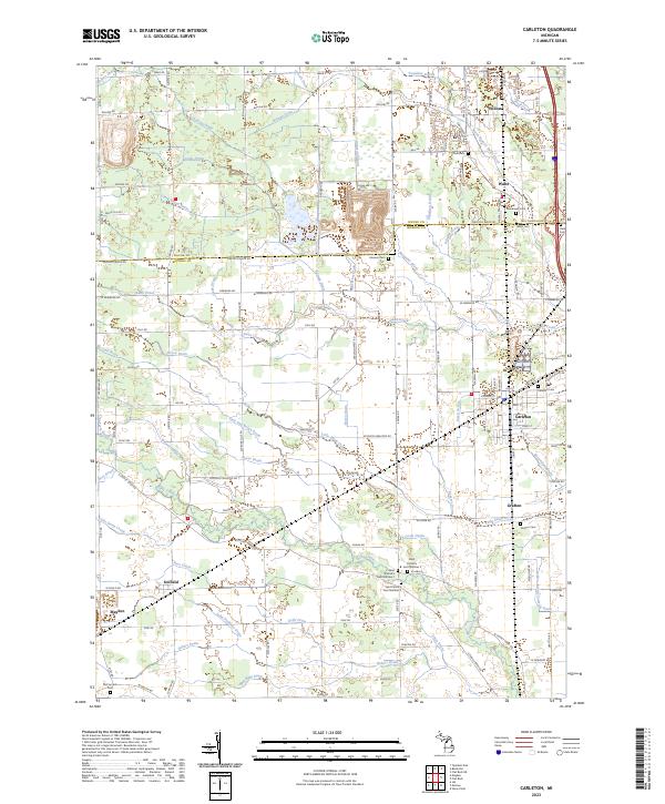 2023 Carleton2023 Print · USGSThe borderlands of Wayne and Monroe Counties appear here in the early twenty-first century, defined by agricultural drainages and historic village centers. Researchers can trace family roots at Saint Patrick's Cem or explore the layouts of Carleton, Waltz, and Maybee.
End of results
Showing maps 1-4 of 4
Top cities near Huron Charter Township
- Detroit historical maps
- Canton Township historical maps
- Canton Charter Township historical maps
- Livonia historical maps
- Dearborn historical maps
- Westland historical maps
See more
Top neighborhoods of Huron Charter Township
Frequently asked questions
- What are the different types of historical maps available for Huron Charter Township?
- What is the oldest map of Huron Charter Township?
- Where can I purchase historical maps of Huron Charter Township for my home or office?
- Where can I download high-res historical maps of Huron Charter Township?
- Are there historical topographic maps available for Huron Charter Township?
- Is there historical aerial imagery available for Huron Charter Township?
- Where are historical maps of Huron Charter Township sourced from?