Old Maps of Westland, Michigan for Metal Detecting
Plan your next treasure hunt with 27 historic maps of Westland. Find old homesites, ghost towns, trails, and gathering spots that may be lost to time — perfect for identifying promising metal detecting locations.
- Locate forgotten sites: Uncover places like long-lost settlements, abandoned rail lines, or gathering spots.
- Plan better hunts: Use map overlays combined with LiDAR or satellite views to narrow in on historically rich areas.
- Made for detectorists: Thousands of hobbyists use these maps to discover relics, coins, and hidden history.
Use these historic maps to boost your research and find new opportunities beneath the surface of Westland.
Westland, MI maps
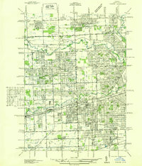
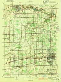
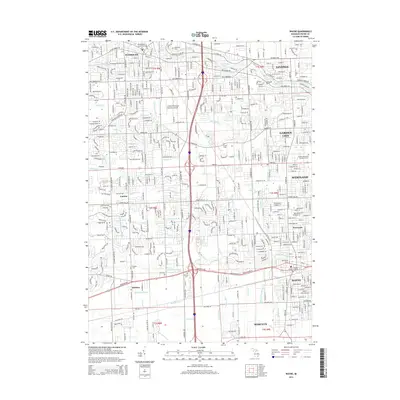
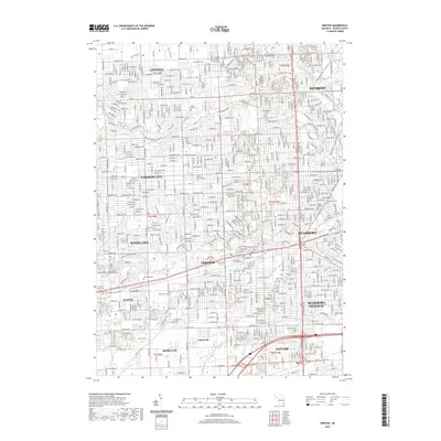
(27)- 1905 Map of Wayne
 1905 Wayne1905 Print · USGSWestern Wayne and southern Oakland counties are seen here at a pivotal moment when electric interurban railways first linked rural townships. Genealogists can trace family footprints in Northville, Plymouth, and Farmington, or locate vanished landmarks like Perrinville and the Wayne County Home.4 unique versions available
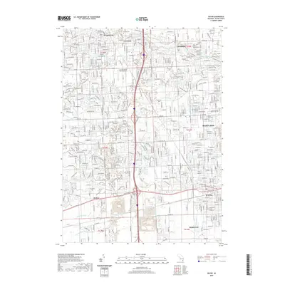
 - 1912 Map of Wayne
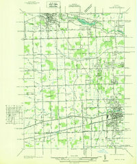
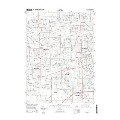
 1912 Wayne1912 Print · USGSWestern Wayne County in the early twentieth century shows a landscape being reshaped by the first concrete roads and a dense network of electric interurban railways. Trace the early development of Livonia, Redford, and Plymouth, or locate long-standing sites like Eloise and Perrinville.
 - 1936 Map of Inkster
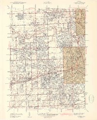
 1936 Inkster1936 Print · USGSWestern Wayne County was a landscape of institutions and early aviation in the years before the war. Researchers can trace the legacy of the Eloise Hospital and Infirmary, locate local landmarks like Wankin Mills, or find family roots near Perrinsville and St Marys Cem.
 - 1936 Map of Wayne
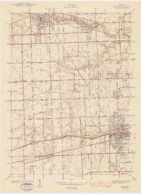
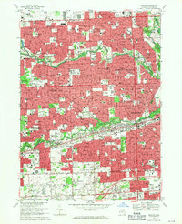
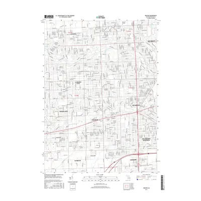
 1936 Wayne1936 Print · USGSWestern Wayne County is seen here during the mid-1930s, showing the early suburban development between Plymouth and Wayne. Researchers can trace old property contexts and local landmarks like the Triangle Airport, Cadillac Mem Park Cem, and numerous country schools including Washington Sch.
 - 1942 Map of Inkster
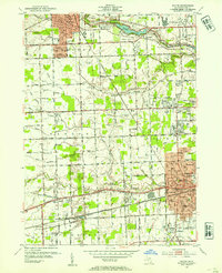
 1942 Inkster1942 Print · USGSWayne County at the onset of the 1940s shows a landscape of growing suburbs and vital transit hubs. Genealogists and local historians can trace the foundations of Garden City and Inkster or locate landmarks like Eloise Hospital and Nankin Mills.2 unique versions available
 - 1943 Map of Wayne
 1943 Wayne1943 Print · USGSWestern Wayne County is shown here during the early forties, capturing the landscape before intensive suburban growth reached the area. Genealogists and local historians can trace family-named landmarks like Chubb Cem, Truesdell Sch, and the small settlement of Sheldon.
 - 1948 Map of Wayne
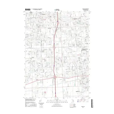
 1948 Wayne1948 Print · USGSWestern Wayne County was a landscape of transit and township life during the 1940s, balancing growing towns with extensive farm drainage systems. Genealogists can locate family landmarks like Sheldon Cem and Truesdell Sch or trace early aviation at Triangle Airport.
 - 1952 Map of Inkster, 1954 Print
 1952 Inkster1954 Print · USGSWestern Wayne County was rapidly transforming during the early fifties as the Detroit suburbs expanded toward the Rouge River forks. Genealogists and historians can locate numerous landmarks including Eloise Cem, the County Hospital, and the historic Nankin Mills.2 unique versions available
 - 1952 Map of Wayne, 1954 Print
 1952 Wayne1954 Print · USGSWestern Wayne County underwent a massive suburban transformation in the early fifties as Detroit's residential grid pushed westward. Researchers can trace the development of Norwayne, find family plots in Sheldon Cem, or locate historic flight paths at Mettetal Airport.2 unique versions available
 - 1954 Map of Detroit
 1954 Detroit1954 Print · USGSThe Detroit metro and its Ontario neighbors are shown at the height of the mid-century industrial era, just as the suburbs were rapidly expanding. Researchers can trace the massive rail networks of the Wabash Railroad or locate landmarks like Grosse Ile and Selfridge Air Force Base.
 - 1961 Map of Detroit, 1973 Print
 1961 Detroit1973 Print · USGSThe international border between Michigan and Ontario was a bustling industrial corridor in the early sixties. Researchers can trace the transit networks and riverfront infrastructure connecting Detroit to Windsor via the Detroit-Windsor Tunnel and major air hubs like Willow Run Airport.2 unique versions available
 - 1965 Map of Detroit
 1965 Detroit1965 Print · USGSThe industrial corridor between Michigan and Ontario is captured here at mid-century, showing the dense rail and river networks of the Great Lakes. Local historians can trace the paths of the Grand Trunk Western RR and locate key landmarks like Selfridge Air Force Base and Grosse Ile.
 - 1968 Map of Wayne, 1970 Print
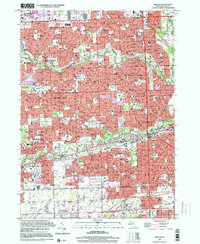
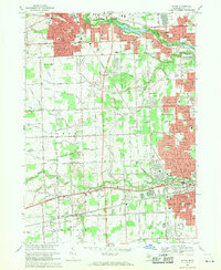 1968 Wayne1970 Print · USGSWayne County saw rapid suburban transformation in the late sixties as the landscapes of Plymouth, Westland, and Livonia converged. Genealogists and local historians can trace family-named drains and landmarks like Riverside Cemetery, the Mettetal Airport, and the Penn Central rail lines.4 unique versions available
 - 1968 Map of Inkster, 1970 Print
 1968 Inkster1970 Print · USGSThe suburban heart of Wayne County comes alive in this late-sixties study of the Rouge River valley. Researchers can trace the mid-century development of Livonia and Garden City, locating long-standing community markers like the Eloise Cem and Nankin Mills Sch.3 unique versions available
 - 1985 Map of Detroit
 1985 Detroit1985 Print · USGSSoutheast Michigan in the mid-eighties shows a landscape defined by industrial power and suburban reach from the Detroit River to the Huron Valley. Researchers can trace the rail lines of the Conrail, explore the grounds of the University of Michigan, and locate numerous sites like Mt Olivet Cem.
 - 1989 Map of Detroit, 1991 Print
 1989 Detroit1991 Print · USGSSoutheast Michigan and across the river into Ontario reached a point of peak metropolitan density at the end of the 1980s. Local researchers can trace the footprint of the University of Michigan campus, the industrial waterfronts of Wyandotte, and the extensive grounds of Glen Eden Cem.
 - 1996 Map of Inkster, 2000 Print
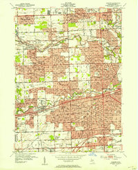
 1996 Inkster2000 Print · USGSThe suburban heart of Wayne County comes into focus in the mid-nineties, showing the fully developed neighborhoods and river parkways of Westland and Garden City. Trace local history through landmarks like Nankin Mills, the St Bernard Seminary, and numerous family-named parks and parish schools.
 - 2011 Map of Inkster, 2011 Print
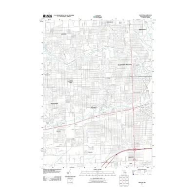 2011 Inkster2011 Print · USGSCovers Westland, including Detroit, Livonia, and other nearby areas
 - 2011 Map of Wayne, 2011 Print
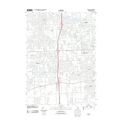 2011 Wayne2011 Print · USGSCovers Westland, including Canton Charter Township, Canton Township, and other nearby areas
 - 2014 Map of Wayne, 2014 Print
 2014 Wayne2014 Print · USGSCovers Westland, including Canton Charter Township, Canton Township, and other nearby areas
 - 2014 Map of Inkster, 2014 Print
 2014 Inkster2014 Print · USGSCovers Westland, including Detroit, Livonia, and other nearby areas
 - 2017 Map of Inkster, 2017 Print
 2017 Inkster2017 Print · USGSCovers Westland, including Detroit, Livonia, and other nearby areas
 - 2017 Map of Wayne, 2017 Print
 2017 Wayne2017 Print · USGSCovers Westland, including Canton Charter Township, Canton Township, and other nearby areas
 - 2019 Map of Inkster, 2019 Print
 2019 Inkster2019 Print · USGSCovers Westland, including Detroit, Livonia, and other nearby areas
 - 2019 Map of Wayne, 2019 Print
 2019 Wayne2019 Print · USGSCovers Westland, including Canton Charter Township, Canton Township, and other nearby areas
Showing maps 1-25 of 27
Top cities near Westland
- Detroit historical maps
- Canton Charter Township historical maps
- Canton Township historical maps
- Livonia historical maps
- Dearborn historical maps
- Troy historical maps
See more
Top neighborhoods of Westland
Frequently asked questions
- What are the different types of historical maps available for Westland?
- What is the oldest map of Westland?
- Where can I purchase historical maps of Westland for my home or office?
- Where can I download high-res historical maps of Westland?
- Are there historical topographic maps available for Westland?
- Is there historical aerial imagery available for Westland?
- Where are historical maps of Westland sourced from?