2020s Maps of Wexford County, Michigan
Explore 20 historic maps of Wexford County from the 2020s. These maps offer a rare glimpse into what life looked like during the 2020s — showing old roads, neighborhoods, homes, and landmarks that have changed or disappeared over time.
Whether you're researching your family's past, planning a metal detecting trip, or studying how Wexford County's landscape evolved across the 2020s, these high-resolution maps are a powerful tool for exploring the history of this region.
- Focus on a specific era: All maps on this page are from the 2020s, giving you a focused view of this time period.
- See what’s changed: Compare century-old streets, trails, and buildings to today's modern landscape using overlays and satellite layers.
- Research with precision: Use these maps for genealogy, historical research, land use analysis, or educational projects.
- View, download, or print: Maps are fully viewable online in high resolution, and can be downloaded or printed for your own records.
Start exploring Wexford County's history through authentic maps from the 2020s. This is your window into the past.
Wexford County, MI maps
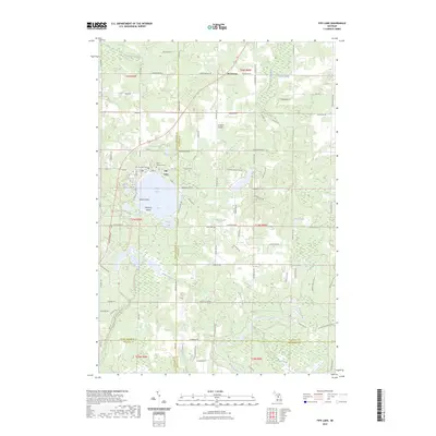
(20)- 2023 Map of Hoxeyville, 2023 Print
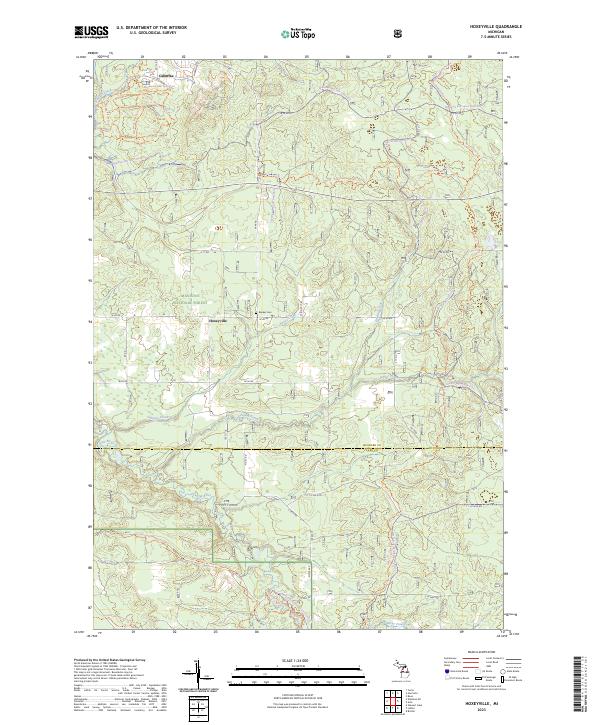 2023 Hoxeyville2023 Print · USGSWexford and Lake Counties were largely defined by forestry and recreation by the 2020s. Genealogists and outdoor historians can trace the vicinity of Hoxeyville and the Banker Cem, or follow the winding Pine Wild and Scenic River.
 - 2023 Map of Boon, 2023 Print
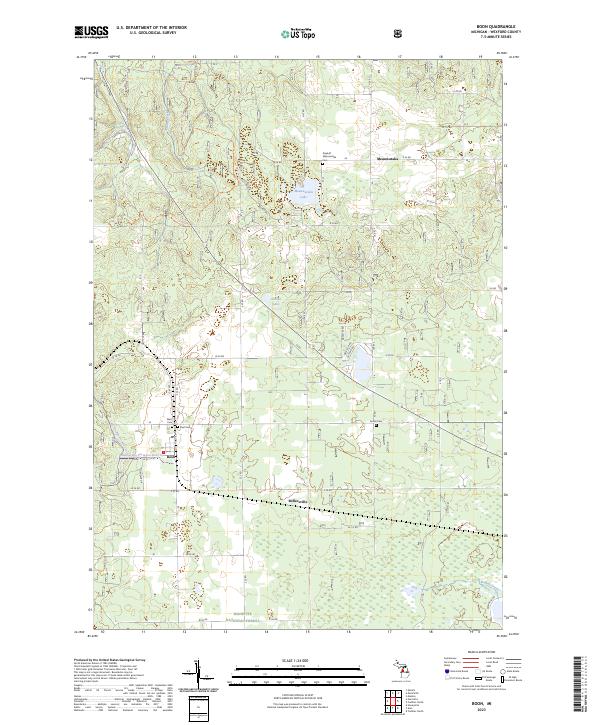 2023 Boon2023 Print · USGSWexford County in the 2020s remains a landscape of forest tracts and small rural settlements. Researchers can locate family burial sites at Dayhuff Meauwataka Cem or trace the early foundations of Boon and Meauwataka.
 - 2023 Map of Jennings, 2023 Print
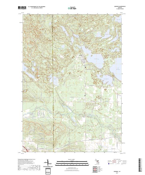 2023 Jennings2023 Print · USGSThe settlement of Jennings and the surrounding lake country of Missaukee County are captured here in the early twenty-first century. Researchers can trace the Old RR Grade and locate burial sites at the Old Jennings Cem and New Jennings Cem.
 - 2023 Map of Walton, 2023 Print
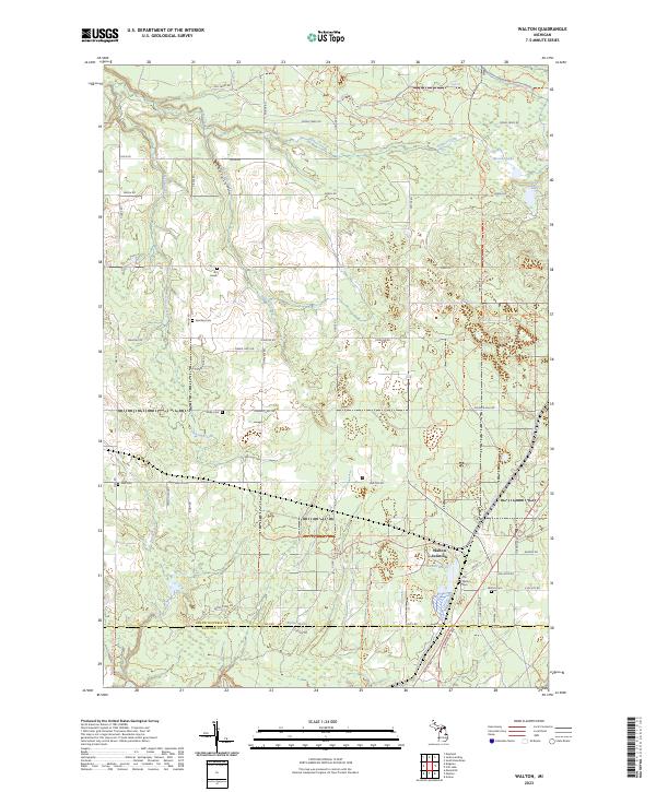 2023 Walton2023 Print · USGSThe Grand Traverse and Wexford county line area appears as a hub of early Michigan settlement and modern trails in this detailed study. Genealogists can trace several local burial sites including Old Walton Cem, Sparling Cem, and the unique Iliff Grave.
 - 2023 Map of Mesick NE, 2023 Print
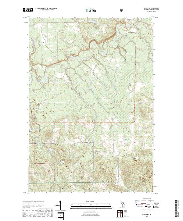 2023 Mesick NE2023 Print · USGSUpper Wexford County in the early twenty-first century remains defined by the winding Manistee River and its vast woodland tracts. Researchers can trace local landmarks like the Soper Cem and the settlement at Baxter, or follow the North Country National Scenic Trl through the forest.
 - 2023 Map of Kingsley, 2023 Print
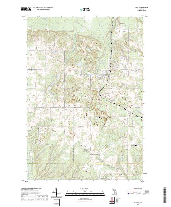 2023 Kingsley2023 Print · USGSThe village of Kingsley and surrounding Grand Traverse County townships are captured here during the early 2020s. Genealogists and local historians can locate numerous small burial sites like Barnum Cem and the solitary Jenny Grave.
 - 2023 Map of Arlene, 2023 Print
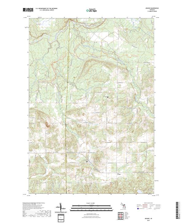 2023 Arlene2023 Print · USGSMissaukee County's rural townships are documented here during the early 2020s, showing a landscape defined by the Manistee River and long-standing farmstead grids. Genealogists and local historians can locate Bloomfield Cem, Caldwell Cem, and the settlement of Arlene.
 - 2023 Map of Harrietta, 2023 Print
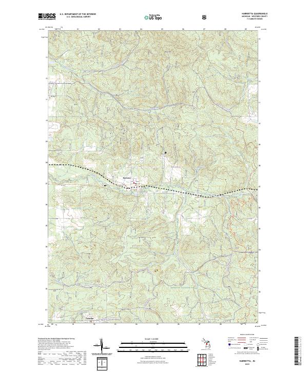 2023 Harrietta2023 Print · USGSWexford County's wooded highlands and the village of Harrietta are documented here during the early twenty-first century. Researchers can trace the local road network and find family landmarks like the Harrietta Cem and the settlement at Caberfae.
 - 2023 Map of Axin, 2023 Print
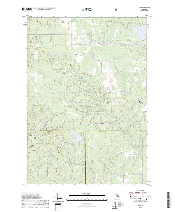 2023 Axin2023 Print · USGSWexford County's forested landscapes and glacial waterways are meticulously documented in this recent survey. Genealogists and local historians can trace the positions of the Larson Family Cem, Cherry Grove Cem, and the shoreline of Lake Mitchell.
 - 2023 Map of Wellston NE, 2023 Print
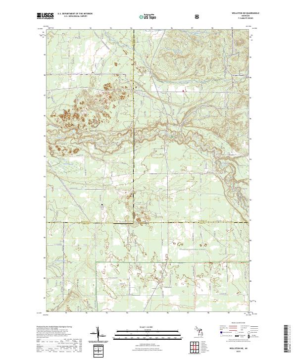 2023 Wellston NE2023 Print · USGSThe Manistee National Forest is shown here at the intersection of three counties during the early 2020s. Genealogists and outdoor historians can trace the Chalker Family Cem or follow the protected corridor of the Pine Wild and Scenic River.
 - 2023 Map of Harlan, 2023 Print
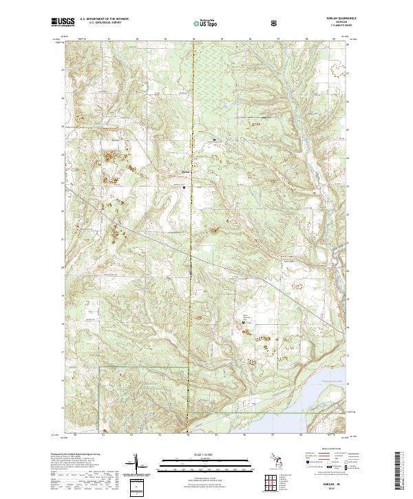 2023 Harlan2023 Print · USGSWexford and Manistee counties meet in this detailed look at a northern Michigan landscape centered on the settlement of Harlan. Genealogists and historians can trace local landmarks like Brethren Cem or follow the Betsie Valley State Trl as it winds toward Hodenpyl Dam Pond.
 - 2023 Map of Lucas, 2023 Print
 2023 Lucas2023 Print · USGSThe tri-county border of Missaukee, Wexford, and Osceola comes into focus in this recent survey. Local historians can trace family land ties near the Lucas settlement and identify burial sites at Richland Cem and Hillside Cem.
 - 2023 Map of Mesick, 2023 Print
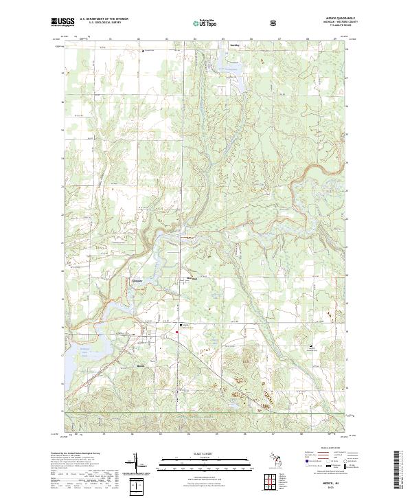 2023 Mesick2023 Print · USGSMesick and the Manistee River valley are captured here in the early twenty-first century, showing a landscape shaped by forest and water. Genealogists and local historians can locate the Mesick - Sherman Cem and trace the paths of the Betsie Valley State Trl through Glengary.
 - 2023 Map of Karlin, 2023 Print
 2023 Karlin2023 Print · USGSThe borderlands of Grand Traverse and Benzie counties are captured here in the early twenty-first century as the landscape transitioned between its lakes and rural townships. Genealogists can locate family sites at De Lorme Cem and Nessen City, or trace the course of the Betsie River.
 - 2023 Map of Cadillac South, 2023 Print
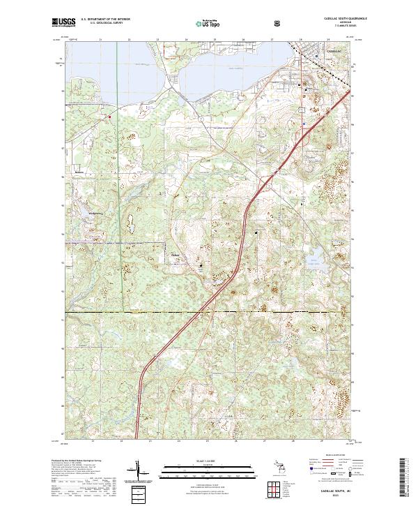 2023 Cadillac South2023 Print · USGSThe southern portion of Cadillac and the surrounding Wexford County townships are documented here during their modern transition. Researchers can find numerous historic burial sites like Green Family Cem and Maple Hill Cem, and trace the route of the White Pine Trail.
 - 2023 Map of Buckley, 2023 Print
 2023 Buckley2023 Print · USGSNorthwestern Michigan's rural highlands are captured here in 2023, showing the borderlands between Grand Traverse and Wexford counties. Researchers can trace the legacy of early settlements at Monroe Center and Hannah, or locate family sites near Saint Mary's Cem and Downs Cem.
 - 2023 Map of Fife Lake, 2023 Print
 2023 Fife Lake2023 Print · USGSFife Lake and the surrounding woodlands of Grand Traverse County are shown here in the 2020s, highlighting the area's complex water systems and small-town infrastructure. Genealogists and local historians can trace family roots at Saint Aloysius Cem or explore the route of the Great Lakes Central RR.
 - 2023 Map of Yuma, 2023 Print
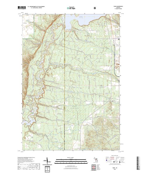 2023 Yuma2023 Print · USGSWexford and Manistee counties meet in this modern survey of the Manistee National Forest as it appeared in recent years. Researchers can trace the North Country National Scenic Trail or locate family roots at Yuma and the Section 16 Cem.
 - 2023 Map of Manton, 2023 Print
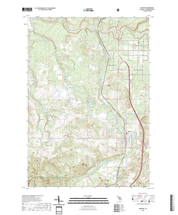 2023 Manton2023 Print · USGSWexford County comes into focus in this contemporary survey of the area surrounding Manton. Genealogists and hikers can trace the North Country National Scenic Trl, locate rural burial sites like Greenwood Cem, and explore the banks of the Manistee River.
 - 2023 Map of Cadillac North, 2023 Print
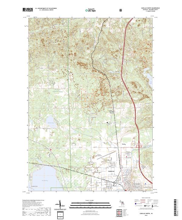 2023 Cadillac North2023 Print · USGSCadillac and its northern environs are captured here at a time of continued growth within the Wexford County lake country. Local historians can trace the footprint of Cadillac, locate the Haring Charter Township Cem, and see the layout of Missaukee Junction.
End of results
Showing maps 1-20 of 20
Top cities of Wexford County
- Cadillac historical maps
- Haring Township historical maps
- Manton historical maps
- Harrietta historical maps
Frequently asked questions
- What are the different types of historical maps available for Wexford County?
- What is the oldest map of Wexford County?
- Where can I purchase historical maps of Wexford County for my home or office?
- Where can I download high-res historical maps of Wexford County?
- Are there historical topographic maps available for Wexford County?
- Is there historical aerial imagery available for Wexford County?
- Where are historical maps of Wexford County sourced from?